
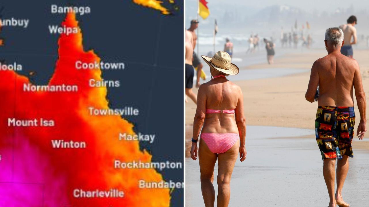
Mercury soars to 46.2C as state roasts
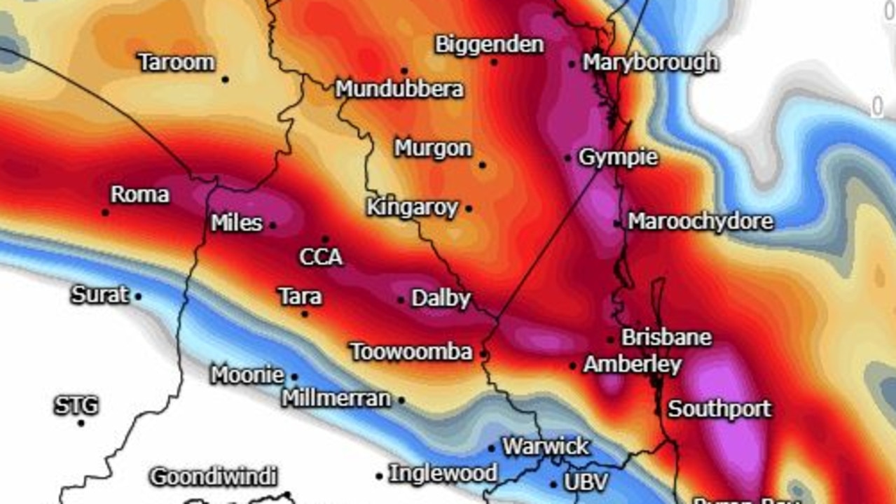
A very dangerous storm is being tracked across the Darling Downs tonight after a day of sweltering temperatures that peaked at 46.2C in Goondiwindi.
QLD weather news
Don't miss out on the headlines from QLD weather news. Followed categories will be added to My News.
Temperatures have again reached sweltering conditions across Queensland while severe storms have swept across the Darling Downs this afternoon.
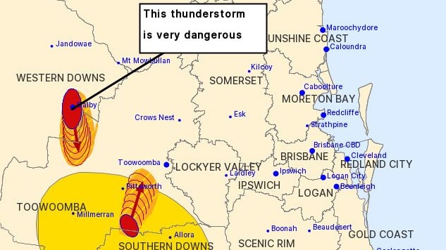
A warning for a very dangerous storm was issued by the Bureau of Meteorology at 6.15pm.
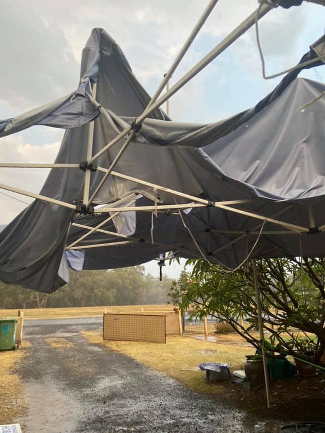
Damaging, locally destructive winds, large hailstones and heavy rainfall that may lead to flash flooding are likely for Daly and surrounding districts.
A 144km/h wind gust was recorded at 6.06pm
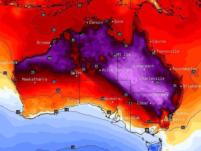
Earlier, the mercury soared to 46.2C at Goondiwindi on the Queensland border with NSW by 3.30pm, making it the hottest place in Queensland.
Windorah in the Channel Country got to 35C by 2.40pm.
Other areas that are scorching include Roma at 44.7C, The Monument at 44.8C, Charleville at 44.2C, while Winton hit 44.4C.
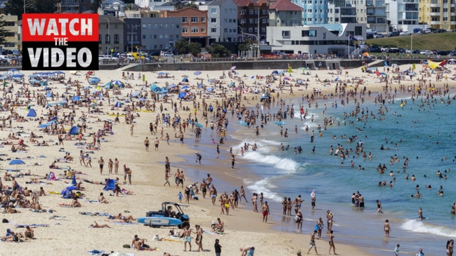
In the southeast, Gatton got to 39.4C, Beaudesert 35.8C, Ipswich 36C and Brisbane City 31.9C.
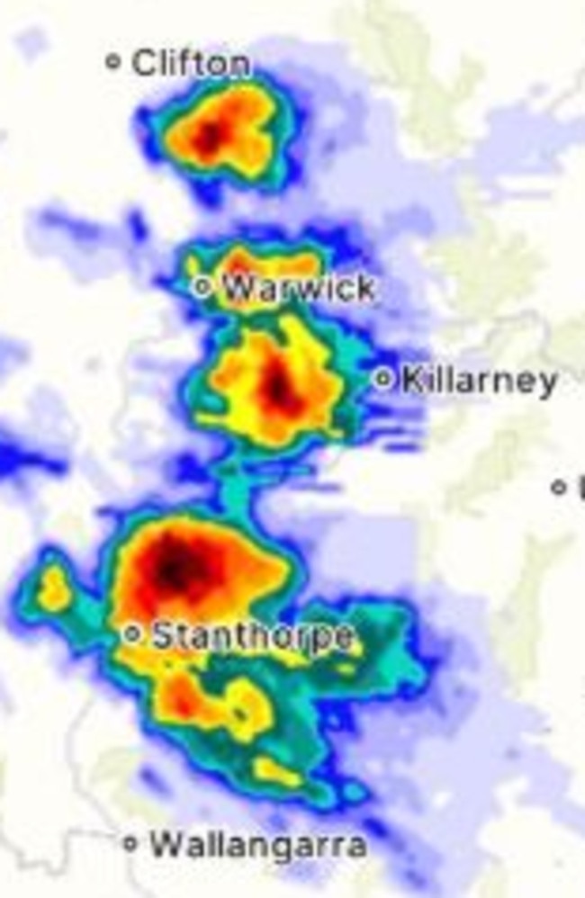
A severe thunderstorm warning was issued at 2.40pm in the Southern Downs region with potential for damaging winds and heavy rainfall northeast of Warwick, the area north of Warwick and the NSW border.
They are forecast to affect Oakington and Maryvale by 3.40pm.
Warwick, Stanthorpe, Allora and Clifton may also be affected.
A hiker decided to brave the heat but had to be rescued from Mt Barney in the Scenic Rim after suffering severe dehydration.
They were taken to the Queen Elizabeth Hospital II in a stable condition.
At least six Queensland Fire and Emergency Services are on scene battling a bushfire at Meridan Plains.
Crews were called to the bushfire burning in the vicinity of Honeyfarm Rd, Rainforest Dr and Kawana Way Link Rd about 1pm.
A Queensland Fire and Emergency Services spokeswoman said the fire posed no threat to property, however nearby residents have been warned about smoke levels.
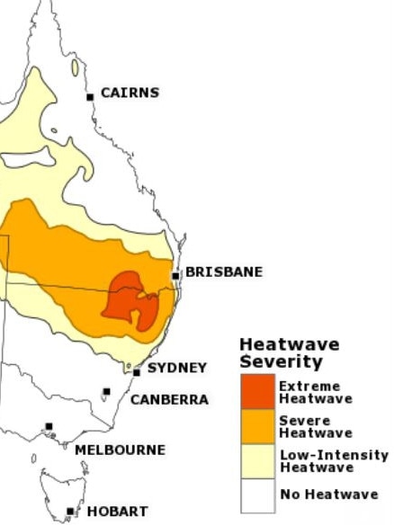
Areas of severe heatwave are continuing in southern and western Queensland, while extreme heatwave conditions will be experienced in south central Queensland and over the NSW border.
Bureau of Meteorology senior meteorologist Felim Hanniffy said temperatures will remain hot over the weekend, however not as extreme as past days, where places like Thargomindah and Birdsville reached 46 and 45 degrees respectively.
He said parts of the southern inland and southeastern interior will still see high 30s and low 40s, while overnight minimums will remain “very, very hot” in the mid 20s.
“Then that trough weakens through the southeastern inland and kind of pushes back a little eastwards and remains slow moving about the interior during Saturday,” he said.
“Saturday temperatures will warm up again in the southeast interior and then we get a significant change coming into the southwest probably late Saturday … eventually across the southeast Monday and Tuesday.
“Ahead of that it’s going to get hot again for a time, temperatures will be back into the low 40s.”
It comes as the state is expected to have elevated fire danger across the weekend, with regions including the Channel Country, Darling Downs and Granite Belt, Maranoa and Warrego and parts of central Queensland today hitting very high fire danger ratings.
Mr Hanniffy said the southeast will see potential for increased fire danger warnings before Monday as chances of storms and showers inland on Friday.
“Wednesday we have very highs around the southeast and inland – it wouldn’t take much for them to go into severe, just a little bit stronger windflow and that could go into severe, so its very high,” he said.
“Saturday and Sunday it will escalate again and there will be potential for severe, particularly Sunday when you get that strong weather system moving into the southwest moving eastwards.”
Temperatures are expected to remain up to four degrees above average.
More Coverage
Storm chasers warn of destructive winds, giant hail; BOM says ‘outside chance’
Amateur storm chasers are warning destructive storms are possible for large parts of southern Queensland this afternoon. It comes as temperatures soar over 36C in parts.
Read more
Supercell, large hail threat for Qld amid 40C temp spike
Temperatures of nearly 10C above the October average are set for parts of Queensland today and into the weekend with conditions prime for thunderstorms.
Read more