
Qld Xmas weather: Gold Coast Coast to cop brunt of southeast storm activity
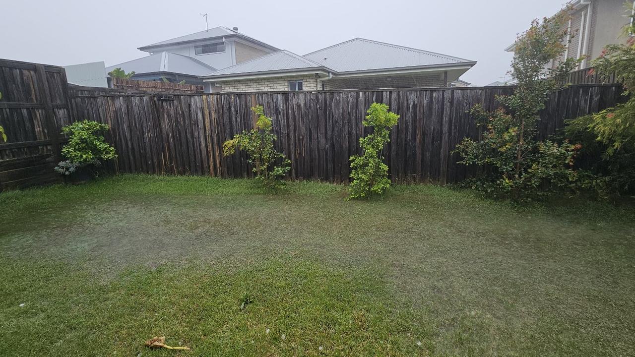
The Gold Coast was in the firing line of severe storm activity on Monday night, as a stormfront swept through from the Darling Downs to the southeast. LATEST UPDATES
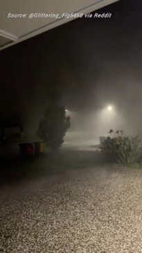
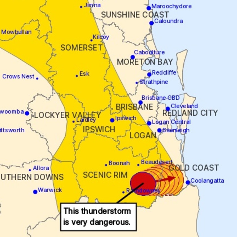
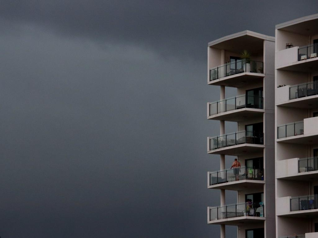
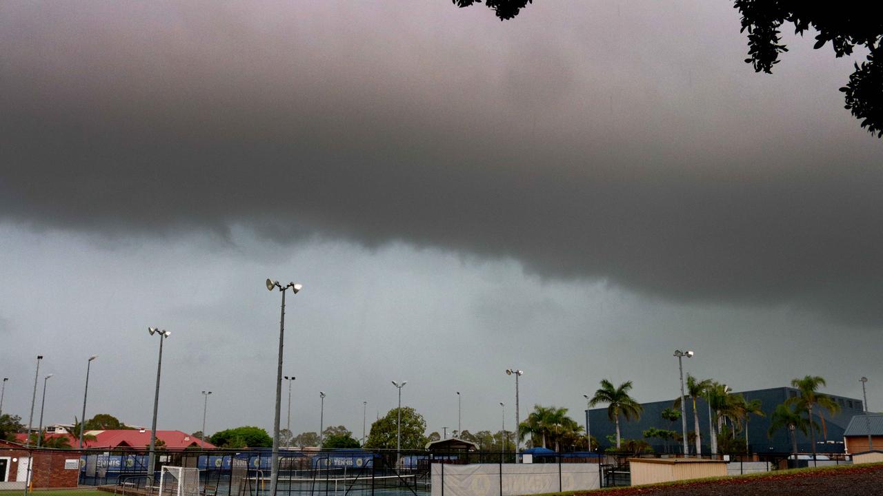
Residents of the Gold Coast have been told to brace for impact as a “very dangerous thunderstorm” bears down on the city.
The bureau has forecast damaging, locally destructive winds, large possibly giant hailstones and heavy rainfall that may lead to flash flooding.
The system, which was tracking over Ipswich, had already produced high-speed winds on the Darling Downs, with Wellcamp recording a 102km/h gust, Oakey 96km/h and Toowoomba 93km/h.
Numinbah Valley, Little Nerang Dam, Mudgeeraba, Canungra and Nerang were on high alert as the thunderstorm rolled in.
There were earlier storm warnings for Brisbane, Ipswich, Somerset, Southern Downs, Toowoomba and the Lockyer Valley.
Earlier in the day, Dalby and other parts of the Western Downs were hit by 90km/h winds while Oakey was buffeted by winds of almost 100km/h.
Emergency services were urging residents in the affected area to park their cars undercover and away from trees, close doors and windows and not to drive unless necessary.
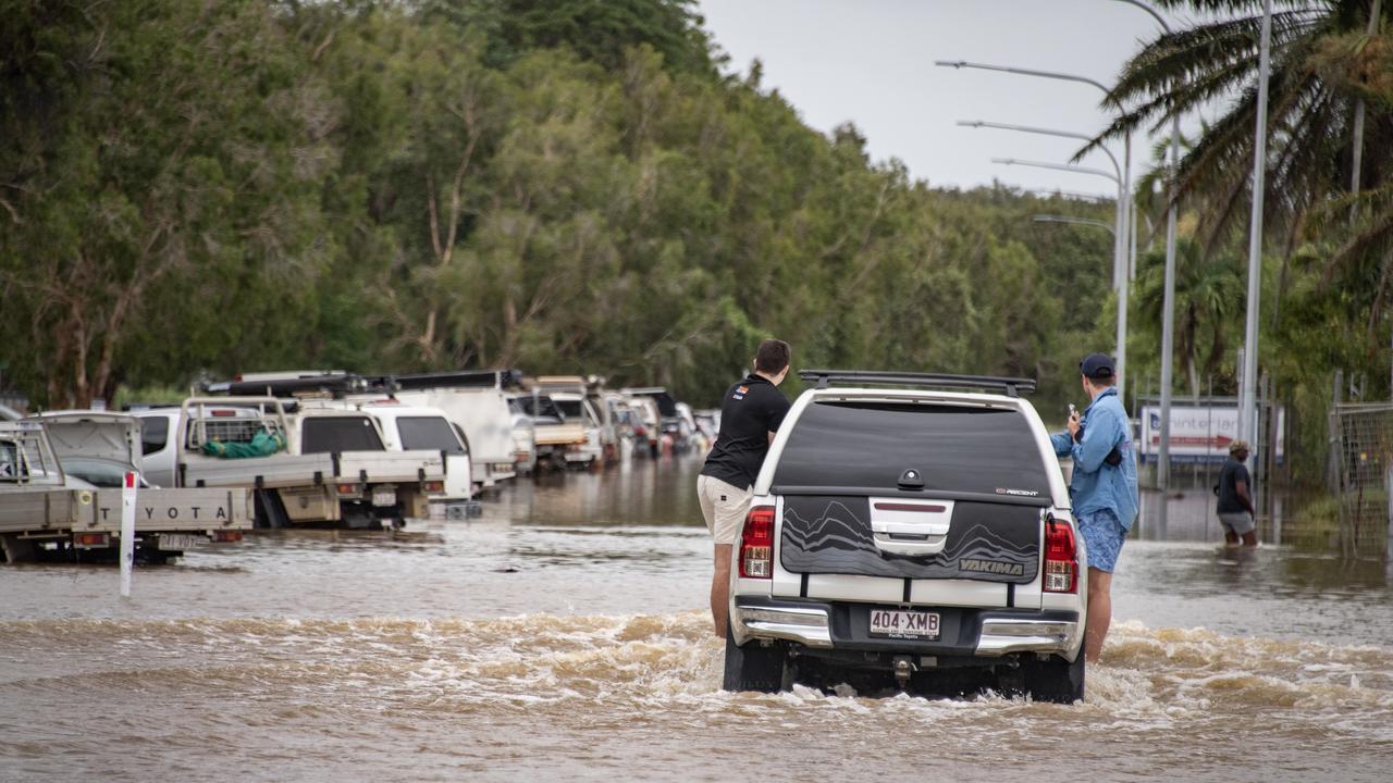
It follows some people needing to be rescued from floodwaters and thousands still without power on Christmas Day.

Wild storms on Sunday saw more than 58,000 Energex customers without power.
As of 2pm on Christmas Day, 541 homes and businesses were without power, with customers in Robina, Logan Village and Eagleby the most impacted.
There had been more than 11,000 customers in blackout at 9.30am.
More than 250,00 lightning strikes were recorded during a four-hour period on Sunday and 130 powerlines were brought down.
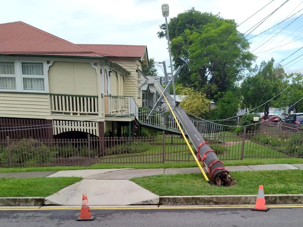
Residents in multiple streets of Coorparoo in Brisbane’s southeast were left without power over Christmas Eve and much of Christmas Day.
Five streets in the area remained in darkness on Christmas morning, including residents on Saint Leonard’s Street where a power pole narrowly missed one woman’s residence.
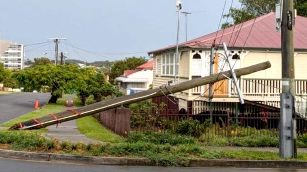
Eight-four-year-old Estelle Cummins said she had been worried about this specific power pole after she noticed it was starting to lean.
“[On Sunday] I heard this almighty crash and I got to the front window and saw the pole down, I thought oh my god what do I do,” she said.
Many residents rushed to Ms Cummins aid and told her to get out of the house due to the dangers of the power lines.
“I had to hop over the fence next door to get away because all the lines were down.”
Ms Cummins said a company had done a check on the pole approximately a month ago, however they said it was in working order.
“I went down there and said, oh it has a lean on it should I be worried, and they told me no it’s safe but we will put a report in.
“He assured me it was perfectly safe. I should have got it in writing,” Ms Cummins said.

At about 1:30pm on Sunday during a severe thunderstorm the pole cracked from the base and fell, damaging Ms Cummins fence and the corner of her roof.
“If it wasn’t for the lines getting tangled it could’ve been much worse … I mean someone could have been walking by and it fall on [them].”
The 84-year-old stayed with a friend on Christmas Eve in case it wasn’t safe to stay in the house overnight.
She added her family have owned the house since 1923 and had grown up in the historical Queenslander.
“I was lucky I didn’t have a fridge full of food.
“For Christmas it could not have happened at a worst time,” Ms Cummins said.
Across the road at 35 Saint Leonard’s Street Michelle Sinclair and Stephanie Deane were having to charge their phones in their cars while they waited for the power to return.
“We haven’t had power since [Sunday] afternoon so we have to charge our phones and get some aircon from the car,” Ms Sinclair said.
“I was just sitting in the dark thinking what do I do?”
The pair were forced to go to a cafe which was luckily open for breakfast on Christmas morning due to their food going bad in the fridge.
“Our food is gone … all the cheese, everything.”

Ms Deane is a nurse and was working a late shift on Christmas Eve when she returned to Energex workers on the street at 4am on Monday.
“I wanted to have a nap today before work, but it’s just too hot and the power still isn’t on,” she said.
Both women said it was frustrating timing on Christmas Eve for the residents in the area, but that Energex had been working for hours to try and fix the issue.
“Well, our next Christmas’s can only go up from here,” Ms Sinclair said
“I am worried about this afternoon and more storms … I’m just thinking it won’t work and the power will be gone again,” Ms Deane added.
An Energex spokesperson said that the fallen power pole would have most likely been the cause of the power outages in those streets, which left over 100 customers without power until lunch time on Monday.
The Energex team were forced to replace the entire pole and correctly route the power lines which took several hours.
Eighth Ave, Sixth Ave, Fifth Ave, Lackey Ave and Saint Leonards Street in Coorparoo were all affected and power was returned to residents at approximately midday on Christmas Eve, more than 24 hours after it had first turned off.
Five uninjured patients were rescued from their car that went into floodwater on the Leichhardt Highway at Billa Billa around 7pm Sunday.

The weather bureau’s Shane Kennedy said it was monitoring the weather system developing in western Queensland that could bring another wave of thunderstorms to the southeast in the late afternoon or night.
“It’s a bit suppressed, (the system) used up a lot of energy overnight and it is taking a while to recharge,” Mr Kennedy said, at about 12.30pm on Christmas Day.
“But the atmosphere is still very conducive to thunderstorms with late evening likely to see the next wave.”
Mr Kennedy said parts of Queensland could be hit with “very dangerous” thunderstorms by this afternoon with Emerald and the Darling Downs regions in the firing line.
He said South-East Queensland could expect damaging wind gusts, heavy rainfall and large hail from thunderstorms if the system continued to develop.
“There should be a couple of hours warning,” he said.
“If we do see severe thunderstorms the rain could be 30-60mm with scattered isolated falls.”

Bureau forecaster Helen Reid said from 9am Sunday to 6am Monday the highest rainfall was 80mm in Mount Binga followed by 76mm west of Rockhampton.
On Sunday there was 30mm was recorded at Gambubal in 30 minutes to 10.30am, 35mm was recorded at Sandy Creek Road in 30min to 10.45am, 9cm hail recorded at Burpengary, 8cm hail recorded at Dayboro around 11.50am and 58mm of rainfall in 30 minutes at Wivenhoe Dam.
Overnight there was 49mm was recorded at Coolmaringa in 30min to 1.30am.
“We had some fairly hefty totals, predominantly for the southeast, but even up into Central Queensland,“ she said.
“It was just such widespread thunderstorm activity, we even had some keep ticking on all night and they’re just working their way up from Central West, Central Highlands.”
Ms Reid said more of the same was expected across the state today.
“I think it’s a rinse and repeat state to be honest. We still have that trough sitting through Western Queensland,” she said.
“Anything to the east of that is likely to see some sort of thunderstorms So we’re talking from Cape York Peninsula, all the way down through the eastern districts right down to New South Wales, Victoria and beyond kind of thing.
At 11.51am, the Bureau cancelled a severe thunderstorm warning for the Herbert and Lower Burdekin and Central Coast and Whitsundays forecast districts as the weather system moved offshore.
The immediate threat of severe thunderstorms has passed, but the situation will continue to be monitored and further warnings will be issued if necessary, the Bureau said.
“A strong upper trough moving over southern parts of the state is promoting thunderstorms
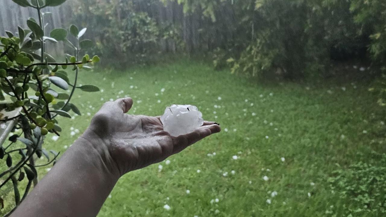
The Bureau of Meteorology had on Sunday said there was “nine to potentially 15cm hailstones reported at Burpengary”.
The Bureau are investigating the reports of 15cm hail which could be a South-East Queensland record.
Bureau of Meteorology forecaster Felim Hanniffy said they were currently looking to verify the reports.
“It will have to be independently verified first and then if it is confirmed it would be a South East Queensland potential hail size record,” Mr Hanniffy said.
“We’ve had bigger records elsewhere in Queensland, two years ago in October we had bigger recorded in Mackay.”

Mr Hanniffy said it would be difficult to verify the reports.
“It has to be measured and there has to be some kind of measuring device, whether a picture is taken and there’d have to be a ruler or something beside it clearly showing the size,” he said.
“A lot of people are sending pictures, but there may not have a ruler or something beside it to see the size.”
Mr Hanniffy on Sunday said there was potential for more hail to fall across South East Queensland in the coming days.
“Certainly over the next day or two the atmosphere remains very, very unstable,” he said.
“There is potential for very intense thunderstorm activity over parts of central and southeast Queensland again during tomorrow’s Christmas Day and Boxing Day as well.
“The ingredients are certainly there for some isolated, very dangerous thunderstorm development again which could fuel further intense hail with intense rainfall as well.”
Energex had encouraged residents across the region to plan for the worst to ensure Christmas festivities run smoothly on Monday, such as considering generator use to keep refrigerators running.
“We ask people to think of other avenues to call on friends and family to help you out,” he said.
The highest number of outages recorded was 24,000 in Logan City, Brisbane City with 14,500 outages and Redland City with 10,000.
There were reports most stores at Logan Hyperdome Shopping Complex were without power on Sunday.
An Energex spokesperson had said outages were affecting areas from the Gold Coast to the Moreton Bay region.
Storms started rolling across the region since about 9.20am Sunday, with 57,000 without power by 2.30pm.
Energex has reported 120 power lines down across South-East Queensland after a barrage of “violent storms” with more than 200,000 lightning strikes in four hours. Of that, 151,000 came within two hours.
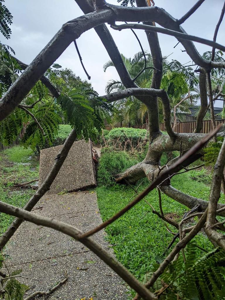
Fallen trees also wreaked havoc across SEQ, including a fallen tree on Frederick Street at Toowong which has impacted powerlines.
A crane was required to remove the tree at Toowong, with the road expected to be closed until early Christmas morning.
The Brisbane Valley Highway northbound in Coominya was partially closed due to multiple trees down at 12.30pm.
The storms also brought heavy rain to the region, with Queensland Police on Sunday warning of reports of flash flooding in Holland Park, Tamborine Mountain, Elimbah, Beenleigh, Russell Island, Upper Coomera, Toowong, Scenic Rim, Marsden, Logan, Carina, Greenbank and the Gold Coast.
Wivenhoe Dam recorded 58mm of rain in 30 minutes, 43mm of that fell in just 15 minutes and many areas of Brisbane recorded falls between 10 and 20mm in 30 minutes.
Gatton received 40mm of rain in the 30 minutes to 11am, while 35mm was recorded at Sandy Creek Rd in the 30 minutes to 10.45am and 30mm fell at Gambubal in the 30 minutes to 10.30am.
The Western Downs was earlier hit with more than 30mm within the hour to 10am.
Millmerran Commens received 32mm in the hour while Centenary Bridge copped 28mm, Campbell’s Gully 26mm and Warahgai 23mm.
At 9pm on Sunday night, the Bureau advised severe thunderstorms were no longer occurring in the state’s southeast.
A BOM spokesperson on Sunday said that severe weather activity would ease through the night and pick up towards Christmas afternoon.

Mr Hannify added the storm cell that swept through the southeast on Sunday was most intense in Dayboro, Strathpine and Caboolture.
“They were in the firing line for this cell … there were reports of 8cm hail at Dayboro.
“These severe storms will persist into Christmas Day and Boxing Day, with the potential for high-end severe storms which can be very dangerous,” Mr Hannify said.
Photos and videos of the storm and damage have been widely shared on social media.
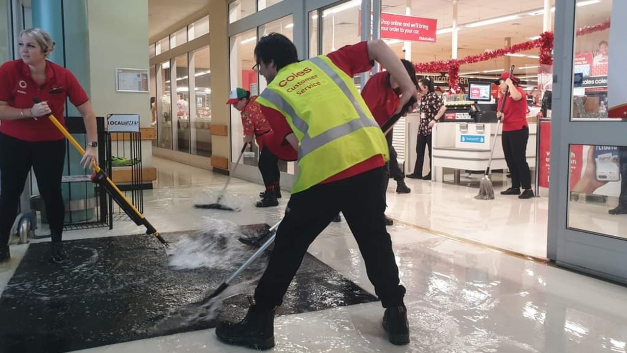
Monique Suridge was sitting just inside the glass doors at Coles Burpengary when a giant puddle started to form.
“I think I was sitting for a few minutes before I noticed my feet getting wet,” she said.
“Staff were grabbing brooms and sweeping the water outside of the actual store.
“It was crazy. There was at least 10 staff sweeping like mad.”
Sundays storms followed wild storms lashed the region Saturday night.
Saturday’s storms rolled in around 10pm, stretching from north of Brisbane down to the NSW border. Somerset, Scenic Rim and Lockyer Valley were also in the firing line.

The Bureau said 37mm was recorded in 30 minutes at Upper Bracker Creek to 7.04pm, while 7cm hail was recorded at Flagstone Creek and 10cm hail was recorded at Gatton.
Parts of the state copped a drenching as the storms rolled through the night with the 24-hour rainfall totals hitting over 60mm in some areas.
Splitters Creek recorded 61mm on Saturday, while Howard recorded 41mm and Tin Can Bay 29mm.
Closer to Brisbane, Beerburrum received 26mm on Saturday, Judds Road 27mm and Caboolture 22mm.

Forecasters had earlier said it was shaping up to be a wet Christmas for Queenslanders.
Thunderstorms were expected to plague the state’s east coast from the tip of Cape York to the border with NSW.
It was predicted Christmas Eve and Christmas Day would see up to 20mm of rainfall in Brisbane on both days.

In the north, flood watches are still in place for parts of The Cape York Peninsula with the latest storms adding more water to already soaked ground.
Residents across Port Douglas are being told to conserve water today to ensure they have enough supplies on Christmas Day, amid ongoing efforts to get the network back to full capacity.
Water Minister Glenn Butcher, in a statement, the biggest flood in the town’s history after copping 2.5 metres worth of rain had caused significant damage to local water supply infrastructure.
The Queensland Reconstruction Authority confirmed crews were continuing to work on burst mains across Mossman, Newell Beach and Cooya Beach.
But it is residents and business in Port Douglas which are being asked to conserve water for only essentials, like drinking, hand washing, flushing and showering.
This will help crews, who are working round the clock, to ensure adequate filtration and long-term reliability of supply.
During the flooding the water intake at the treatment plant was blocked and while the council was able to get the network up and running the network of more than 200 km of pipes have experienced a number of leaks.
It will take some time for the system to regain its usual pressure settings.
Bottled water is available at the Port Douglas Community Centre.
It comes as Emergency Services Minister Nikki Boyd confirmed personnel had assessed 4276 properties, with 554 moderately damaged, 126 homes severely damaged and 12 destroyed.
She revealed $1.5m in disaster assistance payments had been handed out, helping a total of 8758 people.
“Please access the community recovery hotline because we are very keen to make sure that individuals businesses, agriculture and not for profits are accessing the financial assistance that they can to help them to recover as quickly as possible,” Ms Boyd said.
Kowanyama, on the western side of The Cape York Peninsula, is set to be hit by flooding on Sunday and into Monday amid high river levels to rival the 2000 floods.
A crew of six Queensland and Fire Emergency Services personnel are in Kowanyama now to assist as required.

Treasurer Cameron Dick affirmed the far north remained open for tourists, with businesses in Cairns and the Far North asking visitors to come back for a holiday.
Catchments where flooding will continue over several days include the Mitchell River, Stewart River, Normanby River, Jeannie River, and Endeavour River.
“Flooding is likely to continue during the week of Christmas, and is likely to be protracted with the arrival of upstream flood peaks,” the Bureau’s warning reads.
WeatherZone meteorologist Ben Domensino described the mix of a broad low pressure trough fed by moist north-easterly winds and a warm, humid air mass in the low levels of the atmosphere as the “ideal environment” for wet weather.
The addition of dry, upper level air will create an unstable atmosphere and aid hail development he said.
“There is potential for severe thunderstorms over parts of eastern and southeastern Australia on Christmas Day due to the ample instability and combination of moisture-laden air near the surface and much drier air aloft,” he said.
RAINFALLS
– Wivenhoe Dam recorded 58mm of rain in 30 minutes, 43mm of that fell in just 15 minutes
– Between 10.50am and 11.50am,
– Rathdowney 40mm between 10.50am and 11.50am
– Gatton 40mm in the 30 minutes to 11am
– Sandy Creek Rd 35mm in the 30 minutes to 10.45am
– Gambubal 30mm in the 30 minutes to 10.30am
– Millmerran Commens 32mm in the hour to 10am
– Centenary Bridge 28mm in the hour to 10am
– Campbell’s Gully 26mm in the hour to 10am
– Warahgai 23mm in the hour to 10am


300km stretch in the firing line of cyclonic battering
