
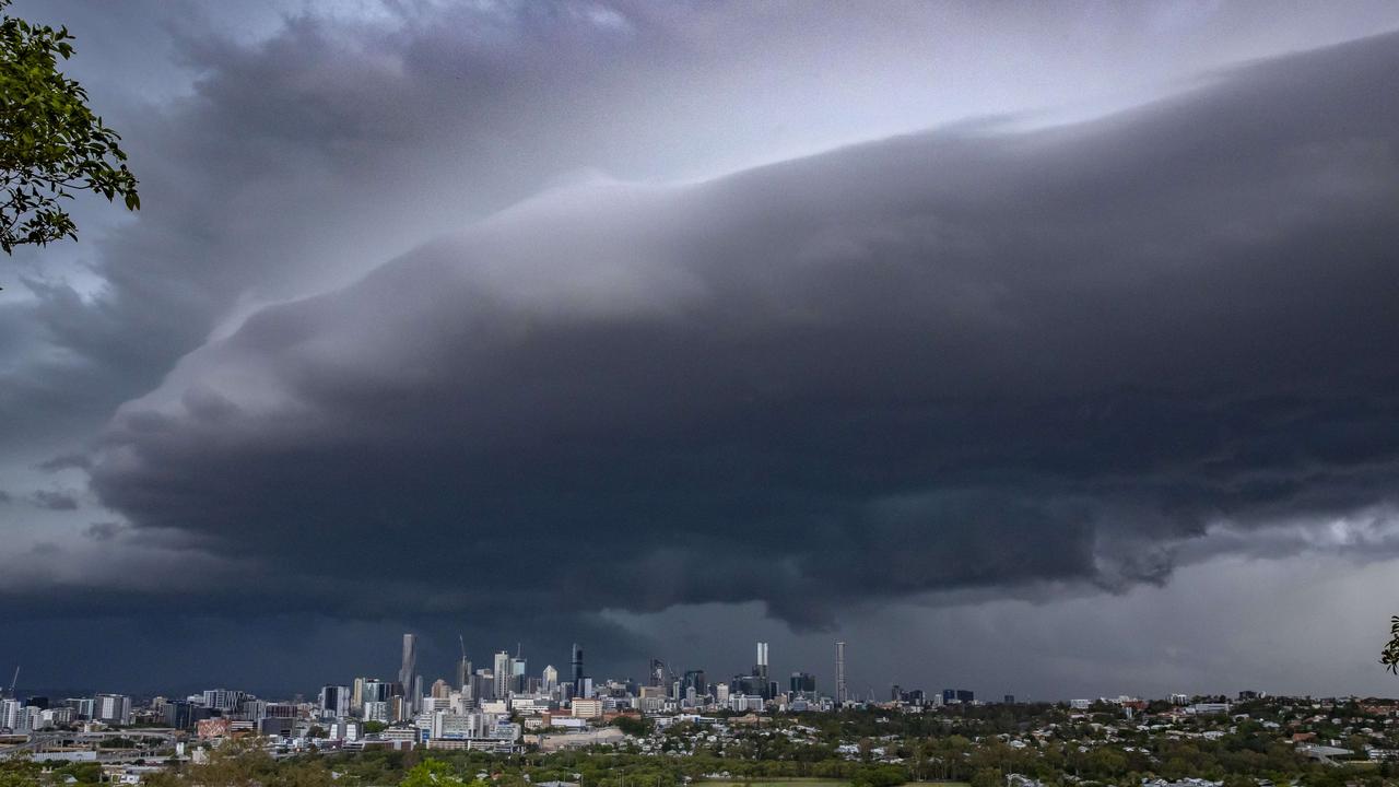
Qld weather: Wild thunderstorms, giant hail smashes southeast
Insurance companies are receiving hundreds of claims after yesterday’s supercell storms caused widespread damage.
QLD weather news
Don't miss out on the headlines from QLD weather news. Followed categories will be added to My News.
More than 2000 homes and businesses are still without power today after supercell storms smashed into southeast Queensland on Monday afternoon.
RACQ has received 158 claims for motor vehicle and property damage with the majority coming from the Ningi, Sandstone Point, Bribie Island and Banksia Beach areas.
The heaviest falls were recorded at Borumba Dam on the Sunshine Coast, with 142mm.
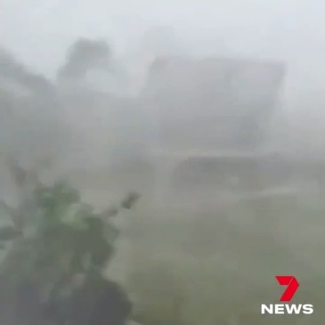
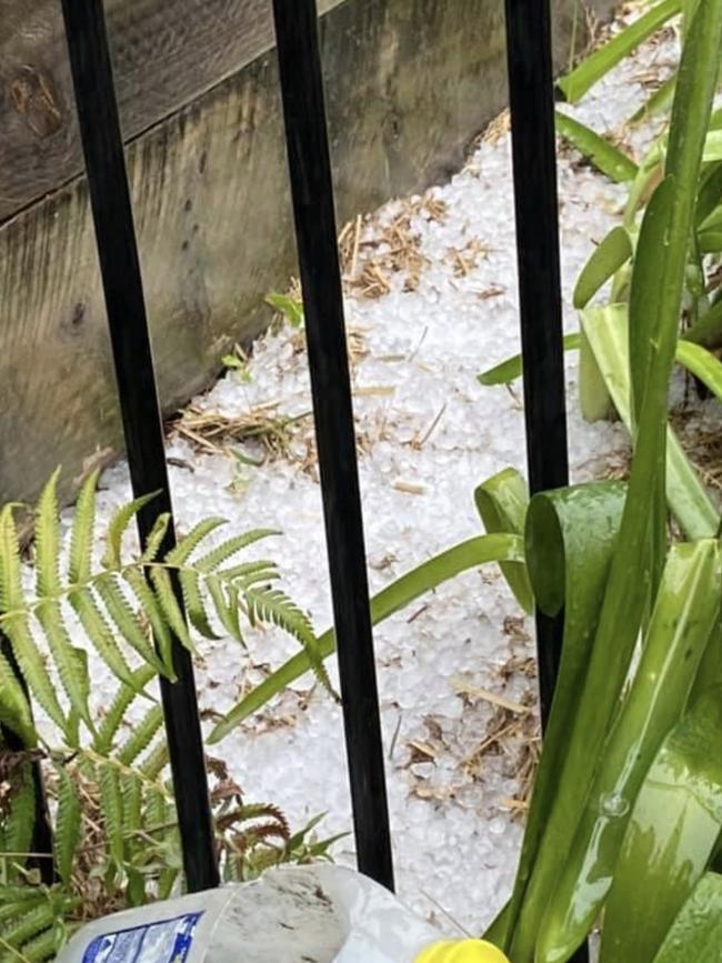
The storms delivered golf-ball-sized hail and destructive winds, and cut power to more than 26,000.
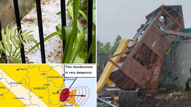
The giant hail, measuring up to 4cm, fell at Bribie Island just after 2pm Monday, while the Bureau of Meteorology also said hail measuring 2-3cm was reported near Woodford just after 1pm.
Also on Bribie Island, multiple trees have blown down as wind gusts of up to 57km/h were recorded in the southeast.
Heavy rain was also seen in some parts.
Up to 35mm fell at Kandanga in the 15 minutes to 4.50pm.
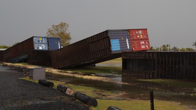
The wild storms also sent trampolines, cubby houses and other backyard items flying. At Sandstone Point Hotel, shipping containers were seen blown over.
Destructive wind gusts as strong as 93km/h were recorded. That strong gust was recorded at Dalby about 4.26pm.
Wind gusts up to 57km/h were recorded in Bundaberg just before 4pm, while gusts up to 39km/h were seen on the Sunshine Coast, 32km/h at Hervey Bay, 32km/h at Tin Can Bay, 30km/h at Tewantin, 28km/h at Cape Moreton and 20km/h in Brisbane.
RACQ said it had received 40 property claims and 30 vehicle claims by 5pm.
What a shot! Three bolts of lightning strike at Wandoan Solar Farm, west of Kingaroy. Warnings remain in place for the South East with cells heading towards Gympie and the Sunshine Coast. Credit: Gav Grilla Bagnall. https://t.co/OyAjjYbB1y #qldweather #7NEWS pic.twitter.com/V1SO9rnyNV
— 7NEWS Brisbane (@7NewsBrisbane) December 7, 2020
The Bureau of Meteorology said at 7.15pm severe thunderstorms in the warning area had temporarily eased.
However the redevelopment of severe thunderstorms with heavy rainfall remained possible north of about Kilcoy.
The bureau was continuing to monitor the situation.
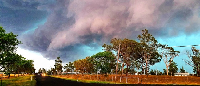
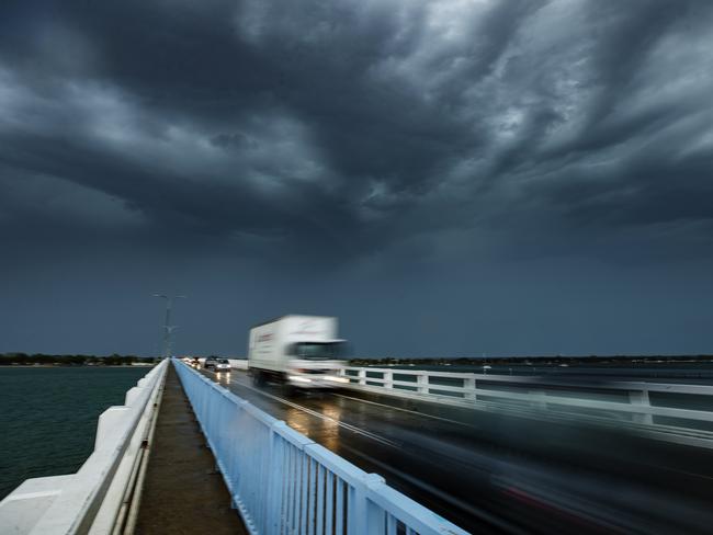
The BoM has issued warnings all afternoon as the severe storms swept through various parts of southeast Queensland from about 1pm.
As many as four super cells at once had earlier swept through the region.
It comes after a muggy day in Brisbane, with the temperature climbing to 34C on Sunday.
It has hit 41.2C in Richmond in the Northern Goldfields, while it has hit 39.7C at Julia Creek, 37C at Rolleston and 36.2C at Gayndah in the final blast from the state’s two-week heatwave.
BOM forecaster Rosa Hoff said a “mix of multiple conditions” was responsible for the storm prediction.
“It’s not just one thing that’s led to this forecast – it’s a mix of conditions at the right time.”
“This will see more storms flow inland in south east Queensland, but we might expect to see something on the coast this evening.”
Despite the promise of coastal falls, Ms Hoff warned the rain was unlikely to make it as far north as Fraser Island, with Tuesday set to be “the best chance” of the week.
“There is some possibility of Fraser getting some rain tomorrow, but it wouldn’t be enough to make any significant changes to the fire situation.”
At 7.10am, Brisbane’s apparent temperature was pushing 32C with an actual temperature of 28.7C making it the hottest place in southeast Queensland this morning.
Earlier, meteorologist James Thompson said the warm days had been consistent since December began.
“We’ve had quite a bit of heat over Central Australia for the last little while and it’s been brought into Queensland for the last week or two, we’ve had pretty warm days and that’s now being dragged into the southeast,” he said.
“Yesterday we had pretty warm temperatures with Ipswich getting to 40C, so it’s been warm for a little while and we’re going to see a continuation of that.

The heat was expected to be accompanied by storms, with a chance of them developing into severe thunderstorms over the southeast this afternoon.
“We are forecasting thunderstorms and even the odd severe thunderstorm in the afternoon or evening through the Brisbane and southeast area all the way up to the Wide Bay.”
More Coverage
Join the conversation
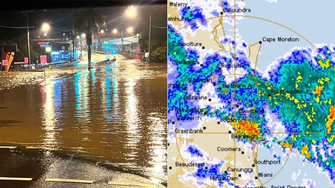
Two women struck by lightning after 234mm rain bomb, severe storms
Brisbane is in the firing line for possible heavy rainfalls, after a night of wild weather during which two women were taken to hospital after being hit by lightning.
Read more
SEQ to be lashed with storms, 100mm downpour ahead of Anzac Day
Showers and storms are forecast to soak South East Queensland on Thursday afternoon with lingering rain expected to fall on Anzac Day Dawn Services and marches.
Read more