
Qld weather: State braces for ‘wet, wet weekend’, with record-breaking rain possible in parts
The Premier has issued severe weather warning for parts of Queensland, saying people should prepare for “incredibly heavy rain” in areas that are already saturated, confirming some places are likely to receive their highest May rainfall on record.
QLD weather news
Don't miss out on the headlines from QLD weather news. Followed categories will be added to My News.
The Premier has issued severe weather warning for parts of Queensland, saying people should prepare for “incredibly heavy rain” in areas that are already saturated, confirming some areas are likely to receive their highest May rainfall on record.
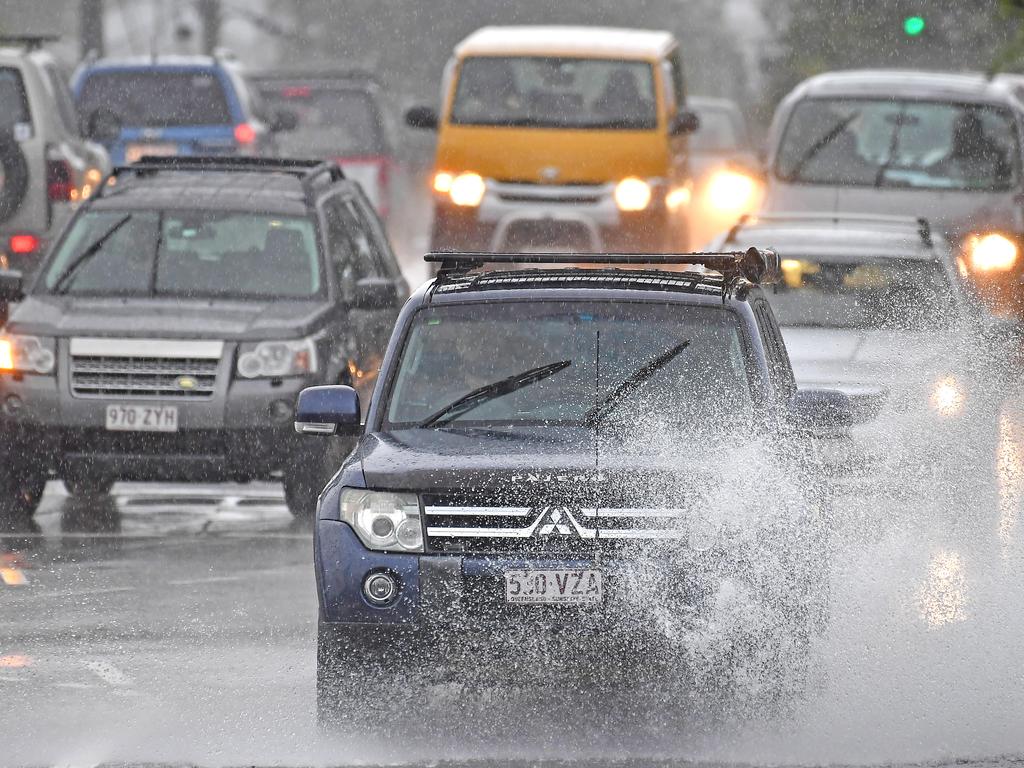
Queenslanders are being warned to brace themselves for a “wet, wet weekend”, with some areas expected to receive their highest May rainfall on record amid falls of up to 250mm.
The southeast is set to cop a drenching, with a new storm system to hover over the region and bring with it the risk of flash flooding following a wild night of storms.
Annastacia Palaszczuk said authorities are closely monitoring the developing weather event, which is expected to ramp up next week.
Significant rainfall totals are expected across large parts of the state, with North Queensland expected to cop the biggest totals.
Ms Palaszczuk said the southeast shouldn’t experience as intense weather as it previously had during the past wet season, but streams and rivers around Queensland were saturated, but rainfall records would be broken elsewhere.
“We are expecting higher rainfall totals than we have seen before in May,” she said.
Ms Palaszczuk said authorities were expecting “incredibly heavy rainfall, particularly in far north Queensland and western Queensland”.
“We want people to think very carefully over the weekend, most of this rain will be coming in early next week, so to think about their preparations,” Ms Palaszczuk said.
She said Local Government Minister Steven Miles had contacted relevant mayors to ensure they had planning in place.
“Once this severe weather event hits, we of course will stand up our Queensland Disaster Management Group,” Ms Palaszczuk said.
She said it was “very unusual” to see this type of situation at this time of year towards the end of the season.
Meteorologist David Grant said already-saturated catchments would be more responsive to this weather event than they were prior to the wet Anzac Day weekend.
Localised flash flooding will become a risk next week, and Mr Grant said the bureau would likely issue a flood watch for some areas on Sunday or Monday.
The focus of the impending severe weather is expected to be around Townsville, Ingham, Longreach, Winton, Longreach, Windora and Barcaldine, where a sheep station last week recorded its highest daily total in 83 years.
Marcelle Chandler, from Home Creek, said more than 200mm in the rain gauge in late April farmers around Barcaldine, previously desperate for rain, wouldn’t have to sell off more stock or buy in hay.
While they would welcome more widespread showers, Ms Chandler said the potential for another 200mm was a concern.
“We don’t want that again because all the waters ways are still full so rain like that again would be devastating,”
“We might even get some stock losses because they can get bogged and it would be just too muddy for the sheep especially.”
Some farmers in the area had begun moving stock and machinery to higher ground.
The weather bureau has advised severe thunderstorms with heavy rainfall and damaging winds were possible from Carmila, near Mackay, right down to Noosa.
Mr Grant said South East Queensland wasn’t “totally out of the woods” and would also see an increase and showers and storms from this weekend.
“In terms of widespread rainfall, at this stage it’s looking less likely,” Mr Grant said.
He said there was still a risk of flash flooding for the southeast with locally heavy showers, given the wet season the southern corner has had.
The bureau has forecast 60mm to 130mm falling on Brisbane over the next five days.
Low flow releases are planned from Somerset Dam into Wivenhoe Dam over the next three days.
The releases are not expected to cause the lake level in Wivenhoe Dam to increase by more than 0.5m during the three-day period.
Low flow operational releases subsequently increased from Wivenhoe Dam from yesterday afternoon to manage water levels.
Emergency Services Minister Mark Ryan said a response was already under way, with planning by Queensland Fire and Emergency Services, police and councils.
“But we do need the co-operation of Queenslanders,” he said.
“So I’m asking Queenslanders to do what they would do usually … which is watch for the weather conditions, do not enter floodwaters.”
He said residents who usually might need to stock up on supplies during the wet season, should do so.
Queensland Police Commissioner Katarina Carroll said 14 people died during the state’s previous weather event.
“And a lot of that was people driving through flood waters or being caught in flood waters obviously rising,” she said.
“So I ask that you prepare now, that you plan your trip and as you’ve already heard, I’ll reiterate that message, please do not drive through floodwaters.”
The Commissioner said there may be issues with supply across the state but there were systems in place to address the issue.
The heaviest overnight falls in the greater Brisbane region overnight were felt near the Scenic Rim area, where 91 millimetres fell. Wivenhoe Dam received 52 millimetres.
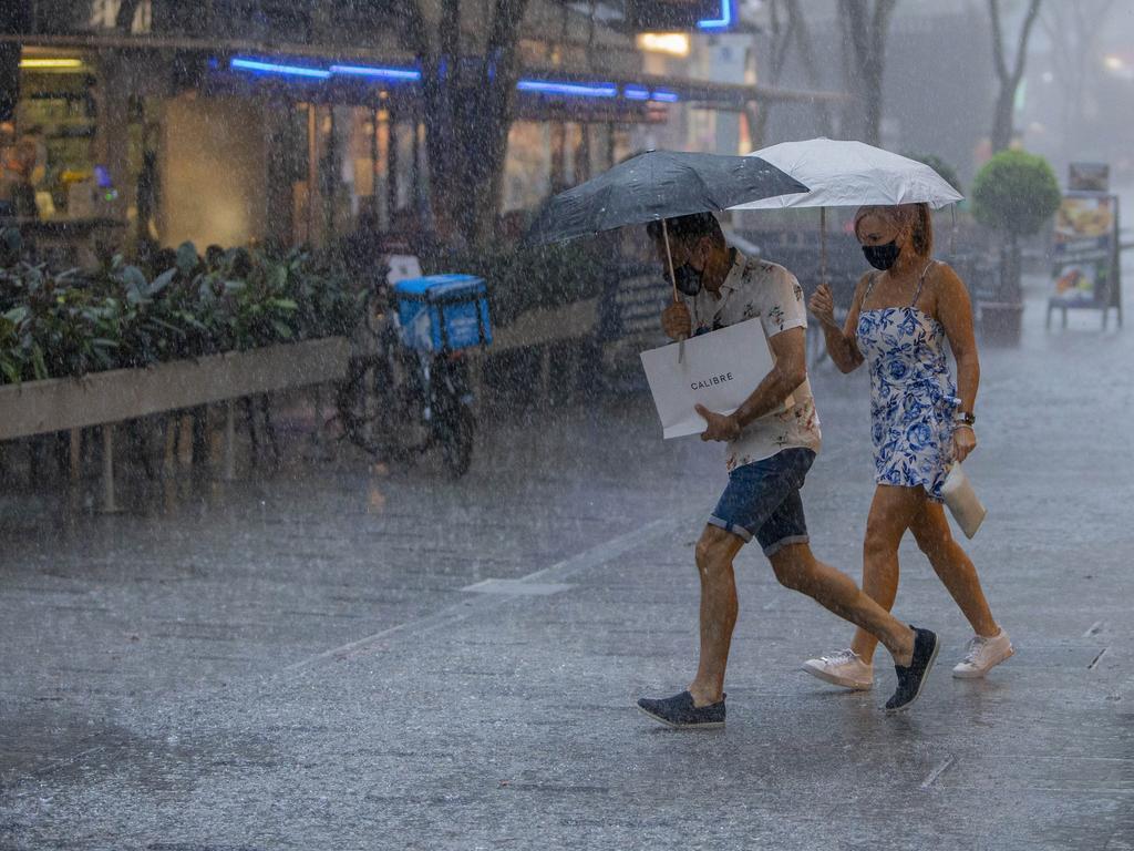
Bureau of Meteorology atmospheric scientist Brooke Pagel said the southeast should brace for a “wet, wet weekend”.
“There is an increased risk of flash flooding due to catchments already being topped up from the last rain we got,” Ms Pagel said.
“In saying that, there is no renewed flood warning out yet for this storm wet weather system.”
The Bureau of Meteorology is advising residents in Charters Towers, Townsville, Cairns and Cooktown to prepare for rainfall totals between 300 and 400 millimetres over the next seven days.
Bureau of Meteorology atmospheric scientist Brooke Pagel said the expected rainfall was 300-400 per cent above average for the month of May.
Those hoping for the clouds to part and a sunny weekend will follow will be bitterly disappointed to learn temperatures are set to drop.
“We are looking at potential morning fog for both Saturday and Sunday, with a very high chance of showers on both days,” Ms Pagel said.
“We are expecting to see rainfall of around 10-25 millimetres throughout the region, including the Gold and Sunshine Coasts.”
The wet weather system is expected to linger in the southeast into next week.

Join the conversation

Ice ice baby: Spectacular images of unseasonal frost as Qld freezes
Queensland’s overnight temperatures will increase to double digits in the coming days, following the coldest start to winter in 16 years, bringing frost and ice to many regions. SEE THE PHOTOS
Read more

City’s coldest June start in 16 years, feels like MINUS 9.8C out west
Southeast Queensland is shivering through its coldest morning in more than 15 years but feels-like temperatures have dropped to insane levels in the southern inland.
Read more