
Widespread damage, 10,000 homes still without power after cyclone-like storm smashes South East Qld
A man is dead and thousands are still without power after a supercell storm comparable to a category 3 cyclone hit late Friday, with 190,000 lightning strikes and 170km/h wind gusts recorded.
QLD weather news
Don't miss out on the headlines from QLD weather news. Followed categories will be added to My News.
A man has died and multiple properties seriously damaged after a supercell storm comparable to a category 3 cyclone slammed into South East Queensland on Friday.
Almost 10,000 properties are still without power this morning, with Moorooka the worst impacted suburb with 1679 outages, followed by 1324 at Woodford and 856 at Salisbury.
Energex spokesman Danny Donald said about 35,000 homes across South East Queensland were without power at the peak of the storms, during which 189,000 lightning strikes were recorded and 250 sections of powerline were brought down.
“That (the amount of outages) is exceptional, I’ve been here for nearly 20 years and that’s some of the highest I’ve seen from a single storm,” he said.
Energex posted on its Facebook page overnight that “the scale and extent of the damage we’re seeing so far is immense; from the Sunshine Coast hinterland down to the Scenic Rim, and dangerous thunderstorms are still rolling through parts of SEQ.”

Recording-breaking winds as strong as a category 3 cyclone along with large hail and torrential rain caused widespread chaos, delaying or cancelling dozens of flights.
Wind gusts of up to 169km/h were recorded at Archerfield at 4.30pm, stronger than Tropical Cyclone Jasper at category 2, according to the Bureau of Meteorology.
A man was killed in Murarrie in Brisbane’s southeast during the wild weather.
Emergency services were called to Murarrie Road just after 5pm following reports of an unconscious man lying near fallen power lines. It is understood he was electrocuted.
Upon arrival, a 30-year-old Murarrie man was located with life-threatening injuries.
He died at the scene.
Police will prepare a report for the coroner.
A local business said they had no idea that a man had died until the power was switched off at their shop.
“We then looked down the street and saw all the emergency vehicles.”
A number of branches lay strewn across the footpath of where a man is believed to have been electrocuted on Friday afternoon.
Another local business owner said he had pleaded for “years” for trees that “dangerously overhang” the powerlines to be removed.
“(The trees) don’t have a lot of good roots and there’s a lot of debris always falling through here,” he said.
“Every time the wind picks up there are branches that fall down (and) a lot of these branches are hollow.”
He aid he was notified that the power had been cut but by the time he got here about 6.30pm it was “too late”.
“(The alarm system) notified me that the power was out, that’s when I came down just to check out the place about 6.30pm,” he said
“But by the time I got down here the ambos had already been here … it was too late.”
Bureau meteorologist Shane Kennedy said Friday’s destructive winds came out of left field.
“The Bureau had flagged the system as a potential thunderstorm but we definitely didn’t expect for it to create this much destruction,” he said.
“A Category 3 tropical cyclone must reach 165km/h winds and the winds out in Archerfield hit 169km/h so we have passed that threshold.
“It is definitely stronger than normal, it is quite a vicious storm.”

The destructive storm has been caused by a “hot, humid and unstable” system which moved through Beaudesert earlier on Friday before lashing the metro area in the late afternoon, with a second band arriving in the evening.
“It really intensified over Archerfield which has now recorded a record wind speed. The previous was 143km/h in 1946.”
At 10.50pm, the Bureau released another warning that severe thunderstorms likely to produce damaging winds and heavy rainfall that may lead to flash flooding were detected near Borumba Dam, the area southwest of Kingaroy and the area east of Nanango and were moving towards the northeast

They were forecast to affect Kingaroy and the area south of Kingaroy by 11:20pm and Nanango, Imbil and Kandanga by 11:50pm.
Various locations between Caboolture and Woodford recorded 60-90mm of rainfall in 30 minutes between 8pm-9pm, while Cooyar Creek recorded 60mm in one hour to 9.49pm.
The more general thunderstorm warning for the southeast was also updated to include the Sunshine Coast and South Burnett regions. Locations which were affected included Yarraman, Cooroy, Imbil, Nambour and Nanango.
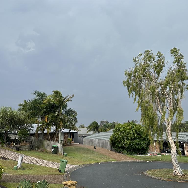
The system was expected to hang around South-East Queensland overnight before cooling off by Saturday morning. Thunderstorms are also forecast throughout the weekend.

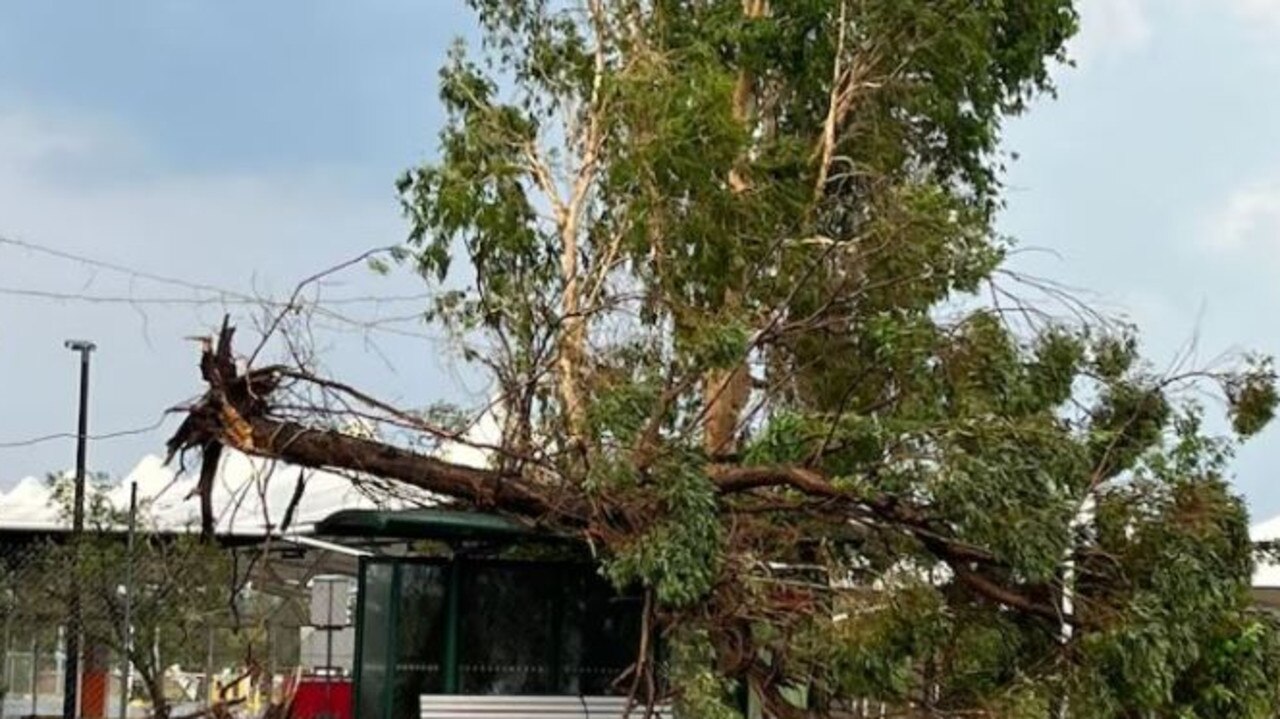
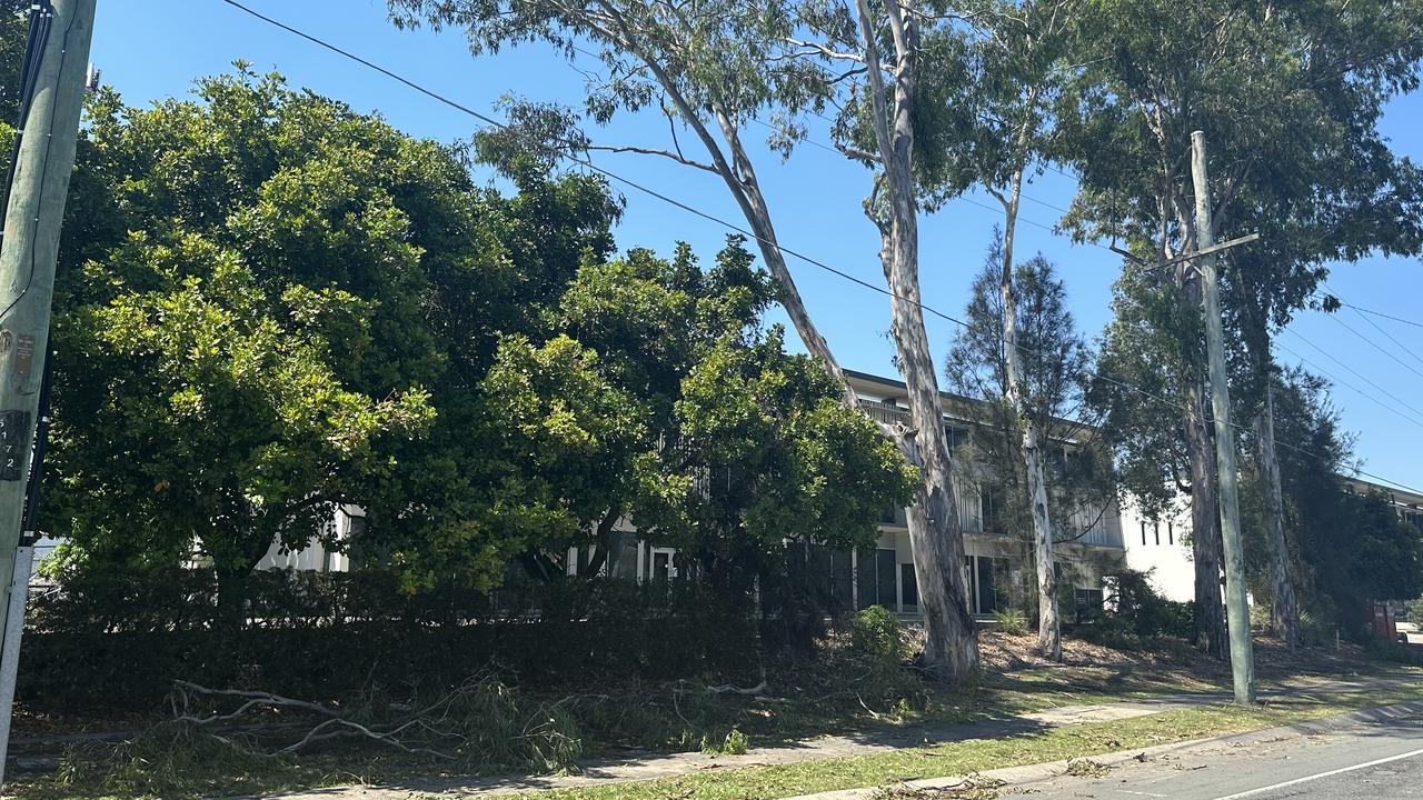
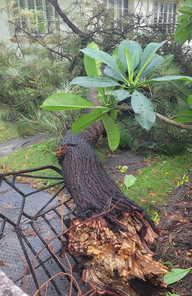
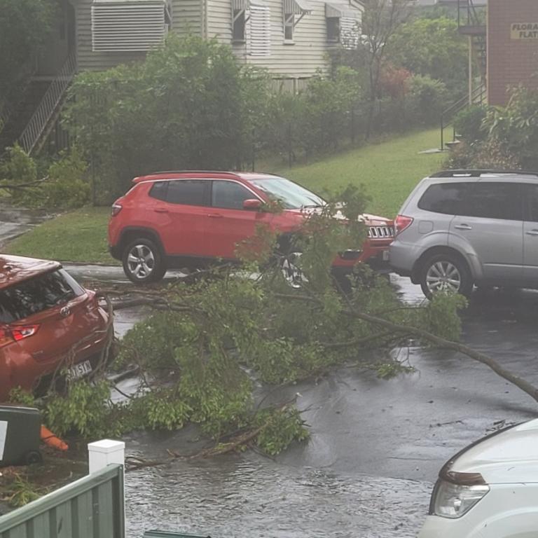
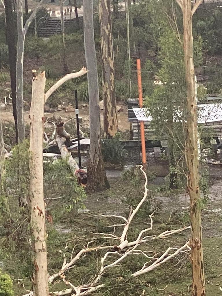
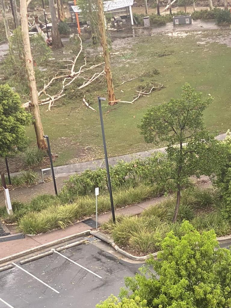
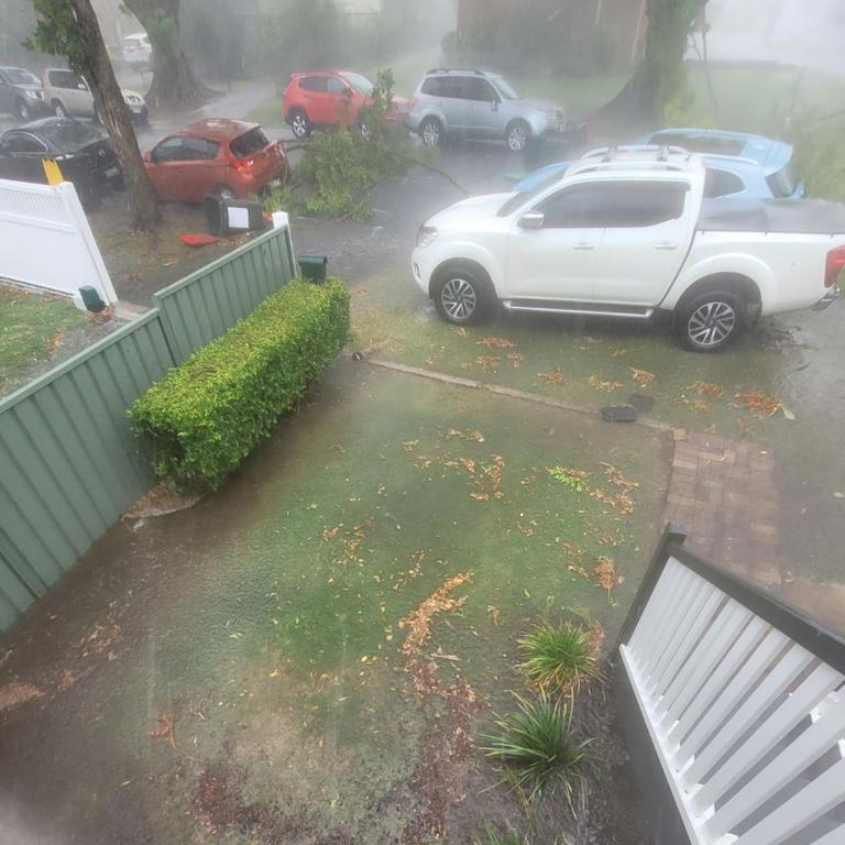
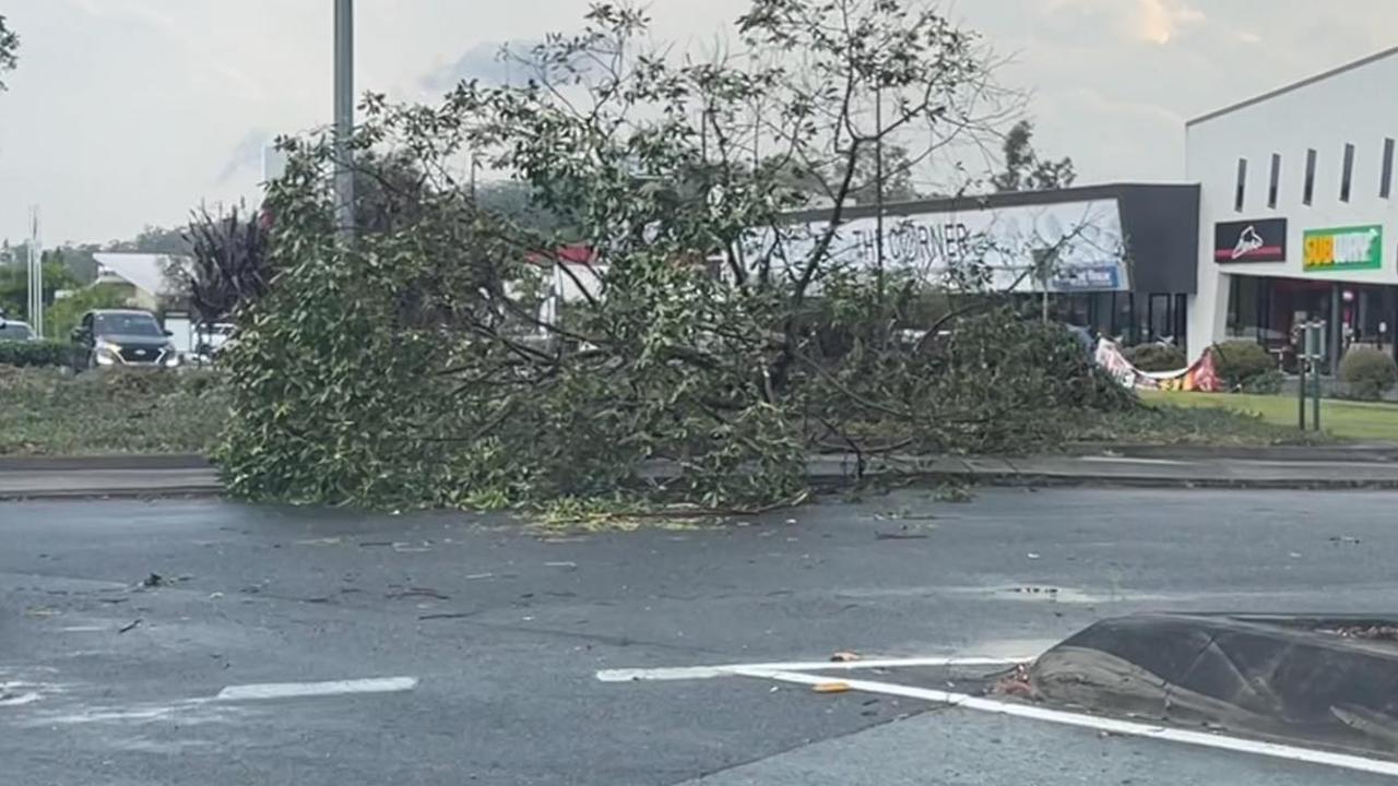
Many Brisbane suburbs were battered with large hail, damaging winds and torrential rain on Friday evening, bringing down trees and leaving locals seeking shelter.
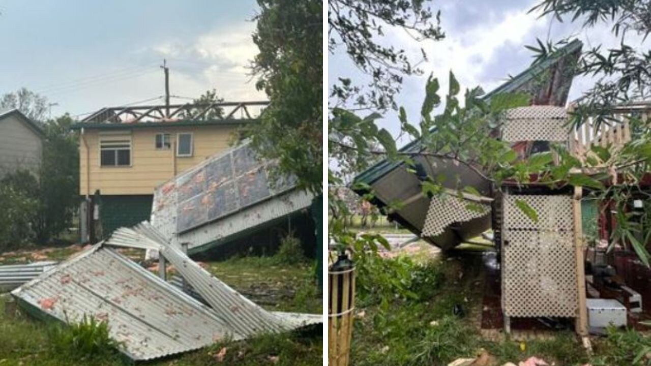
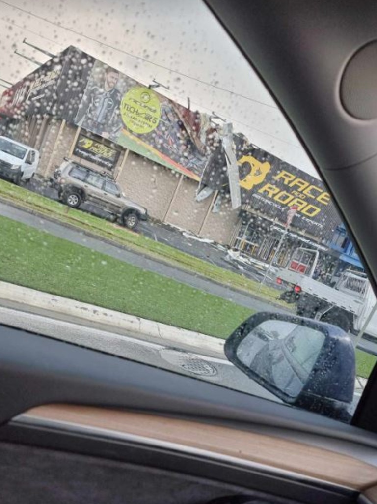
A business in Archerfield lost part of its roof after the cyclonic winds ripped through the building.
The 169km/h winds also toppled light planes stationed at Archerfield Airport.

Photos captured by group staff show at least three planes upside down, leaving behind a massive clean up effort at the airport.

Nathan Drummond was driving through Archerfield when the almost 170km/h winds swept through the area.
“It was absolutely insane,” he said.
“Trees all over the road and everything. Power lines down, all of the power went out, it was a lot.”

One Moorooka resident told The Courier-Mail the suburb “got smashed” with hail, massive wind gusts, trees down, powerlines down and it was so bad you “literally couldn’t go outside”.
As of 7pm, SES had received 147 calls for help in the Brisbane metro area.
More than 50 per cent of the jobs reported were related to structural damage as a result of weather conditions while a further 25 per cent were related to downed trees.
SES received a further 50 calls in the southeastern region, largely because of structural damage.
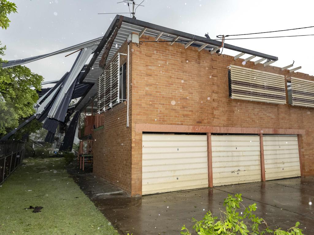
A house on Balham Rd in Rocklea also lost its roof during the 169km/h wind gusts.
Close to 20,000 people around South East Queensland lost power caused by severe weather conditions and downed power lines.
Moorooka recorded the highest amount of outages around the Brisbane metro area with 3,045 customers left without power.
Beaudesert recorded 1647 outages and Camp Hill 1755 all caused by the severe weather conditions.
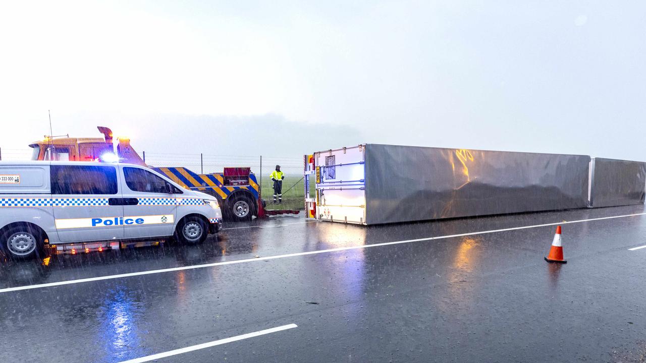
The storms have wreaked havoc on public transport with a number of inbound and outbound flights delayed or cancelled and buses impacted.
A spokesman for Brisbane Airport confirmed that at least seven flights had been diverted away from Brisbane and rerouted due to weather conditions, with dozens of others either delayed or cancelled.
A Qatar Airways flight from Doha to Brisbane and an Air New Zealand flight from Wellington were diverted to Sydney.
After sitting for hours on the tarmac at Sydney Airport, passengers on the Doha flight were told they would have to overnight in Sydney as they couldn’t fly back to Brisbane on Friday night.

Another flight, travelling from Darwin to Brisbane, was diverted to the Sunshine Coast.
Passengers on board the flight from Wellington sighed as soon as they were given the news they would be diverted to Sydney.

Others frantically asked flight attendants how to connect to the free Wi-Fi so they could inform their loved ones of the changes.
At 7.58pm, dozens of planes were still grounded at Brisbane Airport’s domestic terminal.

Jetstar passengers flying to Sydney on JQ823 were told hotels would not be provided as it was a weather event.
Passengers on one Qantas flight inbound from Cairns were warned just after 9pm that there were 35 aircraft ahead of them seeking clearance to land that had first priority, including a medical flight.
Once the plane landed, delays continued, with parking gates occupied by other aircraft.
Planes are waiting on the tarmac loaded with passengers unable to disembark.
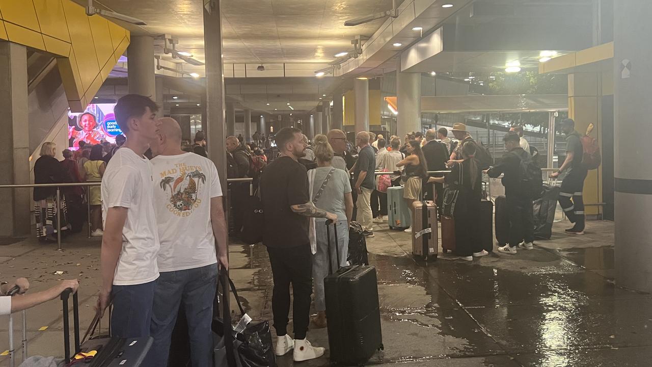
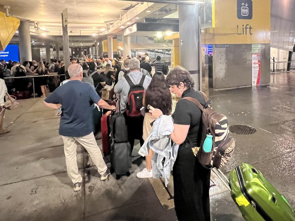
The arrivals hall was in chaos as passengers searched for their bags, with many information screens blank and not displaying which carousel their luggage would arrive on.
Outside, there were enormous lines of people waiting for taxis as the heavy downpour of rain continued.
The queues spilt out of the designated waiting areas that snake through barriers, down the side of the terminal in both directions, with hour-long waits for taxis reported.

TransLink advised passengers that certain buses were delayed by up to an hour due to severe weather conditions.
Social media users have also expressed their anger, taking to Facebook to advise others not to use the buses due to lengthy delays.

The Bureau said severe thunderstorms had developed along a "dry-line" in southeast Queensland on Friday afternoon.
The warnings come as scorching temperatures impacted much of the state on Friday.
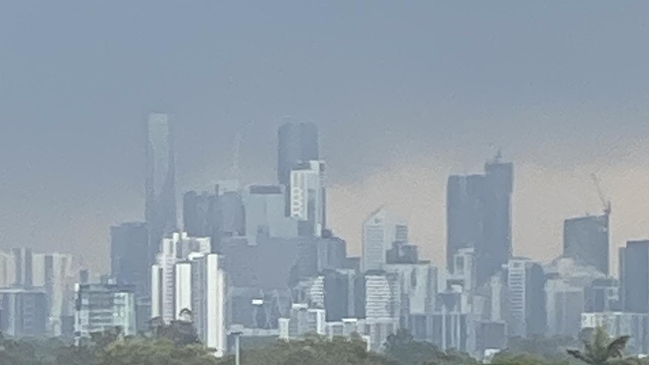
Low cloud cover had blanketed Brisbane this morning as a result of storm activity, but the city reached a high of 35C on Friday – the hottest of any capital city – and was already sitting around 25C by 5.30am.
Bureau of Meteorology Senior Meteorologist Brooke Pagel said there was a severe heatwave warning in place for South East Queensland and into the Darling Downs.
“The heat has developed through from yesterday and will continue into the weekend due to a trough sitting over the coast which is drawing and trapping heat from the north,” she said.
Ms Pagel said maximum temperatures for the South East would reach the mid to high thirties on Friday with overnight minimums sitting in the low twenties.
âš ï¸â›ˆï¸Severe thunderstorm warning update: heavy rainfall, damaging wind gusts, and large hail possible in the southeast, including Beaudesert, Boonah, Jimboomba, Mount Tamborine, and Springbrook. Details and updates: https://t.co/FBmpsInT9opic.twitter.com/EclTVjoCWf
— Bureau of Meteorology, Queensland (@BOM_Qld) December 15, 2023
“The air will be quite hot and humid sitting 4-10 degrees above average for this time of year in parts of South East Queensland.”
Ms Pagel said Ipswich was predicted to get to 37 degrees with Brisbane not far behind.
“Going into tomorrow it’s a similar story with top temperatures of 35 degrees in Brisbane,” she said.
Ms Pagel said the heat would trigger storms with potential for large hail from today until Sunday in the South East.
“There is also going to be damaging winds and rainfall which could bring power outages, tree falls and more so we are keeping an eye on it,” she said.
“Those severe thunderstorms that are shifting in from today will especially affect those metro areas like the Sunshine Coast, Brisbane and Gold Coast.”
Ms Pagel said there was also major to moderate flooding around the Mossman River last night with 266mm of rainfall received between 9am on Thursday morning to 6.30am on Friday morning.
“That is expected to ease off as Tropical Cyclone Jasper moves from the Peninsula today out west and weakens off,” she said.
“But we are keeping a close watch because that could possibly restrengthen over the waters when it moves away.”
Bureau of Meteorology Senior Meteorologist Shane Kennedy said the Daintree River could reach major flood levels due to ongoing rainfall in the region.
“That could be anywhere from 100mm to 200mm and some places up too 300mm,” he said.
“Mona Mona received about 281mm.”
Mr Kennedy said ex-cyclone Jasper was shifting over north eastern Queensland and Cape York Peninsula and was slowly travelling west.
“Moderate flood warnings remain in place for the rest of that region for today and tomorrow,” he said.
“That’s for all of northeast, extending down for Herbert River and Glen Eagle.”
Mr Kennedy said the storm would hinder help reaching areas of damage due to ongoing road closures.

Join the conversation

‘Can’t be ruled out’: Potential for freak Qld snowfall this week
Queensland could see snow this week with weather models predicting up to 14cm falling on the Granite Belt.
Read more

Monster weather system brings storm, heavy rain to Qld
Brisbane and surrounding parts of the southeast have been hit by storms and heavy rainfall this afternoon as a 3000km-long monster low moves across the state.
Read more