Qld weather: Heatwave ends, storms and heavy rain to continue
Damaging wind gusts of up to 146km/h were recorded in northwest Qld and 47mm of rain fell in 30 minutes as severe thunderstorms lashed the state’s south.
QLD weather news
Don't miss out on the headlines from QLD weather news. Followed categories will be added to My News.
Damaging wind gusts of up to 146km/h have been recorded and 47mm of rain has fallen in 30 minutes as severe thunderstorms lash the state’s south on Monday.
The Bureau of Meteorology warned at 8.45pm a severe thunderstorm likely to produce heavy rainfall that may lead to flash flooding was dedicated near Mount Barney and was slow moving. A more general severe thunderstorm warning is also current for parts of the Darling Downs and Granite Belt and Southeast Coast districts.
As the southeast braced for heavy rain and isolated severe storms on Monday night, the northwest was recovering from a large storm bringing 146km/h winds that tore off roofs and flipped vehicles.
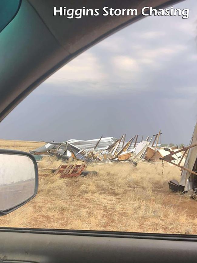
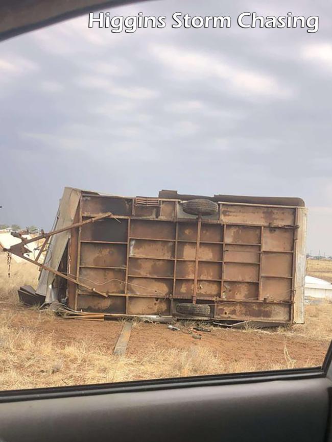
Residents of the small town of Winton were smashed by near cyclonic winds similar to those recorded just 200km away in Julia Creek.
Videos across social media show the strong gales smash residents, with debris flying across the ground and trees near snapping at the roots.
Pictures posted by Higgins Storm Chasing showed a donga that had been destroyed and a caravan tipped on its roof.
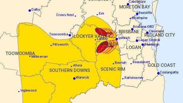
The thunderstorm was moving towards the east and were forecast to affect affect Marburg by 8:30pm and Harrisville, Amberley and Lowood by 8:45pm.
The BoM said 47mm of rain was recorded at Thornton, in the Lockyer region, in the 30 minutes to 8.21pm.
A more general severe thunderstorm warning is also current for parts of the Darling Downs and Granite Belt and Southeast Coast districts.
The more general warning was updated at 7.16pm, with BOM warning that severe thunderstorms could impact Warwick, Stanthorpe, Gatton, Pittsworth, Laidley and Lowood in the coming hours.
Severe thunderstorms are likely to produce heavy rainfall that may lead to flash flooding and damaging winds in the warning area over the next several hours. Locations which may be affected include Warwick, Stanthorpe, Gatton, Pittsworth, Laidley and Lowood, the warning read.
A previous alert for the central northern corner of the state was cancelled in the same alert, despite wind gusts of up to 146km/h being recorded at Julia Creek Airport in the outback just before 4pm.
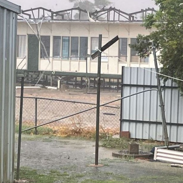
The 6.20pm alert warned severe thunderstorms are likely to produce heavy rainfall that may lead to flash flooding and damaging winds in the warning area over the next several hours.
Locations which may be affected include Warwick, Stanthorpe, Inglewood, Millmerran, Clifton and Pittsworth.
It was expected storms could make their way closer to the coast later in the evening.
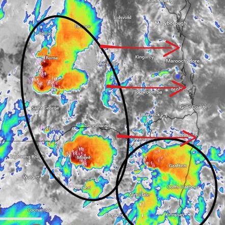
It stated a surface trough through central Queensland with very moist, unstable conditions could bring severe storms, likely to produce heavy rainfall that may lead to flash flooding.
It comes after severe thunderstorms marked a spectacular end to scorching days and nights, as the recent heatwave affecting much of Southeast Queensland came to an abrupt end on Sunday night.
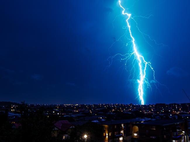
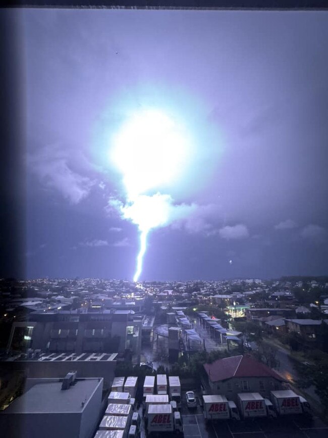
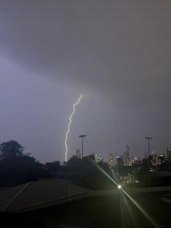
Spectacular lightning lit up huge areas of the southeast, on Sunday, with heavy rainfall of up to 90mm and loud thunder accompanying it in the early evening storms.
MetraWeather confirmed that during Sunday evening there were 5336 lightning strikes within a 50km radius of Brisbane.
“This was a very high number when considering most of these occurred within a 3-4 hour window,” a spokesman said.
The storms persisted until midnight before moving offshore.
More rain and storms are expected to lash Southeast Queensland on Monday night and for most of the week.
Senior meteorologist Miriam Bradbury said the primary hazard into Monday and Tuesday afternoon and evenings would be heavy rainfall.
“We are likely to see heavy rainfall across Charleville, Southern Downs and Granite Beach,” Ms Bradbury said.
“Damage from large hail could cause damage to property and cars.
“Heavy rainfall can quickly lead to flash flooding as a lot of rain falls in a short space of time,” she said.
Ms Bradbury said thunderstorm conditions would continue until Thursday.
Bureau of Meteorology meteorologist Helen Reed said the lightning reached the Gold Coast, Brisbane and northern New South Wales making for “spectacular” sights.
A police spokesman said a total of 55 requests for State Emergency Service assistance were received in relation to severe weather last night with most relating to structural damage.
“With rainfall of 25mm to 50mm generally in the south, a couple of roads and walkways were flooded,” Ms Reed said.
“We have a surface trough running through south east Queensland that helps moisture lift in the atmosphere, there’s a lot of tropical moisture feeding in.”
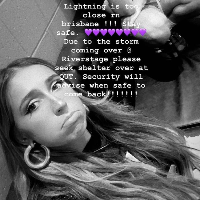
The violent storms forced the Brisbane concert of Canadian pop singer Tate McRae to be evacuated over safety concerns on Sunday night, while Take That didn’t make the stage at all for their A Day on the Green at Sirromet Wines.
Tate McRae’s Riverstage gig had not yet begun when audience members were told to seek shelter at nearby QUT.
The artist posted to Instagram, saying security would advise when it was safe to return.
Audience members were allowed back into the venue around 8.30pm.
At Sirromet, A Day on the Green had support act Rick-Lee’s set but was cancelled towards the end of Sophie Ellis-Bextor’s set.
The British singer announced that she’d been advised to pause the show due to lightning but never returned to the stage, and it was soon announced that Take That’s headline show would not go ahead.


The Back for Good hitmakers issued a statement on Instagram explaining that due to “the severe weather events experienced across Brisbane and South East Queensland this evening, the Take That show at Sirromet has been cancelled.”
Ellis-Bextor also shared a message on social media, writing that she was “so sorry the rain stopped play tonight in Brisbane! Hope to be back again soon and thanks to Take That for having us with them for these show. Xxx hope everyone got home OK.”
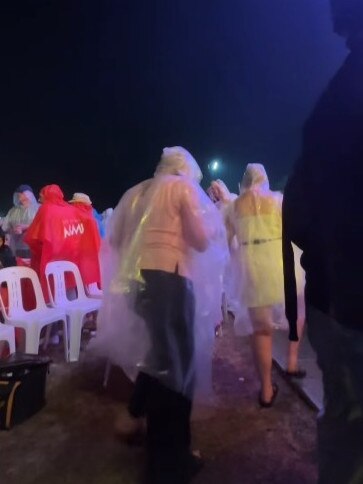
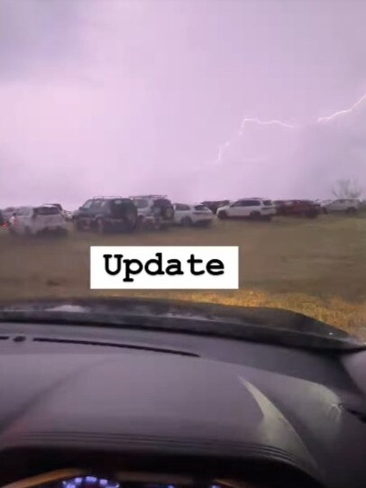
A Day on the Green concertgoers will receive a refund following the cancellation.
One fan shared a breakdown of how the emergency unfolded across several Instagram stories.
“So, they’ve paused the show for Take That, because the heavens have opened and it’s lightning, big bolts of lightning,” she said.
“We’re sat in a field with a few thousand people and nowhere to go. We’re two rows from the stage – see that big metal structure in front of me? Not a fan.”
She and others soon retreated to their vehicles as the conditions worsened, with fork lightning lighting up the sky as the concert was called off and all concertgoers asked to evacuate the site.
Ms Reed said moisture in the atmosphere this week was “a good recipe for thunderstorms”, warning there would likely be more to come.
“Severe storms are set to develop on Monday afternoon and continue into the evening,” she said.
Areas impacted on Monday afternoon were expected to be Darling Downs, Maranoa, and areas to the south of Brisbane.
The heatwave warning is expected to contract towards the northwest where temperatures in the mid 40C are set to linger at the start of the week.
SEQ MONDAY TEMPERATURES
Brisbane: 29C
Logan: 29C
Moreton Bay: 25C
Gold Coast: 29C
Sunshine Coast: 28C
Ipswich: 31C
Toowoomba: 29C
– additional reporting by Nick Bond


