
Qld weather: Storms lash South East Queensland with 57,000 lightning strikes, 46mm falls
Storms have formed over Brisbane and the Sunshine Coast just hours after a severe cell smashed the Gold Coast as unstable weather conditions continue.
QLD weather news
Don't miss out on the headlines from QLD weather news. Followed categories will be added to My News.
Storms have formed over the southeast just hours after a severe cell smashed the Gold Coast as unstable weather conditions continue.
Thunderstorms began impacting Brisbane and Sunshine Coast areas about 1pm, dumping widespread rainfall.
Brisbane Airport and Nambour received 8mm in less than an hour, while Redcliffe and Tewantin received 1.4mm and 1.8mm respectively.
In total Nambour received 23mm on Monday afternoon, Eumundi 31mm, Meridan Way gauge recorded 39mm and Beerburrum 15mm.
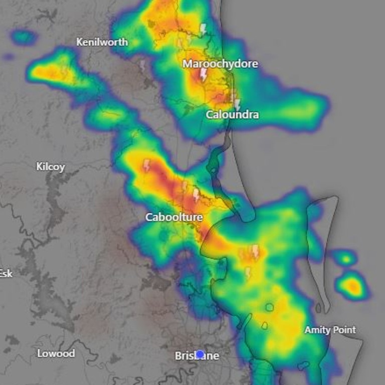
Storms continued moving offshore during Monday afternoon.
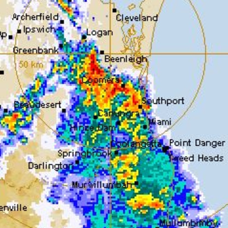
It came about eight hours after the Gold Coast and Logan were rudely woken by surprise thunderstorms that dumped heavy rain on the region.
Gold Coast and Logan locals were hit with thunder, lightning and heavy rain, with 46mm falling in the Scenic Rim, with other isolated rain patches reaching as far north as Caboolture.
In the hours before 7am, 30mm of rain was recorded at Beaudesert, 28.4mm at Coolangatta and 19mm at Cape Moreton.
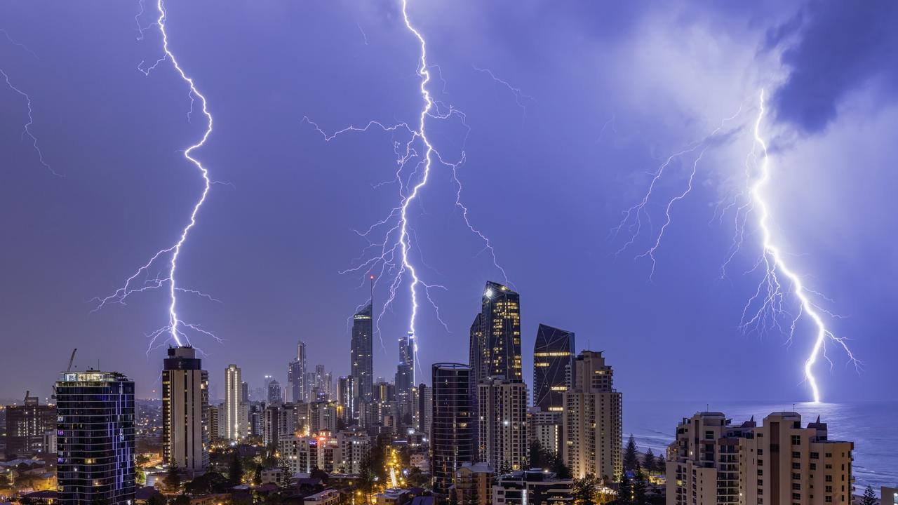
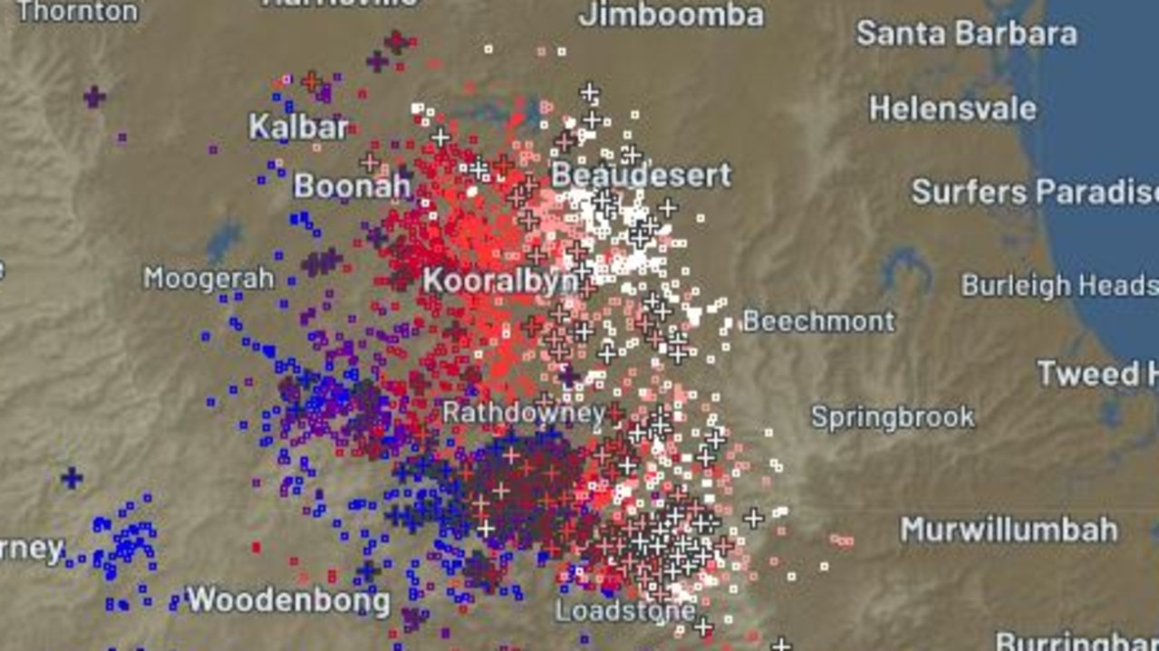
Energex confirmed 57,000 lightning strikes hit the South East overnight, including 9,000 on the Gold Coast. Another 12,500 strikes hit areas across north Brisbane and near Caboolture as the cell moved out to sea around 1pm.
Bureau meteorologist Livio Regano said the early morning storm was short and sharp.
“The Gold Coast Hinterland and the Border Ranges seemed to be the places with the most rain, with 47mm of rain falling around the Scenic Rim region,” he said.
“We had a few decent coastal falls like 26mm in Coolangatta.
“Most of the falls were typically between 10mm and 20mm.”
Mr Regano said there is a further chance of minor thunderstorms and showers this afternoon.
Meanwhile, a catastrophic fire warning is in place for the Darling Downs and Granite Belt, with Channel Country, Maranoa and Warrego on extreme fire alert.
In a post to X on Monday morning, Queensland Fire and Emergency Service (QFES) commissioner Greg Leach said grass fires had already sprouted in Greymare in the Southern Downs.
“Our crews have been kept busy fighting multiple grass fires and conditions are expected to worsen today,” he wrote.
“We are prepared to respond, but the community has a role to play as well.”
Warm, dry north-westerly winds are expected to develop over the warning areas today, with a south-westerly wind shift expected to reach the western Maranoa and Warrego district this evening.
Winds combined with exceptionally high fuel load has significantly enhanced fire risk.
Thunderstorms are expected to impact the Darling Downs and Granite Belt during Monday afternoon, creating further fire threat due to lightning strikes.
It comes as Queensland is expected to face a hot, dry spring that feels like summer, after recording its warmest winter in more than 110 years.
The Bureau on Friday released its national winter summary report on Friday, which showed temperatures in Queensland were 2.32C above average – the hottest ever recorded.


Storm shield: How AI will protect our state of disaster
Queensland has secured world-first AI storm detection technology in a $3m partnership between Suncorp and the state government to revolutionise natural disaster response.

Hail, rain, wind, SNOW: Winter storm on Qld collision course
A rare winter storm threatens to dump 15cm of snow on Queensland's Granite Belt this weekend as forecasters warn of an incoming polar air mass.