Brisbane storm: Suburbs hit by 70mm in hour, M1 flooded, trains suspended
Brisbane residents have been caught out by flash flooding across the city, left stranded and with countless cars inundated as water rose quickly, with some suburbs copping close to 100mm in two hours.
QLD weather news
Don't miss out on the headlines from QLD weather news. Followed categories will be added to My News.
Brisbane residents have been caught out by flash flooding, many left stranded as countless cars inundated were inundated by rapidly rising water as close to 100mm fell in two hours.
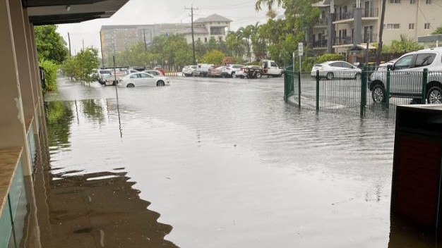
Multiple inner suburban streets were flooded and lanes on the M1 south of Brisbane were also closed by a slow-moving storm across the city. Trains were suspended after tracks were covered with water.
The inner-south suburb of Holland Park West copped 88mm in the two hours to 12.52pm today. Around the same time, Rosalie, in Brisbane’s inner-west, copped 70mm in the 60 minutes to 12.53. The CBD received 51mm in the 30 minutes to 1pm.
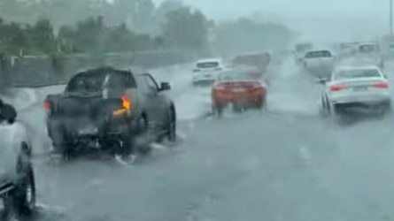
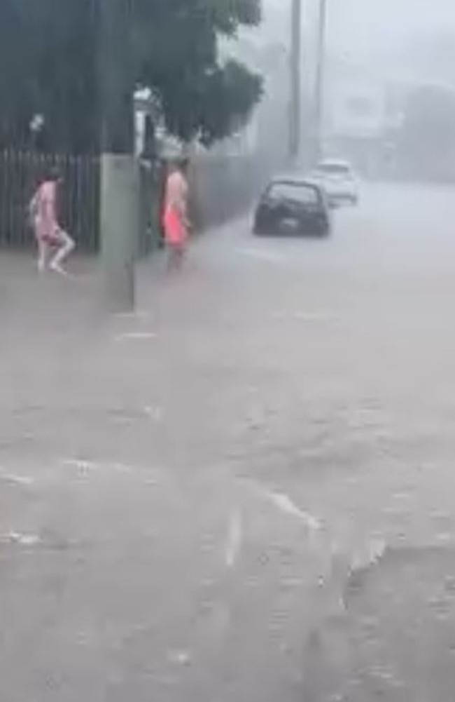
West End residents were caught out by flash flooding on Montague Rd around lunchtime.
Jon Hodgins and partner Nicole Machen said the rain came with “no warning” and their car broke down among the flooding.
“We were just coming down Montague Rd, it was probably about a knee deep of water coming through this road,” Mr Hodgins said.
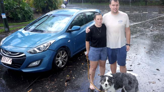
“And then we came up here (Norfolk Rd) and the water came straight over the bonnet of our car.”
A second vehicle, which was parked on the side of the road, also became stranded.
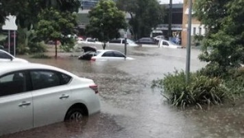
“We heard a lady say ‘someone’s motorbike was submerged’ but we kind of thought she was just being a bit dramatic and then we were like ‘probably should go check on the car just in case’, came down the road and it (the water) was up past the licence plate,” the car’s owner Tarylyn Gardiner said.
There was also considerable flash flooding at Stones Corner, Coorparoo and Greenslopes, with AJ Hanlon Park turning into a raging torrent.
Greenslopes residents Sarah and Jake Barros said while the area often flooded when it rains, their own street had never been inundated.
Mrs Barros said she was driving home with her three children Charli, Alfie and Emery when the rain began.
“It is pretty scary, our backyard and garage have been flooded but our house is okay,” Mrs Barros said.
“We see the park flood regularly but it hasn’t been this bad in a while. It just happened so quickly – it only took ten minutes for the flash flooding to begin.”
Randa and Rod Chammas were attending Sunday mass with their family at St Paul’s Antiochian Orthodox Church when the storm hit.
“We have been stuck here for the past two hours because the road is closed,” Mr Chammas said.
“We had just finished our liturgy and were having a cup of coffee at the hall when in a matter of minutes, it went from nothing to out of this world rain.
“The water flooded the park and it was coming for the church, someone’s poor car got stuck in it. Now we are just waiting for the all clear to leave we had an event after mass.
“It just flooded in about 10 minutes – the problem is not so much the rain but the drains can’t handle it.
“It was just crazy it all unfolding in front of our eyes.”
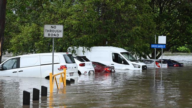
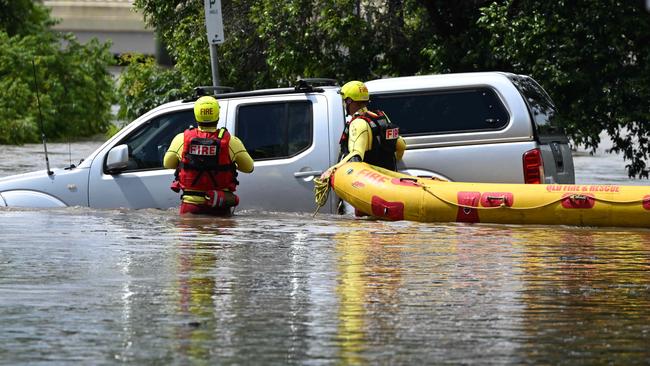
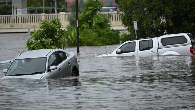
The SES and Queensland Fire swiftwater rescue crews attended multiple incidents where people were stuck in cars because of floodwaters.
Emergency services rushed to reports a man was stuck in his car on Cornwall St and King St at Annerley.
He was removed from the car and was not required transport to hospital.
On Lincoln St at Greenslopes, multiple cars had water up to their roofs. Burwood Rd at Annerley also had cars inundated with water.
Water was knee deep at the Buranda Village on Cornwall St.
The rain created havoc on the Pacific Motorway at Loganholme, with all lanes affected and motorists hit with massive delays.
There was flash flooding at the exit 31 on-ramp and lanes heading southbound towards Beenleigh.
Likewise, there were widespread delays on the rail network.
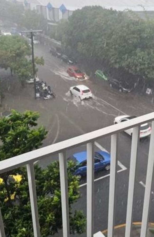
Just after 1pm, Queensland Rail said all train lines across the city were impacted by the rain, with delays of up to 60 minutes due to localised flooding at Bowen Hills and South Bank train stations.
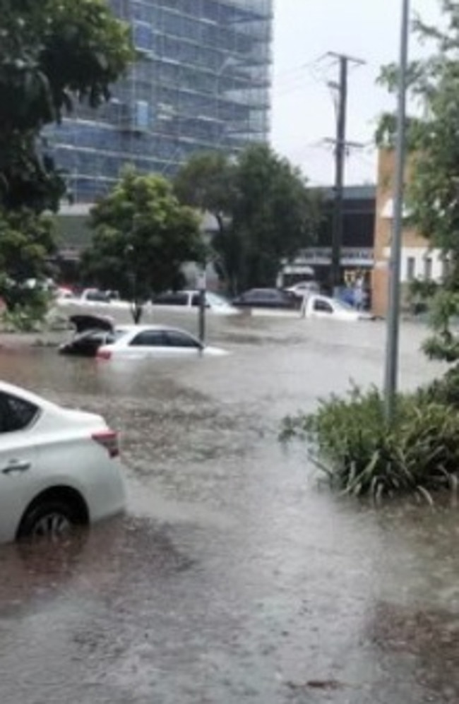
South of Brisbane, Queensland Police earlier warned motorists of multiple rock slides in the Gold Coast hinterland.
Police said Lamington National Park road heading towards O’Reilly’s Rainforest retreat at Canungra was affected.
The Bureau said a “humid and unstable” air mass was causing the slow-moving storms.
It comes as flood warnings remain in place for parts of South East Queensland following severe storms on Saturday afternoon and evening, including flash flooding across the Lockyer Valley.
The warning is in place for the Logan and Albert rivers after isolated severe storms and persistent heavy rain redeveloped.
There is also a moderate flood warning in place for the Bremer River and Warrill Creek with moderate flooding occurring at Amberely and Harrisville.
There were nine minor to major flood warnings across Queensland.
The weather bureau’s Brooke Pagel said flooding was expected for Beaudesert today after a major flood warning was issued last night for the Logan and Albert rivers.
“We are expecting major flooding at Beaudesert this morning and throughout the day, and then across the next couple of days as those flood waters move downstream,” the meteorologist said.
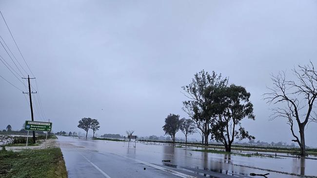
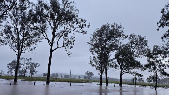
Around 70 storm-related SES callouts were made from 5am on Saturday, predominantly in the Moreton Bay, Ipswich and Gold Coast areas, with more on Sunday afternoon.
The Queensland Fire Department swift water rescue team escorted five people to safety after they were isolated by floodwater on John Road in Mudgeeraba at 2.48am. No one had suffered injuries and did not need to be taken to hospital.
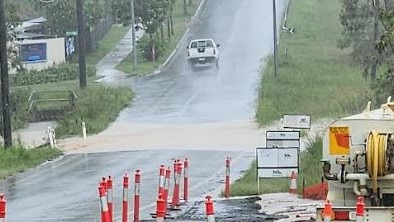
In Beaudesert, a woman was rescued from her vehicle after it got caught in floodwater on McKee Street at 11.09pm on Saturday night.
The woman was taken to Beaudesert Hospital in a stable condition.
Meanwhile, in Griffin, one man was treated after his vehicle got caught in flooding on Dohles Rocks Road at 11.16 pm. The man was uninjured and did not need to be taken to hospital.
The flash flooding across southeast Queensland is a result of torrential rain overnight, which saw rainfall totals skyrocket.
The Gold Coast hinterland saw the most rain overnight, with the highest rainfall seen at Upper Springbrook (265mm), Mt Nimmel (226mm), and Springbrook National Park (232mm).
The City of Ipswich also saw high rainfall totals with Rosewood copping 123mm and Goolman, 120mm. Ms Pagel said Southeast Queensland could expect more showers on Sunday however the threat of heavy rainfall would ease by Monday.
“We are looking at that rainfall easing as the system really weakens and moves away from the state,” she said.
“But we do have thunderstorms and showers continuing over the Far North Queensland, with a little bit of a different system up there at the moment.
“In the west, however, we can expect thunderstorms and showers to return as a new cloud band makes its way through tomorrow – but we are not looking at as significant rainfall totals as what we saw with this one.”
At 7.25 am, an initial flood warning for the Nerang and Coomera Rivers was issued by the weather bureau.
Rainfall has caused some localised rapid river and creek level rises, and isolated minor flooding in parts of the South Coast Catchments.
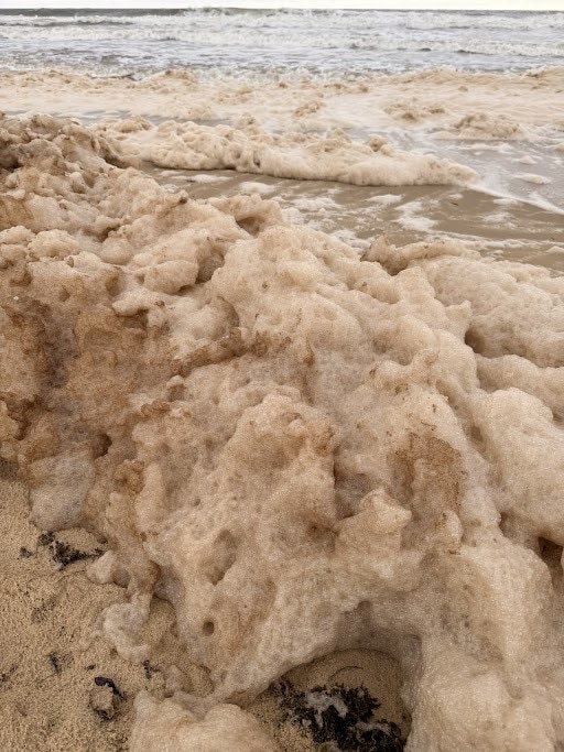
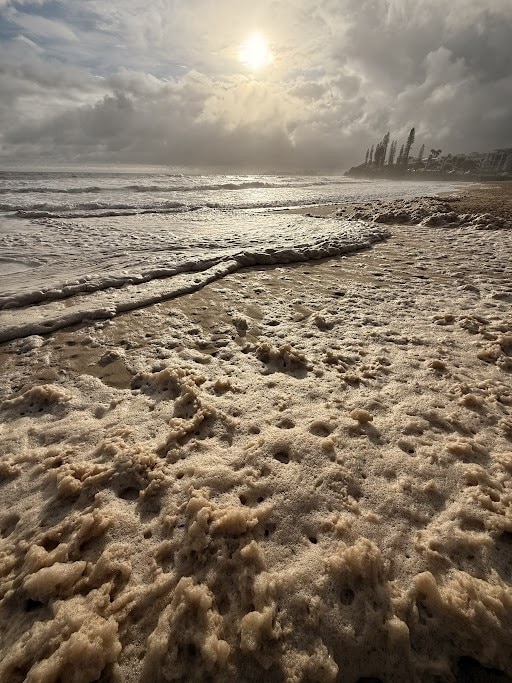
On the Sunshine Coast, the effects of all the rain could be seen with dirty foam water washing ashore at Alexandra Headland and Mooloolaba.
Flash flooding also impacted several properties across the region including at Kensington Grove near Marburg.
“I just hope the rain calms down and it doesn’t go crazy overnight and fill up again.
“Kensington Grove resident Nick Knopke returned from a trip to Bundaberg to find flash flooding impacting his neighbour’s property.
“I just got back from Bundaberg, got down my street and my neighbour’s shed and his backyard had just been totalled by water running straight through,” Mr Knopke said.
“So my boy and I headed over and we put all of his stuff up a little bit higher.
“For me to have a big day coming from Bundaberg back home and just having mates in distress like that, you just got to bloody jump in and get it done.”
In the spirit of not letting a bad situation get to them combined with an appropriately-timed song, Mr Knopke, his son, and his neighbour then started dancing in the water.
“All of a sudden the raindrops song came on the radio so I started video taping that and then my mate was dancing in the water and then the little boy was dancing too,” he said.
“It was just perfect timing for that song to come on and yeah it was just a bit of fun.
“But what can you do? You help your mates, you help your next door neighbours out.
Elsewhere in the Scenic Rim, Mt Marrow recorded 108mm, Coulson Crossing recorded 107mm, while Peak Crossing has hit 105mm.
A small funnel cloud was seen near Bowenville on the Darling Downs this afternoon, as heavy rain and isolated storms moved through the area.
According to Higgins Storm Chasing, this funnel cloud most likely developed due to a combination of deep moisture, low cloud bases and individual cells colliding and causing localised increased shear.
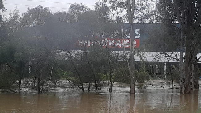
“Moderate rainfall has been observed across the Bremer and Warrill catchments since Friday afternoon. River and creek level rises are occurring throughout the catchment. With forecast rainfall, minor flooding is possible along both the Bremer River and Warrill Creek from Saturday evening onwards.

“Further showers with the chance of thunderstorms are forecast for Sunday, which may cause further river and creek level rises. The situation is being closely monitored and warnings will be updated as required.”
It comes as Queensland is inundated by a “colossal conveyor belt” of tropical moisture that is unleashing torrential rain, severe thunderstorms, and creating flooding risks across the state.
This “vast airborne atmospheric river” is channelling vast amounts of tropical moisture from the Indian Ocean down Australia’s eastern seaboard, clashing with a low-pressure trough to produce sustained and intense rainfall, Weatherzone’s Anthony Sharwood said.
⛈ï¸Thunderstorm FORECAST for TODAY: Thunderstorms possible for most of #Qld. Severe thunderstorms with heavy rainfall possible inland east of #Croydon#Barcaldine#Charleville. Damaging wind gust risk #NorthernGoldfieldsUpperFlinders.
— Bureau of Meteorology, Queensland (@BOM_Qld) November 30, 2024
Warnings updated here https://t.co/CQJkcamqzOpic.twitter.com/vSH7qA0Tap
The “colossal conveyor belt of tropical moisture” is being transported from the Indian Ocean off northwest Australia all the way down to eastern NSW and Victoria, he said.
“The other key part of the equation behind the current high rainfall potential across eastern Australia is the broad low pressure trough over the region,” Mr Sharwood said.
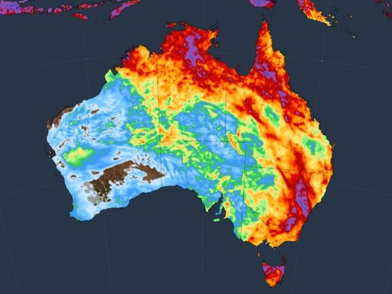
The Bureau of Meteorology has issued severe thunderstorm warnings for heavy rainfall across regions including Townsville, Bowen, Moranbah, and Charters Towers.
Rainfall has reached staggering levels overnight, with Haughton Bridge recording 209mm, Fenton recording 205mm, and Peter Faust Dam receiving 127mm.
In the southeast, Upper Springbrook received 87mm overnight, with the Gold Coast seeing widespread totals above 50mm.
Bureau of Meteorology meteorologist Daniel Hayes warned that the wet weather system currently impacting the Maranoa, Warrego, Darling Downs, and Granite Belt districts is expected to shift east, intensifying over southeast Queensland later in the weekend.
“The system will be gradually shifting eastwards over the course of the next 24 hours,” he said.
“For the time being, the area of severe thunderstorms may extend into the Darling Downs this afternoon as well. It’s not until tomorrow, though that we start to see the increased chance of severe thunderstorms across the south east coast area.”
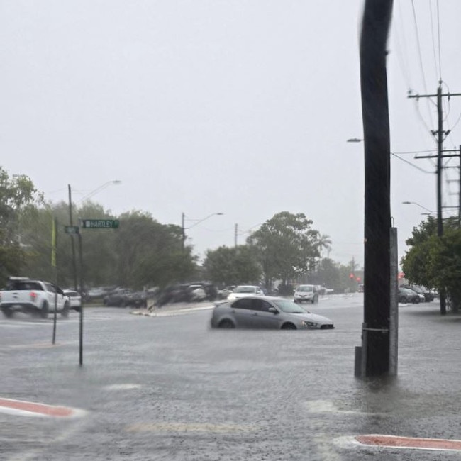
Emergency services are urging residents to remain cautious, with flash flooding and strong winds posing significant risks.
Authorities are advising people to avoid unnecessary travel, secure their homes, and stay indoors until conditions stabilise.


