
Icy blast to bring in rain, wind and the real chance of SNOW
Temperatures in South East Queensland have dipped below freezing on a chilly start to Friday, ahead of warnings parts of the state could be hit with snow early next week as the mercury plummets.

QLD weather news
Don't miss out on the headlines from QLD weather news. Followed categories will be added to My News.
Parts of Queensland could be hit with snow early next week as the temperature plummets across the state.
As the cold change began sweeping through the southeast, Queenslanders woke up to temperatures as low as -1C on Friday, with worse to come.
Bureau of Meteorology’s modelling shows the chance of snowfall along elevated peaks in the Granite Belt on Monday, as a “big pool of cold air” swings from the west into eastern Australia.
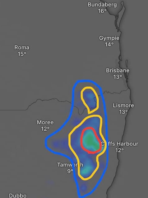
“A lot of this depends how this upper level cold pool moves,” meteorologist Felim Hanniffy said. “Although the chances are sitting at just under 10 per cent we could still get some light flurries.”
Mr Hanniffy said the system could potentially move up from NSW into Queensland, with the best chance for snow locally early on Monday morning.
He said daytime temperature maximums would drop to the mid to high teens across the state next week with “lots of cloud cover.”
Warwick temperatures dipped to -1C on Friday morning, while Applethorpe (0.1C) and Oakey (0.7C) came close to freezing.
Apparent temperatures, which take into account all atmospheric conditions to deliver a “feels like” rating, put multiple places in negative territory, with Warwick (-3.3C) again the coldest place.
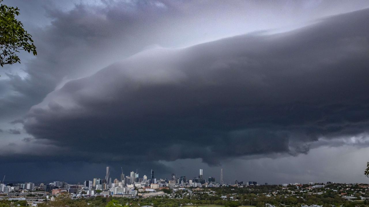
Early Warning Network Meteorologist Ken Kato said the modelling also suggested the potential for heavy rainfall and gusty winds.
“Basically what happens is there’s a really big pool of cold air and that swings up over eastern Australian encouraging a trough of low pressure to start deepening near the coast,” he said.
Mr Kato said there was a 50 per cent chance of a low developing off the coast.
“Either way, Brisbane wind gusts are between 30-50km/h on Monday and into early Tuesday and as for the southern central coast of Queensland overall exposed places like K’gari could see up to 60-80km/h,” he said.
SEQ to be lashed with storms, 100mm downpour ahead of Anzac Day
Showers and storms are forecast to soak South East Queensland on Thursday afternoon with lingering rain expected to fall on Anzac Day Dawn Services and marches.
SEQ sunshine for Easter break as inland ocean inches toward border
Showers are clearing after a wet weekend in south east Queensland, with a forecast of sunny days ahead of the Easter break.