
‘High-end phenomena’: Qld braced for intense and longer lasting upcoming storm season
Key ingredients that make up a fierce storm season, increased wet weather and warmer temperatures, are already being recorded across Qld with residents warned to prepare now.
QLD weather news
Don't miss out on the headlines from QLD weather news. Followed categories will be added to My News.
Queenslanders have been urged to prepare now for an intense and earlier than usual storm season, as the Bureau of Meteorology predicts extreme rainfall this summer.
While this year’s official storm season is yet to be called, last year’s season commenced earlier than usual - on October 1 - and continued right through until April 30.
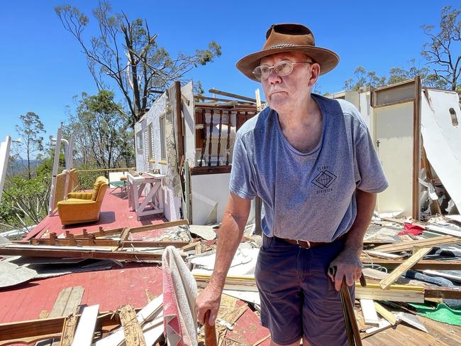
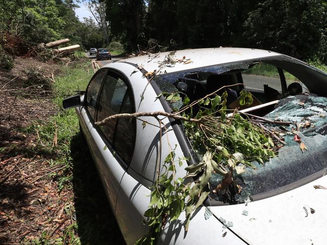
Parts of southern Queensland have already been battered by storms, with hail and heavy rain hitting the Darling Downs on Tuesday.
Sky News meteorologist Alison Osborne said storms may strike at any time but generally peak around the end of spring into summer.
“Severe thunderstorms aren’t just lots of lightning, we’re talking about that high-end phenomena that they can produce, hailstones, cause damage and bring quite nasty and damaging wind gusts,” Ms Osborne said.
This time last year Australia was under an El Nino weather pattern, with Queensland recording one of it’s driest and seventh warmest spring on record.
“Looking at this year compared to last year, we are still seeing quite warm ocean temperatures continuing off the northeast of the country, but we don’t have an active phase in the Pacific Ocean,” Ms Osborne said.
“So we are not La Nina, we’re not El Nino but we are in a cooling phase. We are starting to see some La Nina-like characteristics develop.”
While the severity of a storm can usually be forecast at most a few days before, experts say the two key ingredients that make up for a fierce storm season are already being recorded across the state - an increase in wet weather and warmer than average temperatures.
“In terms of temperatures and precipitation alone, the outlooks are favouring climate-increased chances of above average rain through pockets of Queensland throughout the entire season of spring and then the much warmer-than-average temperatures,” Ms Osborne said.
“This storm season has everything it needs to really kick off just based on temperature outlook and the expectation of above average rain.”
While experts are still yet to determine what impact climate change is having on storms Bureau of Meteorology senior meteorologist Harry Clark said more moisture in the air is having an impact on extreme rainfall, a phenomenon he puts down to climate change.
“Rain events are more intense when they do occur, just because there is more moisture in the air to begin with. More moisture equals more rain,” he said.
Over the past 12 months, RACQ insurance received 16,109 home and motor claims related to severe weather in Queensland.
The following areas with the highest volume of weather claims across the state were, Gympie, Maryborough, Coomera, Helensvale, Gunaba, Biggera Waters, Cedar Grove, Nerang, Gatton and Mudgeeraba.
Mr Clark said the southeast is always in the firing line in terms of storms, with a number of “storm alleys” identified.
“One of them through that Beaudesert, Greenbank corridor - we see a lot of storms go through - and one further to the northwest is Esk, Highvale, Sunshine Coast hinterland area we often see a lot of thunderstorms due to the mountains that are present in those regions,” Mr Clark said.

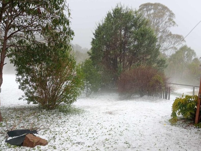
Ice ice baby: Spectacular images of unseasonal frost as Qld freezes
Queensland’s overnight temperatures will increase to double digits in the coming days, following the coldest start to winter in 16 years, bringing frost and ice to many regions. SEE THE PHOTOS

City’s coldest June start in 16 years, feels like MINUS 9.8C out west
Southeast Queensland is shivering through its coldest morning in more than 15 years but feels-like temperatures have dropped to insane levels in the southern inland.