
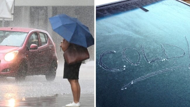
Heavy rain forecast for South East Queensland ahead of cold snap
More than 80mm of rain could fall across parts of South East Queensland over the next 72 hours before a brutal cold snap driven by a “polar surge” sends temperatures plummeting.
QLD weather news
Don't miss out on the headlines from QLD weather news. Followed categories will be added to My News.
Parts of South East Queensland are in for a drenching over the next three days ahead of a brutal cold snap.
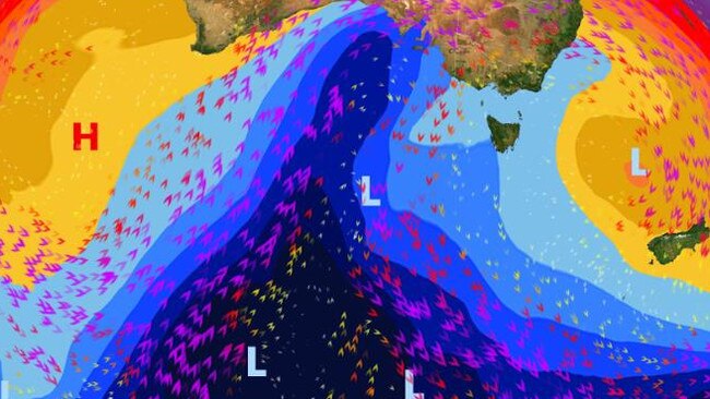
It comes as a major cold weather system – dubbed a “polar surge” – is forecast to sweep across the south and southeast of Australia over the weekend.
More than 80mm could fall on the Gold Coast from today until Saturday, with the heaviest falls of up to 45mm expected on Friday.
The Sunshine Coast could see up to 90mm over the next three days with 40mm on Wednesday and 45mm Thursday.
In Brisbane, there is a high chance of showers over the next 48 hours, with a total of 35mm possible.
The Bureau of Meteorology’s Helen Reid said winds coming from over the water was brining in moisture and a couple of showers with it.
While the rainfall totals have eased since last week, the showery conditions remain for southeast Queensland due to consistent wind activity.
“The upper atmosphere has got enough to assist those showers that just keep on going,” Ms Reid said.
A thunderstorm is also possible for the Sunshine Coast and parts of the Darling Downs.
Once the rain clears, South East Queensland is in for a cold snap which would see temperature drop to below average.
Ms Reid said it would feel more like winter next week. It could get to just 5C in Ipswich on Thursday while it will hover between 8-6C in Toowoomba for most of the week.
Brisbane will fall to 9C on Thursday while it will get down to 7C in Roma on Wednesday.
“We do have a cooler air change coming through … it will be a drier air mass as well so that will make it feel even colder,” she said.
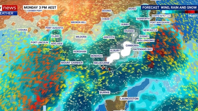
RAINFALL FORECAST
Brisbane
Wednesday – 6-15mm
Thursday – 10-20mm
Friday – 1-3mm
Gold Coast
Wednesday – 10-20mm
Thursday – 25-45mm
Friday – 6-15mm
Sunshine Coast
Wednesday – 20-40mm
Thursday – 25-45mm
Friday – 1-4mm
COLDEST MINIMUMS
Brisbane
Monday – 11C
Tuesday – 10C
Wednesday – 9C
Thursday – 10C
Friday – 11C
Toowoomba
Monday – 8C
Tuesday – 7C
Wednesday – 6C
Thursday – 6C
Friday – 6C
Roma
Monday – 12C
Tuesday- 8C
Wednesday – 7C
Thursday – 8C
Friday – 8C
Ipswich
Monday – 9C
Tuesday – 9C
Wednesday – 7C
Thursday – 5C
Friday – 9C

Feels like -5.3C: Icy blast sends temps plummeting again
South East Queensland has again shivered through a freezing start to the day, as a brutal cold front continues to blast the region with subzero temperatures, made worse by chilling winds.

Feels like MINUS 7.1C: Brutal cold front blasts southern Qld
A brutal cold front is blasting across southern Queensland with subzero temperatures and widespread frost.