
Ex-tropical cyclone Imogen, south-easterly wind surge set to collide
Two major weather systems will collide over Queensland in the coming days, with temperatures set to drop and up to 200mm of rain set to pound already “saturated” parts of the state.

QLD weather news
Don't miss out on the headlines from QLD weather news. Followed categories will be added to My News.
The collision of two weather systems over Queensland is set to unleash more wild weather and flooding in river catchments already “saturated” from relentless rain.
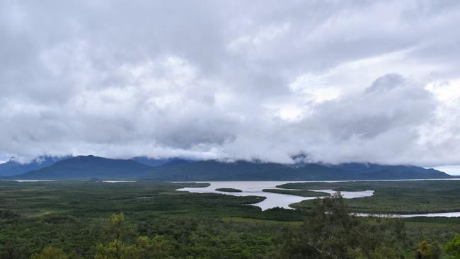
It comes after days of wet conditions across the northern parts of the state triggered by the remnants of ex-tropical cyclone Imogen.
Totals of between 50 and 100mm were also recorded in areas of southeast Queensland on Wednesday, including parts of Ipswich and the Darling Downs.
The Bureau of Meteorology is warning that Imogen, now a tropical low, is charting south towards a collision with a cold front over the coming weekend, bringing potentially torrential rain totals of up to 200mm associated with thunderstorms.
“The heaviest falls over the next 24 hours will be concentrated between Ayr and Mackay, with isolated falls of up to 200mm within thunderstorms, which is similar to yesterday’s totals,” BOM senior meteorologist Laura Boekel said.
“A south-easterly wind surge is currently moving through southeast Queensland, and will enhance rainfall for all eastern districts for the next two to three days as it merges with ex-tropical cyclone Imogen,” Ms Boekel said.
The Bureau warned many river systems facing the downpour in central and north Queensland had already received drenching rain over the past week.
“Catchments are saturated, and rivers will likely respond very quickly to further rain.”
Ms Boekel said temperatures under cloud cover would see temperatures between 5C and 10C below average.
Emerald had a forecast maximum temperature of 26C on Saturday.
Flood warnings were in place for the Gilbert, Norman and Flinders rivers.

The colliding weather systems would move away from the southeast corner from today, but coastal showers were still forecast for the region.
Brisbane was forecast to hit 26C Friday, 27C Saturday and 28C on Sunday, while the Gold Coast was expected to hit 26C on all three days.
The Sunshine Coast was predicted to have tops of 25C Friday, 26C Saturday.
The central and northern coasts of Queensland would see continued rainfall for several more days, with conditions only expected to clear in the Capricornia region by Sunday.
A marine weather warning for Friday was issued for the
Mackay Coast, Capricornia Coast, Hervey Bay, Fraser Island Coast, Sunshine Coast Waters, Moreton Bay and Gold Coast Waters.
Brisbane Lord Mayor Adrian Schrinner on Thursday warned river city residents to be wary of flooding conditions coming south after North Queensland was inundated in recent days.
More Coverage


Ice ice baby: Spectacular images of unseasonal frost as Qld freezes
Queensland’s overnight temperatures will increase to double digits in the coming days, following the coldest start to winter in 16 years, bringing frost and ice to many regions. SEE THE PHOTOS

City’s coldest June start in 16 years, feels like MINUS 9.8C out west
Southeast Queensland is shivering through its coldest morning in more than 15 years but feels-like temperatures have dropped to insane levels in the southern inland.