
Tropical cyclone Tiffany crosses land, severe storm alert
Warnings for severe thunderstorms, heavy rain and damaging winds are current in the state’s Far North after Tropical Cyclone Tiffany crossed the coast.
QLD weather news
Don't miss out on the headlines from QLD weather news. Followed categories will be added to My News.
Warnings for severe thunderstorms, heavy rain and damaging winds are current in the state’s Far North after Tropical Cyclone Tiffany crossed the coast.
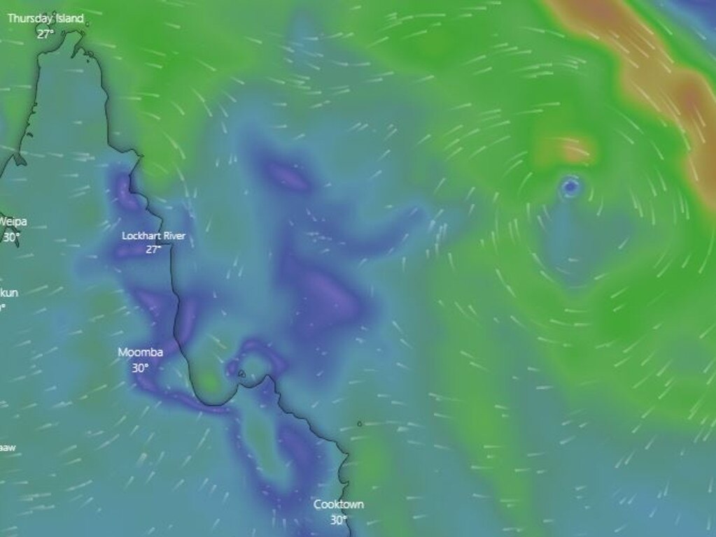
The cyclone weakened to a category 1 after it crossed the coast on Monday afternoon.
It is now 195 kilometres west/northwest of Cooktown with winds of 65 to 95km an hour at its centre.
It is moving west at a rate of 12km/hour.
It is expected to head back over water in the Gulf of Carpentaria and redeveloping on Tuesday.
Widespread falls of 100 to 150mm are expected in parts of the Cape, but there could be isolated falls of 250mm.
A warning zone has been put in place at the Bureau of Meteorology for residents from Coen to Cape Melville and the adjacent inland parts of Cape York Peninsula.
Residents from Nhulunbuy to the Northern Territory/Queensland border, including Groote Eylandt, have also been placed on a watch zone as the cyclone reaches landfill.
Officers in Queensland’s far north have warned of heavy rainfall, gales and destructive winds over the Cape York peninsula throughout the coming days, as they urge the community to avoid and prepare for rising flood waters.
“Residents and travellers are particularly reminded not to become complacent with floodwaters,” Queensland Police said.
“Deciding to walk to drive through floodwaters can have serious consequences on your life.”
Other advice from police includes securing belongings ahead of time.
Tiffany was expected to make landfall between Cooktown and Lockhart River, with the timing dependent on whether the cyclone moves south or north of Cape Melville.
The weather bureau says Tiffany will weaken slightly over land but may maintain tropical cyclone strength as it moves westward across the cape.
The system is then expected to move into the Gulf of Carpentaria on Tuesday and re-intensify quickly as it moves towards the Northern Territory coast.
BOM Meteorologist Harry Clark said that the cyclone will cross the coast on Monday evening, north of Cooktown, before heading west towards the state’s coastline.
Tropical cyclone Tiffany, category 2, is approaching the coast near Cape Melville. Cyclone warning extends across Cape York Peninsula. #CycloneTiffanyhttps://t.co/rVLE6i5J4ypic.twitter.com/nE3eMvzvvd
— Bureau of Meteorology, Queensland (@BOM_Qld) January 9, 2022
BOM has warned that heavy rain is expected to accompany the cyclone.
Abnormally high tides are expected between Cooktown and Lockhart River as the system crosses the coast, however BOM do not expect sea level to exceed the highest tide of the year. Residents and holidaymakers should brace for large waves along the beach front and abnormally high tides on the western Cape York Peninsula during Tuesday and Wednesday.
People between Cape Tribulation and Coen including Cooktown, should immediately commence or continue preparations, especially securing boats and property using available daylight hours.
People between Cape Grenville and Coen including Lockhart River should take precautions and listen to the next advice at 8pm.
People between Mapoon and Kowanyama including Weipa should consider what action they will need to take if the cyclone threat increases.
Tiffany was named at 4.45pm AEST, after developing into a tropical cyclone from a tropical low the Bureau of Meteorology had been monitoring over the weekend.
Senior Meteorologist Dean Narramore said for some regions, the cyclone would mean an increased risk of flooding.
“From tomorrow, people in far north Queensland communities will start seeing and feeling the effects of Tropical Cyclone Tiffany as it comes closer to the coast, which means an increased risk of flooding and some localised damage in these regions,” he said on Sunday.
“Tropical cyclones can intensify very quickly, and shift direction, so we will be updating our warnings and advice to the community and our emergency services colleagues as this system progresses.”
It comes as the aftermath of ex-cyclone Seth has wreaked havoc on the Wide Bay region, dumping more than 670mm of rain in places overnight.
A man is dead, highways have been washed away, entire towns are cut off and residents are being implored to move to higher ground as river levels rise after the “incredibly rare” weather event sparked a major flood emergency.
Police have advised the community to stock up on food and clean drinking water as supplies may soon be cut off.
Torches and spare batteries should also be acquired, in the event electricity is cut, police say.
Advice for those in the path of the cyclone is to head to shelter early if their home is unsafe.
Call SES on 132 500 for storm-related assistance and leave Triple Zero (000) for life-threatening emergencies.
Further information can be found through:
-Local Council websites
- Local ABC emergency broadcasting: abc.net.au/emergency
-Bureau of Meteorology – bom.gov.au/cyclone
- Disaster Management QLD – disaster.qld.gov.au


Monster weather system brings storm, heavy rain to Qld
Brisbane and surrounding parts of the southeast have been hit by storms and heavy rainfall this afternoon as a 3000km-long monster low moves across the state.

Wild storms, polar blast as 3000km monster low barrels towards Qld
The system, which stretches 3000km from north to south and encompasses 30 per cent of Australia, is forecast to pack a punch when it hits Queensland.