Brisbane weather: Flash flooding threat as thunderstorms hit Qld
More thunderstorm warnings have been issued as the rain band that has thrashed parts of Outback Queensland heads toward the east coast.
QLD weather news
Don't miss out on the headlines from QLD weather news. Followed categories will be added to My News.
Flash flooding remains “a possibility” across Queensland as severe thunderstorms continue to hit communities across the state.
The Bureau of Meteorology issued updated a severe storm warning for the Herbert and Lower Burdekin and Northern Goldfields and Upper Flinders areas just before 9am.
A severe storm was moving east, north of Charters Towers, while other storm activity was being supported by an upper trough over western Queensland.
The Bureau warns that these storms could potentially lead to flash flooding in the warning area later today, with damaging winds and heavy rainfall expected.
Mingela and Woodstock are among the areas which may be affected.
“We can still expect to see widespread rainfall and showers and thunderstorms right through the eastern districts today,” Meteorologist Helen Ms Reid said.
“We’re likely to see some more warnings for heavy rainfall coming through, possibly some large hail and damaging wind gusts as well depending on where you are in the state,” she said.
Ms Reid said far western parts of Queensland can expect clearer conditions today.
“The trough that’s driving all the moisture that we have into thunderstorm activity has now moved a little bit further east,’’ she said.
Saturday is expected to be the wettest day for Brisbane over the next seven days, with up to 40mm of rainfall possible.
There is also a very high chance of rainfall for both the Sunshine Coast and Gold Coast over the weekend, with a chance of a thunderstorm.
“The thunderstorms that we’ve been seeing the last couple of days, they’ve been dropping up to 100mm in places because they’re also quite slow moving, there’s a lot of moisture there,” meteorologist Ms Reid said.
“There is a potential for some thunderstorms that could bring a little bit more rainfall than others, a lot of places are just picking up the 30-40 millimetres.
“As we see the weekend evolve... there’s another system coming into place. We could actually see an increase in rainfall over the South East but we’re still looking into that one.”
BIG RAINFALL TOTALS
Parts of Central Highlands, Maranoa, Warrego and Whitsundays have copped record rainfall totals since Tuesday, with Glen Rock Alert, southwest of Emerald, recording over 50mm of rain in the span of an hour, and the Stonewall Alert, southeast of Collinsville receiving 47mm in just 30 minutes.

Despite the flood threat, many residents in regional Queensland are remaining optimistic despite the deluge.
Mother-of-two Sammy Joliffe, who owns a cattle property north of Roma, continues to refer to the rain as a “welcome sight”, after the region suffered many years of drought.
“We’ve had enough drought years, so we’re not going to turn the rain away,” she said.
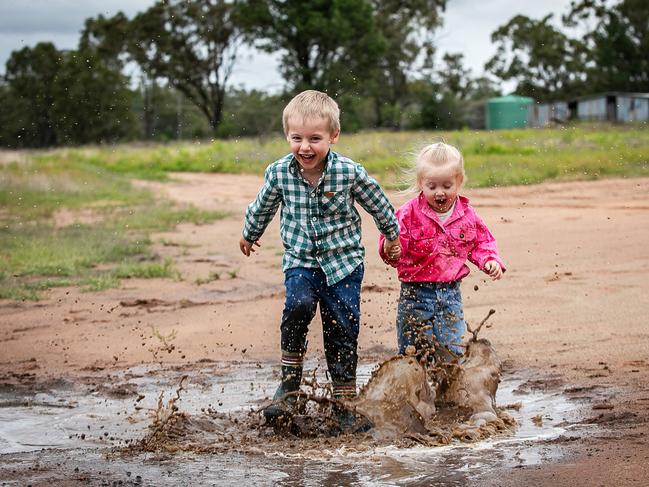
Ms Joliffe added that the hardest part about all the rain was keeping the kids out of the mud.
“They’re absolutely loving it, it’s quite hard keeping them out of it, that’s for sure,” she said.


