Brisbane weather: Multiple storm fronts in southern Qld
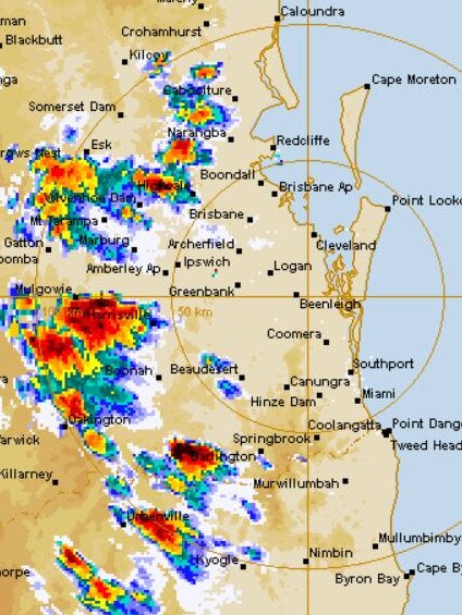
The aftermath of the severe storms across southeast Queensland is still being felt, with homes still without power and train services suspended on an entire line. It comes after up to 105mm of rain fell in an hour in some parts.
QLD weather news
Don't miss out on the headlines from QLD weather news. Followed categories will be added to My News.
A MASSIVE band of wild storms stretching from the Sunshine Coast down to Byron Bay has dumped up to 105mm of rain in just one hour, causing widespread commuter chaos and power outages.
More than 600 homes in the southeast remain without power this morning, with most of those affected in the Brisbane City and Logan City council areas after almost 6000 homes were without power at midnight.
Cleveland line trains are suspended in both directions between Cleveland and Manly due to a signalling issue caused by severe weather. Customers can expect delays of up to 60 minutes. Replacement buses have been arranged. https://t.co/G4xJWKiWNF #TLAlert #TLClevelandline pic.twitter.com/YnYmA6DP1x
— TransLink (@TransLinkSEQ) March 15, 2019
Shorncliffe line trains are delayed up to 15 minutes in both directions due to a signalling issue caused by severe weather conditions at Lota station. https://t.co/tBq4P7WXVu #TLAlert #TLShorncliffeline pic.twitter.com/06S7T0JGuT
— TransLink (@TransLinkSEQ) March 15, 2019
At the height of the storm more than 23,000 residents were without power in the state’s southeast.
A spokeswoman from Queensland Fire and Emergency Services said they received over 260 calls for assistance overnight, the majority of which were in Brisbane.
The Sunshine Coast received the most rain in the southeast over the past 24 hours, with 178mm being recorded at Sugarbag Road near Caloundra, and the rest of the region receiving between 60 and 180mm.
Brisbane saw 100mm in 24 hours in some areas and the Gold Coast had up to 70mm.
Ipswich saw less rain with around 35mm recorded since 9am Friday.
A spokesman from the Bureau of Meteorology said this was the highest level of recorded rainfall in a 24-hour period Brisbane and the Gold Coast had seen this year.
There are still 450 homes affected by power outages due to severe weather damage, most of which are in the suburbs of Brisbane.
Trains are also still feeling the after effects, with services suspended on the Cleveland line in both directions due to a signalling issue caused by last night’s storms.
The Bureau of Meteorology cancelled its latest severe storm warning, which was for the Sunshine Coast, at 8.45pm. A more general thunderstorm warning remained for parts of the Central Highlands and Coalfields districts.
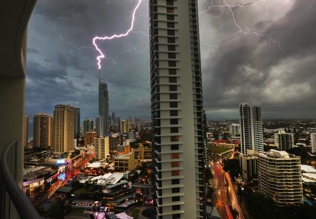
The large band of storms, which earlier threatened to bring ‘giant hail’, brought hail, thunder, lightning, heavy rain and flash flooding, caused up to 75 minute delays to Brisbane’s transport network and sent gazebos and tents at the CMC Rocks event at Ipswich flying.
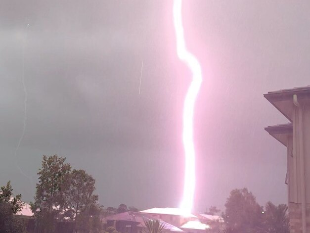
Loud claps of thunder and incredible bolts of lightning were reported across the region in the height of the storms.
Flights were delayed across Brisbane, Gold Coast and Sunshine Coast airports, with one passenger on a flight to Sunshine Coast saying it was the “scariest flight I’ve ever been on”.
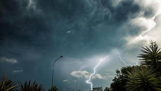
The flight from Melbourne reportedly experienced severe lightning and was ‘very bumpy’ and was diverted to Brisbane and could not land and was subsequently diverted to the Gold Coast.
It was also reportedly the first flight able to land on the Sunshine Coast in two and a half hours.
TransLink had reported all train services on the southeast Queensland network were delayed by up to 75 minutes. All council-run bus services were back to normal by about 8.15pm after experiencing delays of up to an hour.
The storms brought huge downpours to several areas.
Delaneys Creek received 105mm of rain in an hour, 85mm fell in an hour northwest of Samford near Dayboro, 86mm fell in one hour at Kobble Creek, 76mm fell in one hour at Kallangur and 3cm hail was reported near Oakey.
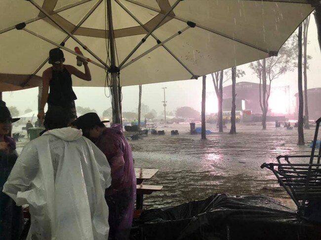
Emergency services had received more than 70 call-outs related to the storm between 2pm and 5.30pm.
“North Brisbane definitely got it the worst, we had a lot of calls up there,” she said.
The latest storm warning from the Bureau of Meteorology for the southeast was issued at 7.55pm for parts of the Sunshine Coast. This was cancelled by 8.45pm, with the BoM saying “heavy rain in thunderstorms” had eased and while rain and thunderstorms were persisting, they were no longer expected to be severe.
Water has subsided and Muriel Ave is open in both directions between Fairfield Rd and the Ipswich Mwy in #Moorooka #bnetraffic
— QLDTrafficMetro (@QLDTrafficMetro) March 15, 2019
The Bureau of Meteorology said while the threat of hail had eased, heavy rain would continue through the night in parts of the southeast.
Several beaches were closed due to wild weather conditions and dangerous surf.
Woorim Beach at Bribie Island and Tallebudgera Creek beach on the Gold Coast have been closed, with further beach closures expected along the coast.
EARLIER:
Cleveland train lines are suspended in both directions between Manly and Cleveland stations due to severe weather conditions, however buses remain to transport people.
All inbound and outbound bus services were expecting delays of 45 minutes, TransLink said.
Bureau of Meteorology spokesman David Crock warned of potentially life-threatening rainfall in the Moreton Bay region.
“There’s been a recorded 85mm of rain in the last hour northwest of Samford near Dayboro,” Mr Crock said.
“This amount of rainfall meets our criteria as being extremely dangerous.”
When asked if the rainfall is potentially life-threatening, Mr Crock said: “Yes, it meets that criteria. There will be extreme flash flooding.”
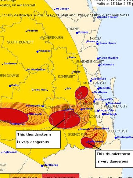
Meanwhile, bureau meteorologist Annabelle Ford warned of potential “giant” hail in areas around Laidley, Ipswich and Beaudesert, with predicted “large” hail to fall in other parts of the state.
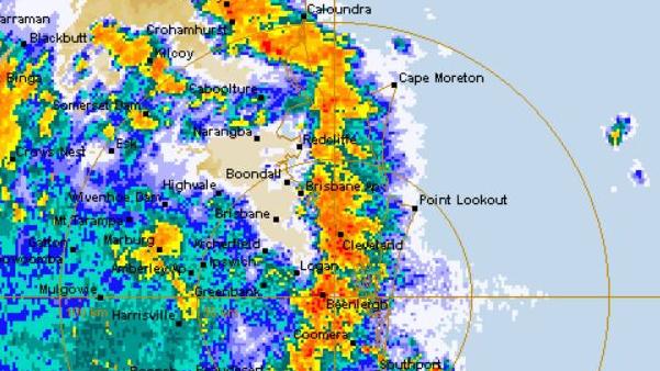
The current warnings range from the southeast coast to parts of the Central Highlands and Coalfields, Central West, Wide Bay and Burnett, Maranoa and Warrego and Darling Downs and Granite Belt districts.
Communities that be affected include Brisbane, Gold Coast, Toowoomba, Warwick, Dalby, Roma, Kingaroy, Coolangatta and Ipswich.
Getting absolutely smashed here atm #bnestorm pic.twitter.com/5mqPulOR2i
— Brian MacNamara (@BMac_TLDR) 15 March 2019
“Giant hail measures anywhere from 5cm and up, while large hail is 2cm,” Ms Ford said.
“Giant hail is very dangerous and will cause significant destruction.”
Some of the hardest hit parts of the state can expect to see anywhere from 40-70mm of rainfall, while pockets outside of the storm catchments can expect 10-30mm.
Localised flash flooding is likely in low-lying areas, especially as storms continue to roll in over the weekend.
“Severe thunderstorms, heavy rains and destructive winds are expected to hit in similar areas tomorrow afternoon into the evening,” Ms Ford said.
“There may be some flash flooding in areas with heavy and repetitive rainfall across the weekend.”
Sandbags are available at local council collection points across the state.
Queensland Fire and Emergency Services advises that people should:
* Move your car under cover or away from trees.
* Secure loose outdoor items.
* Never drive, walk or ride through flood waters. If it’s flooded, forget it.
* Seek shelter, preferably indoors and never under trees.
* Avoid using the telephone during a thunderstorm.
* Beware of fallen trees and powerlines.
* For emergency assistance contact the SES on 132 500.
The next warning is due to be issued by 6:10pm.


