
Behind the scenes with Brisbane Weather’s David Taylor
More than 200,000 people follow his Brisbane Weather Facebook group. Now the man behind the highly popular page reveals his forecast secrets and some rather dire predictions for Queensland.
QLD weather news
Don't miss out on the headlines from QLD weather news. Followed categories will be added to My News.
More than 200,000 people follow the ‘Brisbane Weather’ Facebook page, but who exactly is the man behind the scenes? And how did his weather predictions gain the trust of hundreds of thousands?
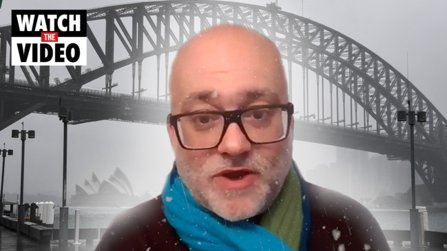
Brisbane Weather is run by David Taylor.
Born and bred in Brisbane, the 51-year-old has travelled and lived all over Queensland – depending on the weather of course.
Currently based in the rural town of Ayr, just south of Townsville, Mr Taylor has given The Courier-Mail an exclusive look inside his weather forecast methods and reveals what his future weather predictions are for Queensland.
Meet David
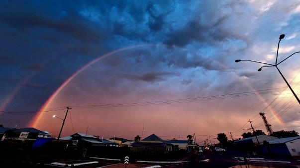
Mr Taylor’s passion for meteorology started at an early age, so it’s not surprising that he grew up to become an avid storm chaser and weather guru.
But he says being related to legendary Queensland forecaster Inigo Jones may have something to do with how he turned out.
“I did a lot of storm chasing things long before I started Facebook pages and so on. I’ve been forecasting for a very, very long time,” Mr Taylor said.
“As a younger kid my parents used to always ask me, you know, when were the next lot of storms coming around. And back then there was no internet. No nothing.
“But I was pretty cluey, just using The Courier-Mail when they used to release the weather maps.
“I’m actually related to Inigo Jones, the legendary long-term weather forecaster. A lot of farmers used to use him back in the day, he passed away in the ‘80s I think.
“Inigo used a lot of sunspots in his method of predicting weather and I do the same.”
The sunspot method
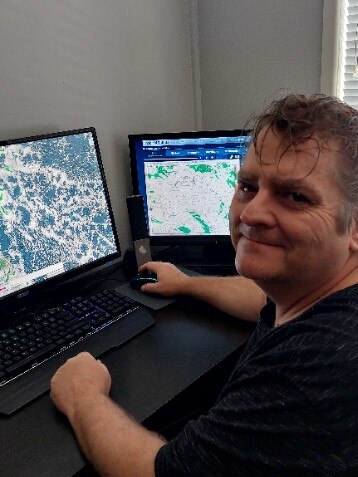
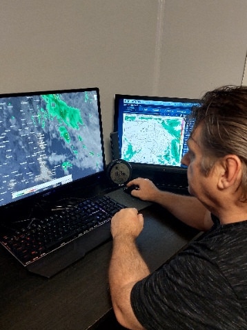
Compared to “mainstream” forecasters like the Bureau of Meteorology, Mr Taylor uses sunspots as his main forecast method.
He also used the GFS (Global Forecast System) base model and cross references this with other models to calculate weather forecasts.
“A majority of other web pages don’t use sunspots,” he said.
“Basically how it works is say on a normal standard sunspot day, the sun will throw approximately, I think it’s 1800(K) Kelvin temperature towards the Earth, which affects the upper atmosphere.
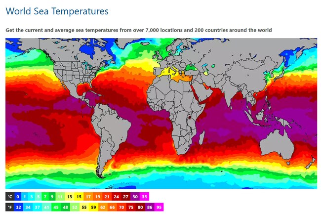
“People don’t realise that heat that comes in the atmosphere, 90 per cent of that is absorbed by the oceans and the oceans is a big key when it comes to the weather.
“When the sunspots drop, you get a lot of what people call grand solar minimum and what‘s happened in 2019 is the average temperature that reached the Earth was about 800K give or take so it’s (become) generally cooler.
“And I find that during these low sunspots activity, you will find the higher chances of La Nina developing as well.”
While the Bureau of Meteorology uses the ENSO (El Nino-Southern Oscillation) method, which looks at predicted and actual ocean temperatures, Mr Taylor uses the sunspot count to predict when major weather events would occur.
“Earlier this year, I noticed that some spots were going up,” Mr Taylor said.
“I was the only one, more or less, saying I don’t think this La Nina is going to hold, it’s going to break down and of course it did and that was because we’re getting extra heating.
“Now there’s always a chance that we could go back into a La Nina and the latest updates -because it updates monthly- is that the sunspots are starting to drop, so therefore the heating on the planet is dropping and a La Nina could actually re-establish.”
Mr Taylor admits the nature of weather forecasting means his predictions are not always perfect, but after years of practice, he comes pretty close.
“Over the years my predictions have become more and more accurate, not 100 per cent though, especially some of my long-term predictions,” he said.
“The BOM s not 100 per cent accurate as well. A lot of people have got to realise that.
“Even in their forecasting you’ll notice sometimes, especially during summer, at one o’clock, they’ll change their weather forecast for the South East Queensland to thunderstorms, and then that morning it’ll be fine.
“So there’s many methods out there but I like sunspots. Other well-known web pages have inboxed me in the past have spoken to me about trying to work out sunspots and are asking me questions about it and It makes me feel privileged.”
The birth of Brisbane Weather page
The Brisbane Weather page has gained 126,258 follows since its inception in 2009.
And although Facebook has changed dramatically since the page’s inception 18 years ago, Mr Taylor is adamant he will never charge a subscription for his weather information because “he wouldn’t be able to live with himself,” if something went wrong.
“The Facebook page is actually the longest Facebook weather pays for South East Queensland and Queensland. It’s older than Higgins (Storm Chasing),” Mr Taylor said.
“I originally started it under a different name - Brisbane Thunderstorms - doing it for family and friends because I’ve always been pretty good with storms … and it’s just exploded.”
“I do it because at the end of the day we’re dealing with people’s lives. That’s the main reason why I went into it from day one, I’m just doing it to help people.
“I do have other admins who help out with the comments and things, don’t get me wrong, but when it comes to the predictions, that’s all my work.”
From day dot Mr Taylor promised himself he would never charge Facebook subscriptions for his service, particularly as the time-consuming forecasting doesn’t interfere with his side job.
“I would feel guilty at the end of the day if someone paid a subscription to my service and, for argument‘s sake, I’ve failed to do an accurate weather update for them and something horrific happened to them,” he said.
“I wouldn’t be able to live with myself.
“The weather can be dangerous and the majority of weather data is free anyway so why charge someone for a service that’s naturally free?
“I invest in the stock market on the side as well so I’m always at my computer anyway. It all sort of fits together.”
Life of a storm chaser
Like all storm chasers, Mr Taylor is a textbook thrillseeker, but there’s one storm in particular he says he’d never forget.
“My partner and I noticed this storm was travelling north so we decided to go from the Gold Coast out towards Kyogle, but it fizzled out and we went to have a look around town,” Mr Taylor said.
“Then it really escalated and we left Kyogle to go and to chase it.
“We decided to go to Lions Rd to cross the Queensland border but as we’re going up we noticed to our left that the storm started throwing a funnel out which started turning into a tornado and we had this big hail core behind this so we couldn’t go backwards.
“I was in my partner’s brand new car and Lions Rd only turns left which puts us back directly towards this funnel and it’s like what do we do?
“We got fairly close to it, kilometres away, before Lions Rd turned north again, and we met up with it again near Beaudesert.
“Took some amazing photos but that was a really good storm chase. The hunter became the hunted.”
Climate change
When it comes to climate change and what it would mean for Australia’s future, Mr Taylor says he “strongly believes it’s too late.”
“I‘ve seen the data and I’ve seen the facts,” he said.
“We’ve had solar minimums in the past, normally our winters were colder during that period of time but that wasn’t the case in 2019, our summers got hotter and our winters were warmer.
“What can be triggering our temperatures that are actually escalating instead of declining during a period where the earth is not getting as much heat from the sun?
“To me, there’s only one word for that and that’s climate change.”
But Mr Taylor’s biggest concern is the severe weather events that could happen as a result of the earth not being able to cool itself down.
“History shows that it (earth) naturally starts to cool down but we’re finding that’s not happening … when the sunspots do explode and get to a peak, I can see more heatwaves, more severe and dangerous thunderstorms, more severe cyclones and so on,” he said.
“And I don‘t think they’re going to stop it.
“I think over the past years you get these climate experts who have jumped the gun, they’ve come out too early and they’ve tried to put a time frame on something that you can’t put a time frame on.
“Then these things they said would happen they seem to fail and people then say ‘climate change is hocus pocus’.
“It’s like people who used to smoke cigarettes, we used to tell them how bad they were for their health and they didn‘t believe it.
“People just didn’t want to listen and that’s what we’re seeing with climate change.”
Mr Taylor is confident climate change will eventually cause various weather issues and say’s all that’s left to do is attempt to lessen the severity of the inevitable events.
“I strongly believe it‘s too late. I think that they can stop the peak of what’s going to happen but at the end of the day, we can only go by data on what could happen,” he said.
“We won’t know the full extent until it’s happened.
“We may not experience it, it might be our kids or grandkids or their grandkids, but it’s going to happen, and for anyone to put a time frame on it, good luck.”
Future predictions
What does this mean for Queensland’s weather over the next few years?
Mr Taylor predicts Australia will experience warmer winters and hotter summers in the lead up to 2026 followed by droughts until around 2030.
“In 2019, we averaged sun spots between 0.4 and 9.4 and that sunspot activity is increasing,” Mr Taylor said.
“By 2024 we should reach close to about 120 sunspots, which means our planet’s upper atmosphere is heating up again.
“It will mean warmer winters and hotter summers, rainfall will be above average from 2023 to about 2026.
“From 2026 I can see rain falling below average and droughts possible until around 2030 and we could see El Nino somewhere between 2024 and 2030.”
For now, Mr Taylor’s long-term forecast includes a strong chance that La Nina will return this Summer but if it doesn’t Queensland is in for a “horrific” storm season.
“This summer coming up is a 50/50 chance that a La Nina wave may reform and if it does reform South East Queensland will be looking at more tropical rain with thunderstorms,” he said.
“Possibly more flooding as we know during a La Nina it will flood somewhere in Queensland and or in New South Wales.
“Sunspots increased to 96.5 in May, that has dropped in June and that’s why I think that the La Nina now may actually rebuild, but we’ll see what happens with the July sunspot count.
“However, if the La Nina doesn’t trigger, it’s going to be pretty horrific thunderstorm season. It’s going to be pretty full on.
“If a La Nina does fail this year, the storm activity could be one of the worst in years.”


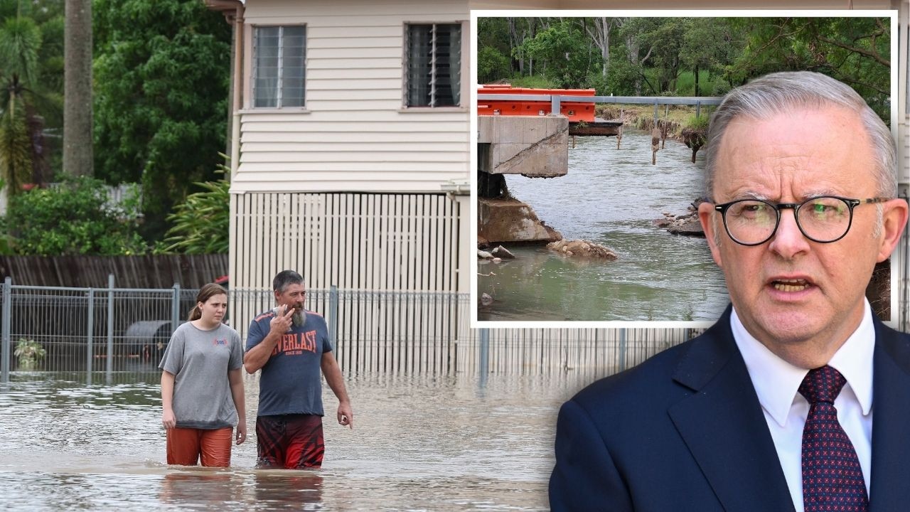
PM in flood-ravaged north, as military might unleashed on clean-up
Defence Force members are in north Queensland to rebuild parts of the Bruce Hwy as the Prime Minister visits some of the disaster zones, while “disgusting” acts are being reported in evacuation zones.
PM leaves parliament to visit flood-ravaged north Qld towns
The defence force has been brought into rebuild parts of the decimated Bruce Hwy as the Prime Minister has jetted into the north Queensland flood disaster zone.