
700mm deluge, flooding threat for South East Queensland in ex-TC Alfred’s aftermath
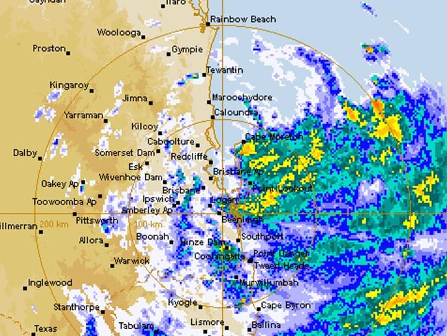
Meteorologists have warned heavy rain could continue into next week causing life-threatening flash flooding, with the centre of the system to the furthest cloud bands measuring 400km.
QLD weather news
Don't miss out on the headlines from QLD weather news. Followed categories will be added to My News.
South East Queensland could still be smashed by heavy and intense rainfall of up to 700mm leading to major flooding as Ex-Tropical Cyclone Alfred continues to hover over the state.
Meteorologists have warned heavy rain could continue into next week causing life-threatening flash flooding, with the centre of the system to the furthest cloud bands measuring 400km.
Alfred was downgraded to a tropical low at 6am on Saturday and was expected to be near Dalby by midnight on Saturday and near Goondiwindi later on Sunday.
After hovering near Bribie Island for most of the day, the tropical low was expected to cross the coast on Saturday evening between Maroochydore and Caboolture.
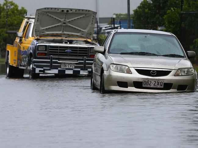
There were major flood warnings for the Logan and Bremer rivers and Warrill Creek on Saturday afternoon, with a moderate warning for the Albert River.
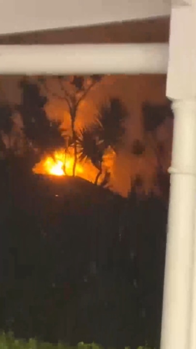
Winds from Alfred smashed the Gold Coast and southern Brisbane suburbs with trees and debris knocking down as many as 1000 power lines.
More than 300,000 homes were without power on Saturday night with most on the Gold Coast, with 1200 Energex staff and 800 from Ergon set to work around the clock.
Premier David Crisafulli warned intense rainfall in the coming days could lead to widespread flooding.
“The challenge is now,” he said.
“Flash flooding, creek rising – they remain a real prospect. We have to be ready for that prospect.
“I ask Queenslanders to remain vigilant.”
Bureau of Meteorology senior meteorologist Matt Collopy warned totals in excess of 700mm were possible in some areas.
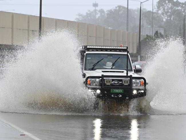
“In terms of the flooding, that heavy to intense rainfall is expected to produce the risk of dangerous and life-threatening flash flooding and widespread minor to major riverine flooding across much of the south east,” he said.
Mr Collopy said high rainfall totals had already been recorded across the southeast, with widespread totals of 300 to 500mm possible in coming days, with up to 700mm in some areas to Monday.
“We have already seen rainfall totals as high as 280mm to 9am Saturday morning, and since 9am we’ve seen falls of between 40 and 70mm across South East Queensland, including Brisbane,” he said.
“As the system tracks west, localised falls of 100 to 200mm are possible during six-hour periods, and these may lead to life-threatening flash flooding.”
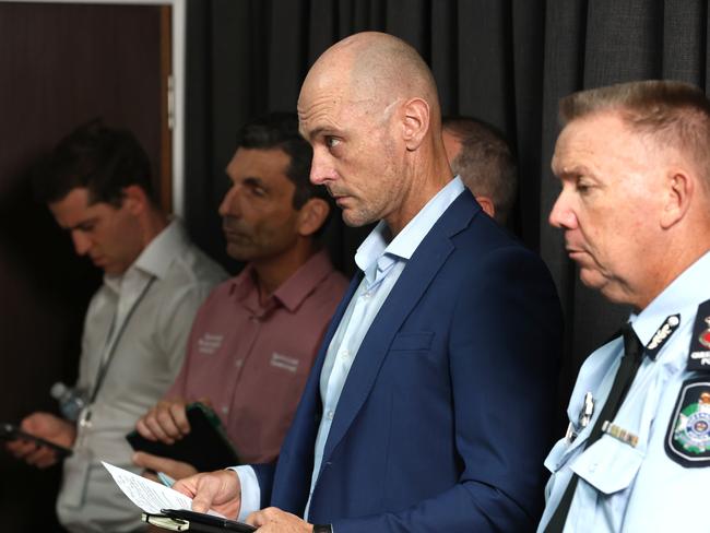
Queensland Police Service Acting Commissioner Shane Chelepy said there were no significant reports of damage to houses or infrastructure on Stradbroke or Moreton islands or the lower bay islands.
“Officers have been responding to calls for service and assistance today, primarily in the Gold Coast, Redlands, Logan and Brisbane area,” he said.
“We’ve seen police respond to 167 calls for service today alone, Queensland Fire Department 270 calls for service, and we’ve seen Marine Rescue Queensland respond to six jobs today.
“There’s a lot of rain forecast this evening and the coming days, as we’ve heard from the bureau, and as I’ve already said, we have not had any loss of life from this weather event, and we are really keen to keep it that way,” he said.
“We ask the community to please be responsible, don’t drive through flood waters, and if it’s flooded, forget it.”
Brisbane city bus services will resume on Sunday and CityCat and KittyCat services will begin operating again on Monday.
Mr Crisafulli said he would update the state on Sunday as to whether schools would be open on Monday but the government planned to open as many as possible.
Sky News Weather Bureau forecaster Alison Osborne said ex-Tropical Cyclone Alfred was quite large in scale in terms of cloud cover.
“From the centre of the system out to the furthest cloud bands is 400km, so quite big geographically,” she said.
Ms Osborne said as ex-Tropical Cyclone Alfred approaches the mainland, the hardest hit areas were likely to be north of Brisbane.
She said South East Queensland is likely to see several days of rainfall into the middle of next week.
“For Brisbane, Ipswich, Sunshine Coast, and Gympie are likely to see 24-hour totals between 120 to 200mm, while we can’t rule out up to 400mm in some isolated pockets around there as well,” she said.
“So from now until the end of the weekend, the area that is looking likely to receive the heaviest falls will mostly be over the northernmost area of the Sunshine Coast and the southern Wide Bay-Burnett.
“So areas like Rainbow Beach, Tin Can Bay, and out towards the hinterland could see 24-hour totals over 500mm.”
Mr Crisafulli said there were 850 fire and rescue crews on the ground on Saturday, in almost 300 trucks, removing fallen trees and debris.
He said there was about 100 Australian Defence Force personnel helping in 30 trucks, including at Mount Tamborine.
The SES had 1000 callouts on Saturday, a third of the calls for structural damage and a third for trees.
Mr Crisafulli said 330,000 homes and businesses had gone without power across the state since the cyclone event began.
“To put that into perspective, at 330,000 that’s the largest loss of power from a natural disaster in Queensland’s history,” he said.
“It’s bigger than (Cyclone) Yasi, bigger than Debbie, bigger than Oswald.
“So it shows you the scale of the destruction, because of that populated area.”
A flood warning has been issued for the Brisbane River downstream of Wivenhoe Dam, with minor flooding expected with the high tide on Monday and Tuesday mornings.
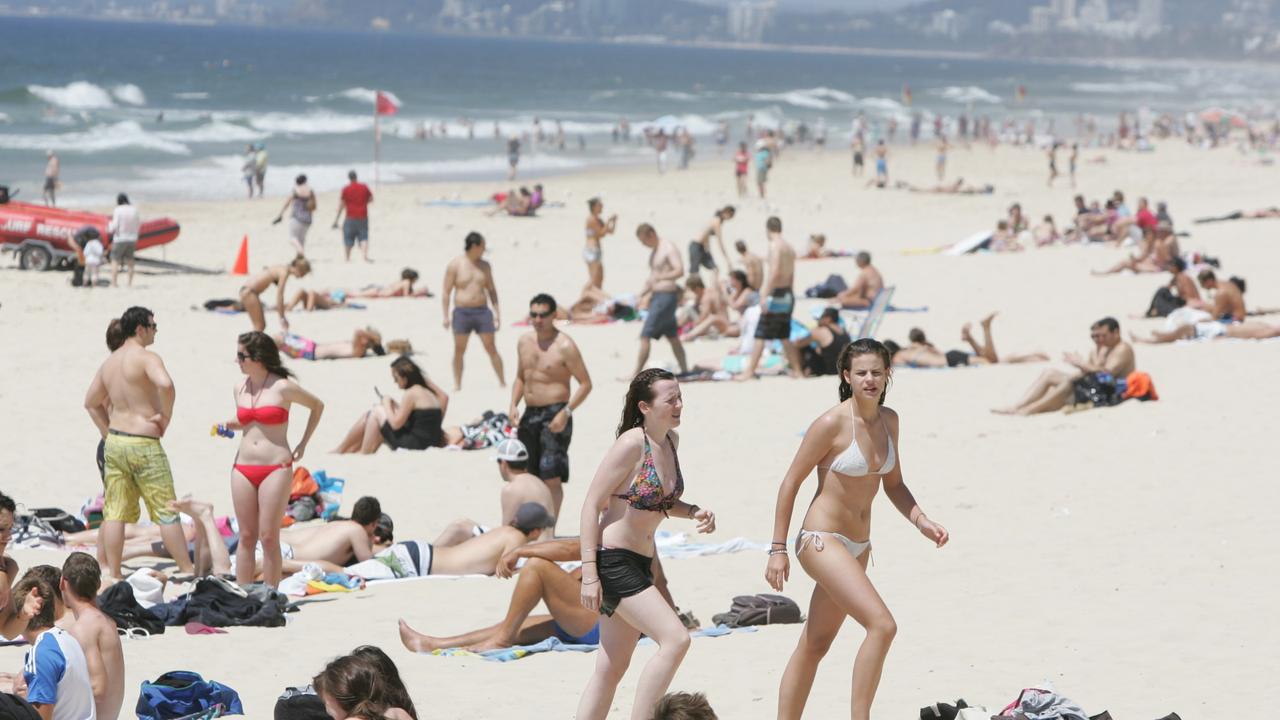
SEQ sunshine for Easter break as inland ocean inches toward border
Showers are clearing after a wet weekend in south east Queensland, with a forecast of sunny days ahead of the Easter break.

Outback dream wiped out by flood disaster as repair bill tops $1m
The owners of an outback motel face a $1m repair bill in the wake of the once-in-a-generation flood in Thargomindah.