400mm deluge, dangerous storm surge: TC Kirrily barrels towards Qld
Tropical Cyclone Kirrily has officially formed as a Category 1 system, as parts of Queensland prepare to be hit with a 400mm deluge, along with wind gusts of 165km/h, with more than 12,000 homes in one city alone expected to be impacted.
QLD weather news
Don't miss out on the headlines from QLD weather news. Followed categories will be added to My News.
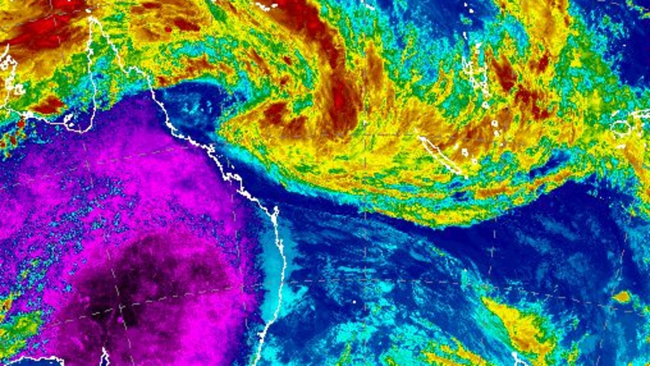
Tropical Cyclone Kirrily has officially been named, with the system intensifying into a Category 1 system about 4.50pm on Wednesday.
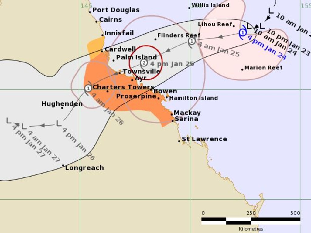
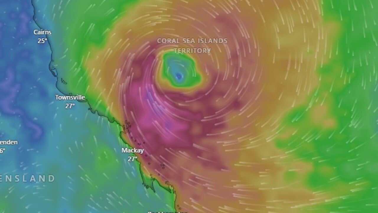
A 400mm deluge is expected for parts of Queensland, along with wind gusts of 165km/h, when the cyclone crosses the coast in coming days, with an updated tracking map showing Kirrily will likely intensify over the next 24 hours before making landfall on Thursday night between Cardwell and Bowen as a Category 2 system.
Residents between Cardwell and Bowen have been warend to expect possible life-threatening flash flooding.
The cyclone warning zone is now Cardwell to Sarina, including Townsville, Mackay, Bowen, the Whitsunday Islands, and extending inland to Charters Towers.
The watch zone includes areas from Innisfail to Cardwell.
Kirrily will then revert to a tropical low and continue tracking west through the northern interior.
Bureau meteorologist Harry Clark said regardless of Kirrily’s exact landfall location, the risk was still the same for all areas within the warning zone.
“It doesn’t matter where it crosses, the impact of the strongest winds will be there regardless,” he said.
“On the tracking map, it crosses directly over Townsville but all of those warning areas will see the gale force winds between Cardwell and Bowen.”
Latest forecasting shows minimal chance of Kirrily crossing as a Category 3 cyclone.
“Intensity forecasts are really difficult… it can go either way but at this stage it’s crossing as a mid range cat 2,” Mr Clark said.
“Cat 2 is a 55-knot system which is right in the middle scale.”
HOMES IN FIRING LINE, EVACUATION CENTRES SET UP
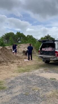
More than 12,000 Townsville homes are expected to be impacted by Kirrily’s crossing, but Mayor Jenny Hill has advised residents they are able to shelter through the storm in place.
However, if required, QPS disaster co-ordinator Shane Chelepy said that in the Townsville area alone there are more than 600 rooms of emergency accommodation available.
Townsville Council has now opened two emergency evacuation centres at its officers on Walker St and the Heatley Secondary College.
Areas including Cungalla, Gumlow and Saunders Beach have been urged to consider relocating or face isolation.
Two public evacuation centres have opened at the Wills St Evacuation Centre and Heatley Secondary College.
The Bureau of Meteorology said the system is expected to make landfall between Innisfail and Bowen on Thursday night without an accompanying storm tidal surge.
The Bureau has forecast damaging winds reaching up to 120km/h to hit the Whitsundays from Wednesday night, before extending to Ayr to Sarina, including Townsville, on Thursday morning.
Coastal communities could see gales reaching 140km/h.
Risks of flash flooding are most likely between Innisfail and Sarina from early Thursday and will intensify as the system moves inland.
A storm tide is also expected to hit between Townsville and Mackay however the Bureau has forecast only minor flooding along beaches.
Coastal areas are forecast to receive up to 400mm of rainfall between Thursday and Saturday before the system moves inland, where it is expected to create widespread flooding.
“What we’re expecting during the event through Thursday and Friday is total rainfalls up to the order of 300 to 400mm and then if that system is forecast to move away from the coast, and then continue to have heavy rainfall over more widespread areas through central and western Queensland,” Bureau manager of hazard preparedness and response for Northern Queensland Luke Shelley said.
“We expect that that may continue for several days throughout the weekend.”
Costal areas could receive up to 300mm on Thursday and another 150mm on Friday, before rainfall starts to ease on Saturday.
“The highest risk for that (lingering system) at the moment is further inland from Townsville, so it’s really the Charters Towers, Hughenden the Flinders catchment is probably the highest risk area for … the more widespread rainfall and flooding,” Mr Shelley said.
“More broadly speaking, we are have already had significant rainfall during the recent TC Jasper event around the Herbert river, so that is definitely a concern ongoing for the community and flooding.”
Council is predicting minor damage for up to 12,000 homes, including broken windows and doors, while 620 older, more lived-in homes have been identified as high risk and could become uninhabitable.
Cr Hill said with the absence of the storm surge, beachfront residents would now be able to take shelter in their homes, including those on Magnetic Island.
“It doesn’t mean we should take our foot off the pedal,” she said.
“If you’re living in areas such as Saunders Beach and Cungulla where there’s a risk you could be isolated for more than two to three days, depending on the rainfall, think about maybe moving in with some mates here in the city.
“Police will be door knocking in those areas suggesting to people to move to locations … where they can access if they need medical assistance or anything like that.
“If you are going to stay and shelter in place, please ensure you’ve got everything: food, fuel, water, or any medical prescriptions you might need.”
As of 6pm, the storm was 630km east-northeast of Townsville and 530 kilometres east-northeast of Mackay.
It is tracking southwest toward the Queensland coast at eight kilometres an hour.
WHAT WILL HAPPEN AFTER LANDFALL
The rainfall event following Kirrily’s crossing continues to be of most concern, with falls forecast between 300mm and 400mm along coastal communities and in Townsville City between Thursday and Saturday.
Inland areas around the Herbert and Burdekin River including Charters Towers, Hughenden and those near the Flinders catchment could receive even higher rainfall totals, and are at most risk of flooding as the system slowly tracks south over the weekend.
“At this stage they (Bureau) are confident around the intensity of the event as it crosses and they believe on probability that the rainfall information will be correct,” Ms Hill said.
“Now, I do agree in light of what happened in 2019 and what happened north of here with cyclone tropical cyclone Jasper, it was really heavy rainfall after the event.
“We will continue to monitor that as we progress through this and we have discussed that at our DMG and we think we’ve got capability to deal with that.”
The Bureau of Meteorology’s Adam Blazak said there would be intense rainfall across central, western and southern Queensland during Friday and into the weekend.
Mr Blazak said modelling now suggested the system will track further west, toward Cloncurry in the state’s far west, bringing intense rain.
“To the Northwest, and maybe sort of around Winton, Longreach might be more in the line of fire now over the weekend with that heavy rainfall as the system decays overland,” he said.
“Certainly for the three or four days after the cyclone the North tropical coasts would expect to see a lot more rain and storm activity.
“So because of that chance of flash flooding after the event, people would need to keep updated with their warnings, certainly throughout the weekend.”
But there’s still a chance of severe thunderstorms around on the weekend in southern Queensland, he said.
Flooding also has the potential to intensify if the low meets a trough moving up over northern New South Wales and into Queensland.
Premier Steven Miles said personnel had been deployed to Townsville with 54 from interstate – with 46 from New South Wales and eight from Victoria.
“It is important Queenslanders consider what travel is necessary from Thursday and into the weekend,” he said.
Bureau meteorologist Laura Bokel said damaging winds were expected with the cyclone.
“We are already seeing gales in southern areas of this system,” Ms Boekel said.
“We are expecting them to start impacting Queensland coast tonight.”
She said the Whitsundays would be affected from tonight, while Ayr to Sarina would see big gusts from Thursday morning.
“Category two cyclones can see winds to minor house damage, fall down large trees and have damage to caravans and risk to power failure,” she said.
Risks of flash flooding were most likely between Innisfail and St Laurence.
QPS State Disaster co-ordinator Shane Chelepy said the system was moving slower than expected but allowed emergency services time to get prepared.
Premier Miles said authorities were carefully monitoring dam levels and they remained in a manageable range.
“There is plenty of room in the dams at this stage,” he said.
EMERGENCY CREWS ARRIVE IN TOWNSVILLE
Five fire and rescue strike teams have arrived in Townsville in anticipation, with support crews to be deployed to impact zones by 10am.
Strike teams will be strategically positioned depending on latest advice from the Bureau of Meteorology.
Several additional swift water rescue boats are now being housed in Townsville in the case of severe flooding following TC Kirrily’s crossing.
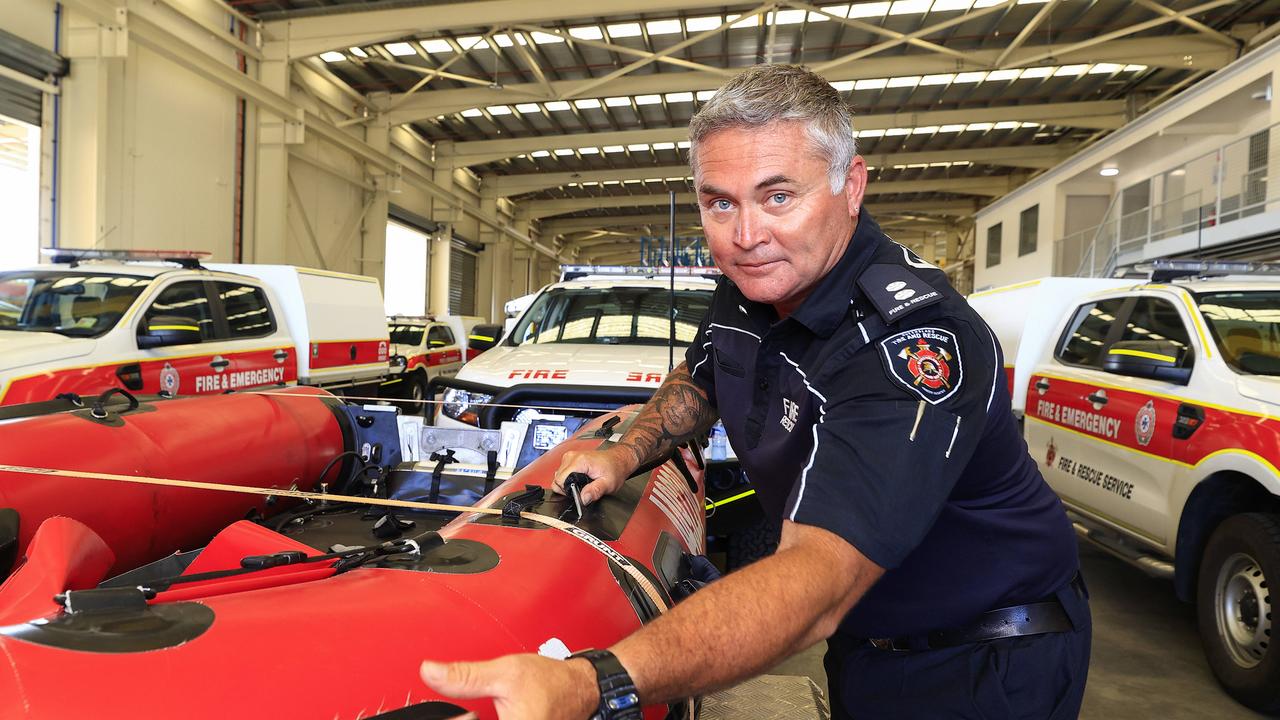
Gold Coast QFES station officer Paul Dunn said truckloads of equipment had been hauled to north Queensland for the cyclone response.
“All the equipment we brought is for the impact of the cyclone and the damage that could come from the strong winds,” he said.
Townsville District Acting Superintendent Dean Cavanagh confirmed additional police and vehicles had been deployed to inland areas including Charters Towers.
He urged any residents who were not already prepared, to start now.
“We know that we could have some winds coming in that might be quite severe, that has an impact on debris and other things.
“Please move out those low lying areas of those areas that potentially could be isolated.
“If a weather event continues post-crossing this cyclone, so another important message is please heed our advice.”
KIRRILY’S IMPACT ALREADY FELT
In the meantime, Townsville’s Australia Day events have been postponed.
But Ms Hill said the invitation for Prime Minister Anthony Albanese and Premier Steven Miles was still open if they wanted to “fill their boots”.
“I’m happy if the Prime Minister and Premier arrived today and live through a cyclone, fill your boots, but right now we’ve spoken to the department and everything’s been postponed,” Ms Hill said.
Mr Miles has cancelled a planned appearance in Townsville for Friday’s Australia Day as the city braces for the cyclone.
Mr Miles had been due to travel to North Queensland for Friday’s Australia Day ceremony, but confirmed on Wednesday his trip was cancelled ahead of the impending weather event.
“The airport is going to close before I intended to fly, but the event I intended to attend has also been cancelled,” he said.
Asked whether Queenslanders in the forecast impact zone should also consider cancelling their public holiday plans, the Premier said “certainly”.
“I understand Townsville has cancelled its activities on Friday,” he said.
“I just encourage people to look at the forecasts and make sensible decisions.
“Certainly you wouldn’t want to be travelling great distances in these kinds of conditions.”


