
Warwick weather: Potential ‘life-threatening flooding’ after intense rainfall, storms
Residents across Warwick and the Southern Downs are being urged to prepare now for the intense and possibly devastating rain and storms predicted to batter the region, with one area already copping 86mm in just hours.
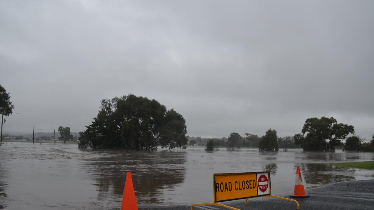
Warwick residents and emergency services alike are bracing for what experts predict could be one of the most intense weather systems to hit the area in the past year.
The Granite Belt record a whopping 86mm of rain overnight Wednesday, while Warwick managed to stay dry.
This has since been upgraded to a severe weather warning for heavy rainfall from early Thursday morning, bringing six-hourly totals of 50mm-100mm to the Southern Downs and as far west as Charleville.

“Thunderstorms may also produce localised areas of damaging to destructive winds.”
BOM meteorologist Doctor Helen Reid said Warwick’s flood risk was exacerbated by the heavy rains and storms of the past weeks, after the region received more than 40mm in a downpour on Monday alone.
“There’s been a lot of rain, and now we’ve got this system with more coming through that’s just going to feed into rivers that are already close to flooding,” she said.
“We are expecting a possibility of more intense rainfall on the Granite Belt. Warwick and Stanthorpe aren’t that far away, but the landscape does change quite a bit to that higher ground where rainfall can accumulate that much more.

“That’s not to say Warwick won’t get lots, and if Warwick gets these thunderstorms it might be in the running for those top numbers, but at the moment it’s just that terrain.”
Southern Downs Mayor Vic Pennisi said the region’s Local Disaster Management Group was on alert heading into the danger period, but would wait to see whether the heavy rains actually eventuated before taking action.
“I know there’s a prediction that we could get – and I stress ‘could get’ – major falls and that could result in flooding, but it hasn’t rained yet and until it does the message is ‘don’t panic’,” Cr Pennisi said.
Cr Pennisi said producers could again bear the brunt of damages during the intense weather system, only weeks after Granite Belt farms were hammered by hail storms.
“What I’ll say about the rain is it stays dry a lot longer than it stays wet, and today we are a lot closer to the next drought,” he said.
Warwick Police acting officer-in-charge Senior Sergeant Shane Reid agreed that while emergency services had plans in place, it would be a matter of keeping a close eye on water levels to determine evacuations or road closures.
“We know rainfall from The Head in Killarney takes about 24 hours to come down to Warwick, so we’re guided by the Condamine River and those levels,” he said.
“If anyone’s in low-lying areas, or indications of the rainfall or media releases and warnings indicate there is going to be major flooding, people need to prepare general food and the concept they may be restricted from entering certain parts of town if it does occur.”
General flood preparation advice from the SES includes keeping an emergency kit on hand, identifying evacuation routes, and staying away from flood waters.

Explosive findings: 100 bombs a year wash up on our beaches
