
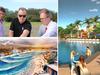
Sunshine Coast aerial images reveal decade of development
New aerial images of the Sunshine Coast reveal how much the region has developed throughout the past 10 years with massive transformations sweeping suburbs. SEE THE PICTURES
Sunshine Coast
Don't miss out on the headlines from Sunshine Coast. Followed categories will be added to My News.
New aerial images show the dramatic transformation of the Sunshine Coast over the last 10 years with past and present developments reshaping its urban landscape.
Numerous residential community precincts and infrastructure builds such as the new Maroochydore CBD, the Sunshine Coast University Hospital and airport upgrade have modernised the region.
Real Estate Institute of Queensland’s Sunshine Coast zone chairman Matt Diesel said investment in public and private assets had fostered economic growth during the past decade.
“There’s been significant growth, a lot of the infrastructure that the Coast was lacking has been put into place since 2011,” Mr Diesel said
“The foundations are being built to support and sustain our growth we’re going to get especially over the next 10 years. I think the Sunshine Coast is really coming of age which is a good thing, but we’ve still got a long way to go and there’s still a lot more infrastructure needed to support future growth as well.”

As more construction projects are touted ahead of the 2032 Olympics and migration continues to rise Mr Diesel said balancing development and the environment will be crucial for the region’s identity.
“What makes us unique is that we’ve got beautiful beaches and lots of nice big tracks of green space and the last thing we want to do is replicate a CBD-style living here, we’ve got to know who we are and keep that essence,” Mr Diesel said.
“There has to be growth, but there can be sustained growth and careful planning to make sure we get what we need moving forward and keep the environmental landscape we’ve got now.”
See the comparisons in development for featured suburbs below with aerial imagery from Australian location intelligence company Nearmap:
Nearmap provides government organisations, architectural, construction and engineering firms, and other companies, with easy, instant access to high resolution aerial imagery, city-scale 3D content, artificial intelligence data sets, and geospatial tools to assist with urban planning, monitoring and development projects in Australia, New Zealand, and North America.


From the wilderness: New sides shake up Aus School rugby
A Super Rugby icon will spearhead an Australian Schoolboy’s side that are enjoying flying under the radar before hoping to pull off a major competition upset.
Read more

Hungry! Teen rugby guns with a point to prove at Australian junior champs
They are young guns with a point to prove and desire to impress elite scouts at the Australian juniors rugby championships. Discover the players to watch from the boys under-18s division.
Read more