
Satellite imagery reveals magnitude of Bribie Island breakthrough
A timelapse video over almost 40 years shows the shock extent of the Bribie Island breakthrough as new warnings of the treacherous conditions are made ahead of the holidays.
Sunshine Coast
Don't miss out on the headlines from Sunshine Coast. Followed categories will be added to My News.
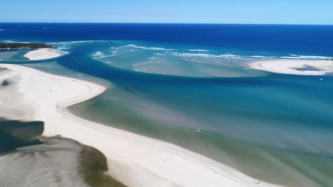
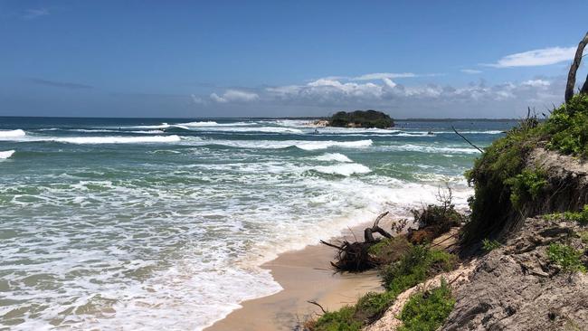
Satellite imagery reveals the scale of the Bribie Island breakthrough, which has created challenges for local authorities out on the water.
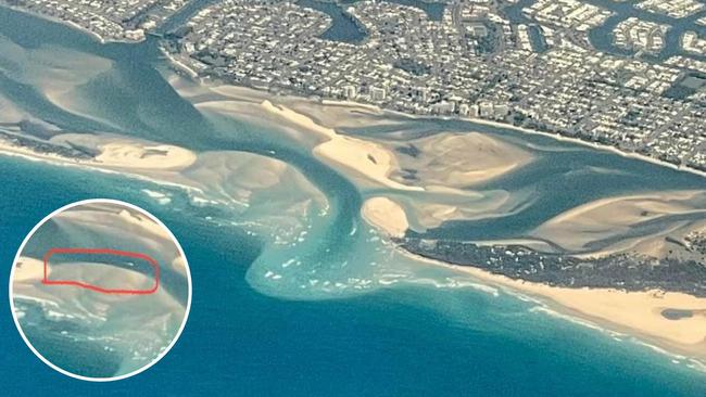
A Google timelapse compiling satellite imagery of Golden Beach and the Pumicestone Passage from 1984-2022 shows the moment of the Bribie Island breakthrough in January, 2022 following Ex-Tropical Cyclone Seth.
The ex-tropical cyclone and a king tide combined to create surging waves that smashed through the landmass to create two separate islands, causing a large build-up of sand in the area.
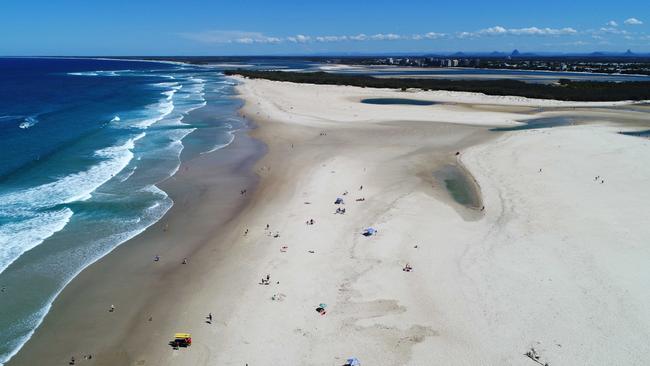
The breakthrough created a fast-changing environment in the Pumicestone Passage, forming a new crossing into the ocean dubbed the Bribie Bar and resulting in sand closing up the Caloundra Bar.
The constantly changing conditions in the passage prompted a marine service leader to warn water users of ever-changing conditions and the dangers near the Bribie Island breakthrough ahead of an expected influx of holiday-makers to the Sunshine Coast.
Coast Guard Caloundra Commander Roger Pearce said the marine service expected the number of people on the water in the Pumicestone Passage to increase two-fold over the summer holidays.
He said there was an area inside the bar where “eddies” were being created that had recently turned around a motor boat and flipped a kayak.
Recreational boatie Jim Brody, who saved the man on the kayak, said that conditions near the bar were “choppy”.
“The man had been fishing when he got caught in an eddy and that flipped him out of his kayak,” Mr Brody recalled.
“The bar was very choppy, there were waves breaking over the side of my boat, and there was a lot of current – I don’t think he would have got back on his kayak, it would have got just worse.”
Mr Pearce also said the bar had extended about 300m out to sea and where it dropped off, into about 7m of water, waves were “standing up quite markedly”.
He said boaties should cross the bar at high tide when there was no water movement.
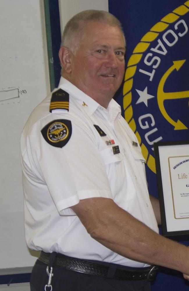
“When you’ve got a full tide, it’s the safest,” Mr Pearce said.
He also said boaties who wanted to attempt a bar crossing should first check the Department of Environment and Science waverider buoy.
He said if the swell was more than a metre, boaties should “be very careful on the bar”.
The breakthrough has also created additional workload for lifeguards in the area.
Due to the changes in the area, lifeguards have created a temporary outpost at Happy Valley, for the purpose of advising people not to enter the rough water on the ocean side.
The outpost at the unpatrolled beach was set up after a teenage girl was pulled from the water in April earlier this year.
Despite the challenges posed by shifting sands for coast guard and lifeguards, a study by the Department of Environment and Science (DES) has revealed that the water quality in the area has not deteriorated.
According to DES, there has been “no substantial change in water quality within the northern portion of Pumicestone Passage since the formation of the new entrance in January 2022,” with data from the water monitoring buoy near Bulcock Beach revealing that “water quality in the northern section of Pumicestone Passage remains consistent with other sites further south”.


$3.3m mansion war: Buyers, sellers film each other in dramatic standoff
A tense stand-off between the vendors and buyers of a $3.3m waterfront Sunshine Coast home has been caught on camera, with police called to the dispute over who had the right to be on the property, a court has heard.

Class act! Top teen rugby stars to watch at Australian school champs
Weapons, speedsters, big units, a player with Joseph Suaalii athleticism and a ‘man boy’ - the rising stars to watch at the Australian schools rugby championships. FULL TEAM LISTS