
Expert explains fire cloud that formed over Sunshine Coast blaze
An incredible video shows a “mushroom” cloud that formed over a Sunshine Coast fire as a weather expert weighs in on what caused the phenomenon.

Sunshine Coast
Don't miss out on the headlines from Sunshine Coast. Followed categories will be added to My News.
A weather expert has explained the conditions behind the cloud that formed over a Sunshine Coast bushfire earlier this week, which was captured by many curious residents on social media.
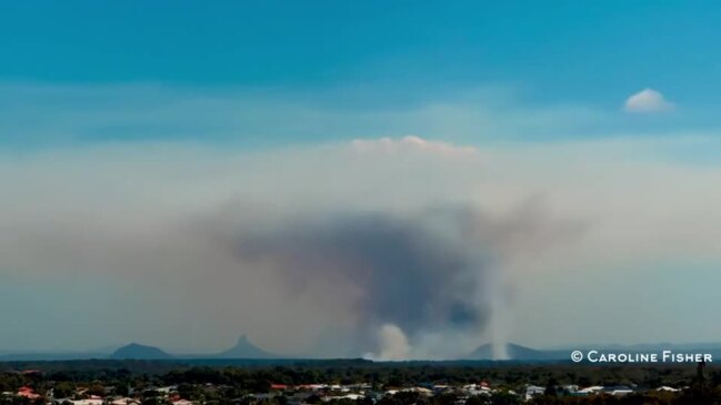
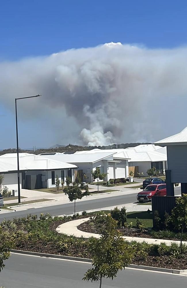
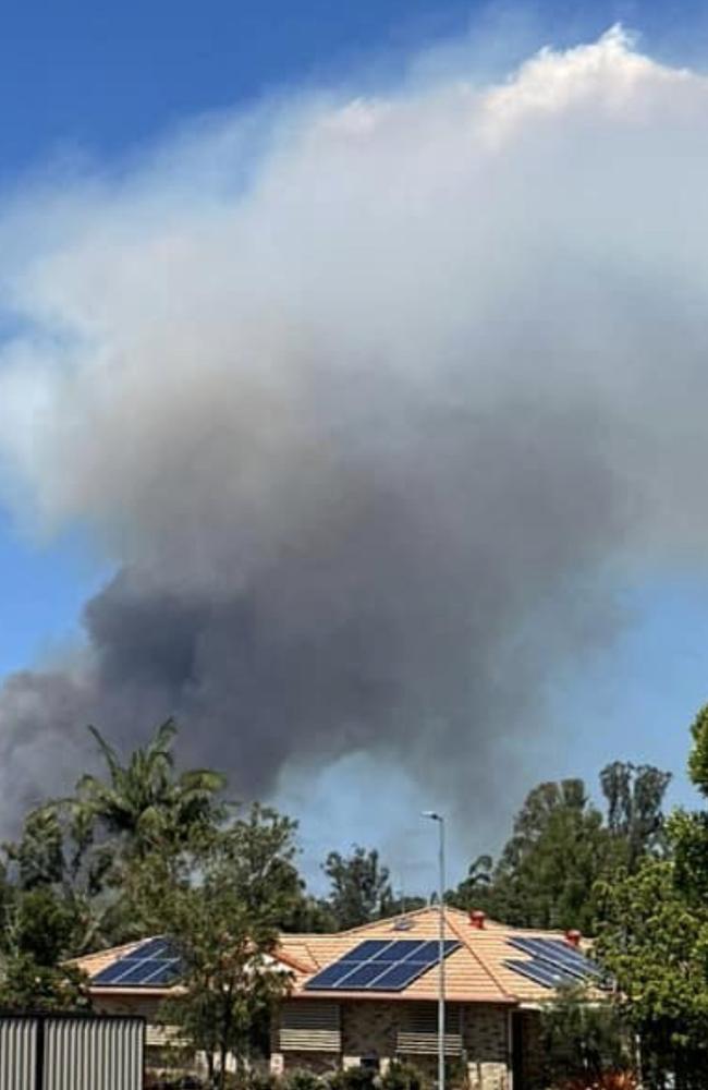
As the Beerwah bushfire burned earlier this week, many Sunshine Coast residents saw a cloud shaped like a mushroom that started to form above the blaze.
The fire at Beerwah near the Bruce Hwy, Mawsons Rd and Roys Rd, started on Sunday, September 17, and continued to burn within containment lines on September 22.
Cinematographer Caroline Fisher shared a timelapse of the cloud forming over the fire, condensing about two hours of footage into 25 seconds.
The Bureau of Meteorology’s Harry Clark said the phenomenon was not “overly rare” and happened with “stronger” fires.
“There has to be a combination of the right conditions to get it,” he said.
The meteorologist said the video showed a pyrocumulus cloud, or the cloud caused by the fire, forming.
He said the fire was producing heat at the surface and when the hot air rose it started to cool and formed a cloud.
“This case is really interesting because it hits a certain level and there’s an inversion,” Mr Clark said.
The inversion was stable air in the atmosphere, the meteorologist said, which was like the cloud “hitting a wall” and dispersing horizontally causing the mushroom shape.
Mr Clark said if the cloud had formed in an unstable atmosphere a pyrocumulonimbus, or a fire thunderstorm, could occur.
Fire thunderstorms develop in bushfire smoke plumes and can cause unpredictable and rapid change to blazes.
Other Sunshine Coast residents also shared several photos of the cloud on social media.
The meteorologist said the Sunshine Coast had experienced a significant cool change on Thursday night but it was windy with gusts of up to 50 or 60km predicted on Friday.
“Winds are easing slowly over the weekend,” Mr Clark said.
A Queensland Police Service spokeswoman said an investigation into what caused the Beerwah blaze continued.
Police officers revealed earlier this week they were investigating if the fire was started by hoons in the area.
A Queensland Fire and Emergency Service spokeswoman said firefighters were also at another fire in Belli Park, near Boyle Rd, that began yesterday, September 22, about 5.10pm.
She said it was reported that powerlines had come down and caused a grass fire in mostly inaccessible land.
Firefighters were monitoring it, the spokeswoman said.


Transport minister admits long-debated Sunshine Coast rail cost unknown
The state government does not know how much it will need to spend to fulfil its major election pledge to build the Sunshine Coast Rail to Maroochydore by 2032.
Read more
Birtinya set for major expansion as council backs height increase
Following a lengthy debate, the Sunshine Coast Council has approved plans to increase building heights in Birtinya.
Read more