
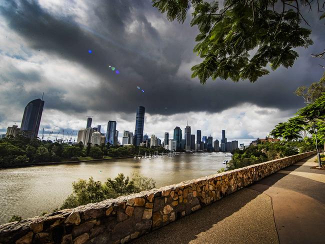
Southeast Queensland braces for more rain after overnight downpour
A series of very dangerous storms has hammered the Gold Coast, with 126mm of rain falling in just two hours in some parts, prompting an emergency alert to be issued.
QLD News
Don't miss out on the headlines from QLD News. Followed categories will be added to My News.
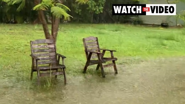
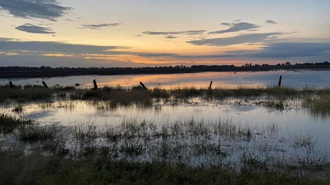
Sodden Gold Coast and northern NSW residents are mopping up and counting the costs after the second major deluge in less than a week wreaked flooding havoc across the region.
It comes as southeast Queenslanders are being warned to brace for more potential flooding rains in the lead-up to Christmas.
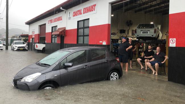
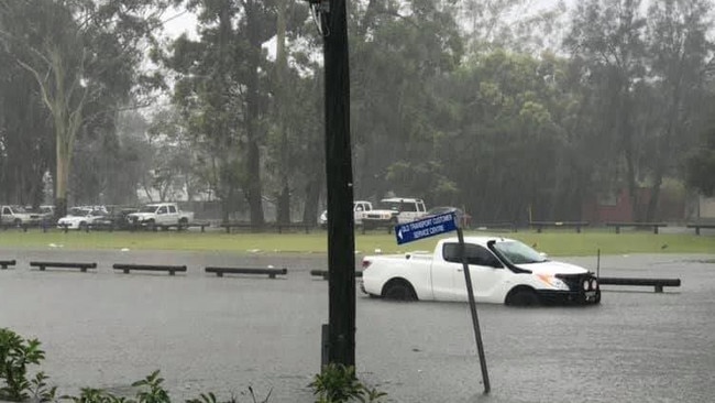
Scores of roads were closed by flash flooding and landslides, at least one motorist was rescued from a submerged car and a major business district was thrown into turmoil as almost 200mm of rain was dumped on parts of the southern Gold Coast and Tweed in just six hours on Thursday.
Hardest hit areas included Currumbin, which by late yesterday had been drenched by more than 800mm of rain in six days.
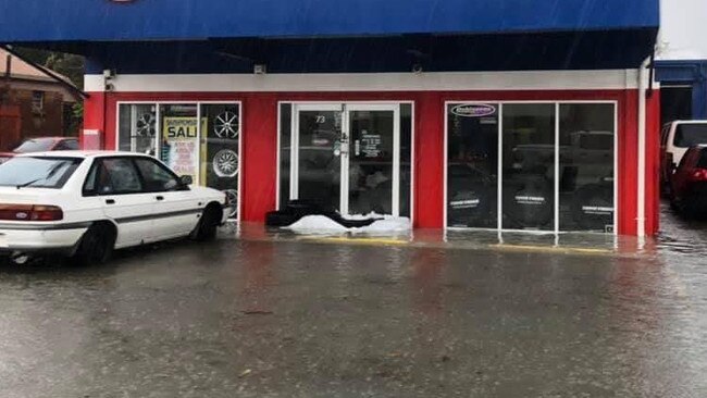
Currumbin Creek broke its banks in parts and floodwater surged through businesses in the busy Currumbin industrial estate.
Tallebudgera Creek recorded 145mm of rain between 9am and noon and 83mm more in the two hours to 3pm, while Tomewin in the Currumbin Valley copped a 93mm drenching.
Many other parts of the Gold Coast received well over 50mm of rain in the three-hour period.
A total of 122mm has fallen at Oyster Creek over two hours to 10.30am while falls in excess of 150mm have been recorded in the southern ranges just west of Coolangatta.
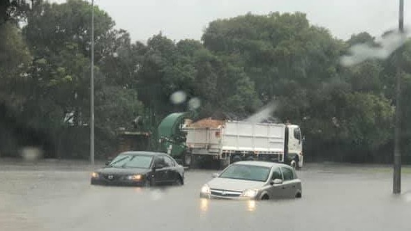
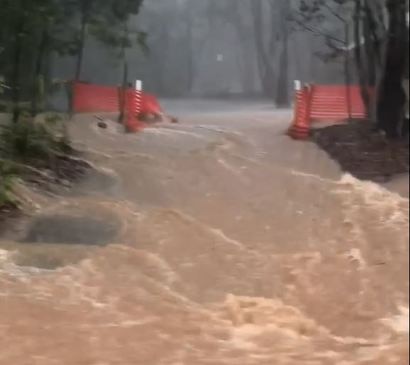
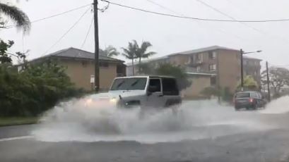
Major flooding on the southern Gold Coast is causing traffic chaos in Tallebudgera and Currumbin as motorists attempt dangerous water crossings despite a number of road closures.
Emergency services have been called to the intersection of Tallebudgera Connection Rd and Valley Dr after a male driver attempted to cross flood waters and required a swift water rescue about 10.50am by Queensland Fire and Emergency Services.
Low-lying Galleon Way at Currumbin Waters has been closed due to flooding while Old Coach Rd and Tsipura Dr at Burleigh Heads are also being heavily impacted.
BOM warns a very dangerous thunderstorm is tracking over Miami, Mudgeeraba and Tallebudgera, and is expected to impact Coolangatta by 11.25am.
Parts of the Tallebudgera Creek have reportedly surpassed minor flooding levels and are surging towards moderate flooding just before 11am this morning.
Kennedy Drive in Tweed Heads has also reportedly flooded, with Terranora Creek which feeds into the Tweed River also suffering from minor flooding.
Three separate storms with reported heavy falls are set to hit the coast in the next few hours.
Caution is now being advised throughout the southern Gold Coast, as severe thunderstorms, heavy falls and potential flash flooding is predicted.
The warning comes as Oyster Creek on the coast received 42mm of rain in a 30 minute period, with warnings showing it’s just a taste of what’s to come for the rest of the day.
The Department of Transport and Main roads have also tweeted reports of flash flooding already occurring at Currumbin Creek Road, Currumbin.
These thunderstorms are moving towards the south to southeast.
Heavy rainfall that may lead to flash flooding is likely.
âš ï¸Severe Thunderstorm Warning issued for #GoldCoastâš ï¸
— Bureau of Meteorology, Queensland (@BOM_Qld) December 16, 2020
Severe storms are occurring near #Coolangatta & #Miami, moving S-SE. Heavy rain that may lead to flash flooding is likely. Oyster Creek reported 42mm rain within 30 minutes to 8:55am. Warning details: https://t.co/IYjpNGqryF pic.twitter.com/Cx6Ys9pJ2f
The southeast is set for another damp day after reports of up to 180mm falling in some parts of southern Queensland overnight.
On the southern Darling Downs, where a man died in floodwaters while trying to move cattle to higher ground, there are reports 180mm fell in just an hour.
People are also reporting more than 100mm of rain overnight in Theodore and 50mm in Chinchilla.
In southeast Queensland, 45.4mm fell in Coolangatta with another 30mm possible today.
Nambour on the Sunshine Coast recorded 43.2mm, with the Bureau of Meteorology predicting an 80 per cent chance of up to 25mm more today.
It comes as heatwave conditions have returned to the state’s west, with temperatures expected to exceed the average by six to 10C.
Birdsville is expected to reach 45C today, while Thargomindah and Longreach can expect to be as hot as 43C.
Official Rainfall totals since 9am Wednesday
Coolangatta – 45.4mm
Nambour – 43.2mm
Gold Coast – 31.2mm
Canungra – 28.4mm
Greenbank – 5.4mm
Brisbane – 4.8mm


Chilling details emerge as woman’s home birth tragedy in court
A Brisbane doctor who allegedly assisted a home birth that caused the death of a mother did not tell paramedics she was a medical professional when they turned up, a court has heard.
Read more
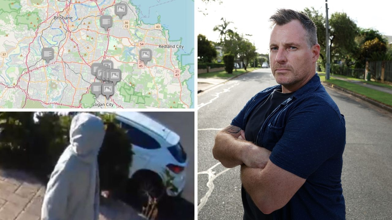
Crime spree mapped: Fed-up suburb takes fight into own hands
A 3000-strong group of residents in a Brisbane suburb are tracking crime and patrolling their own streets. SEE THE HOT SPOTS
Read more