
Slow-moving trough brings uncertainty for north Queensland
Weather experts tell north Queenslanders to prepare for potentially life-threatening weather and intense rainfall as an uncertain and slow moving trough approaches.
QLD News
Don't miss out on the headlines from QLD News. Followed categories will be added to My News.
As north Queensland braces for the possibility of intense rain and flash-flooding, the Bureau of Meteorology has advised another area of Queensland could cop a drenching over the weekend.
Widespread rain, accompanied by moderate to fresh winds and below-average temperatures, will likely impact western parts of Queensland including agricultural areas from Sunday to Tuesday.
Meteorologist Harry Clark said the likely conditions would be caused by moist air feeding in from the Coral Sea and Gulf interacting with a surface trough.
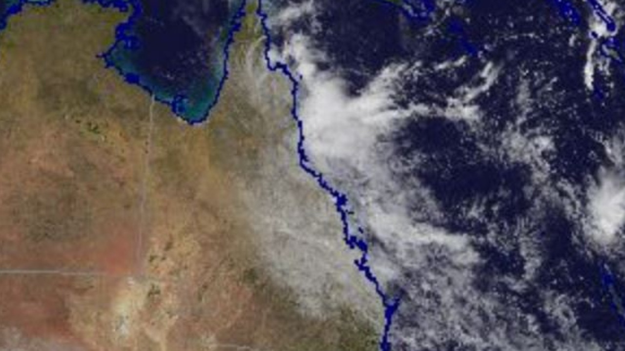
The advice came as a slow-moving surface trough continued to linger just offshore of the northeast tropical coast.
North Queenslnaders spent Friday on alert after the bureau issued a severe weather warning as a result of the weather system which could bring six-hourly totals up to 300mm.
The intense rainfall is expected only if the trough moves back onshore.
A flood watch is current for coastal catchments in Far North Queensland.
Locations which may be affected include Cairns, Port Douglas, Mossman, Yarrabah, Wujal Wujal and Hope Vale.
Severe weather is no longer occurring in the Herbert and Lower Burdekin district and the warning for this district has been cancelled.
The bureau has forecast a few showers and partly cloudy conditions for southeast Queensland this long weekend.
Light winds and a minimum temperature of 17C are expected for Brisbane on ANZAC Day.
Rainfall recorded on Friday:
85mm recorded in the hour to 2:45pm at Narada Alert.
92mm recorded in the hour to 2:45pm at Rankin Creek.
59mm recorded in the hour to 3:15pm at Crawfords Lookout.


‘Not appropriate’: Bleijie denounces WorkCover board deputy’s ‘slutty nurse’ post
Screenshots of questionable Facebook posts by the Jarrod Bleijie-appointed deputy chair of the WorkCover board have forced the Deputy Premier into a hasty response.

Northside traffic chaos: Major delays on key routes out of Brisbane
Traffic is at gridlock on multiple major routes and rat runs in Brisbane’s north, leaving commuters with a hellish trip home.