
QLD bushfires: Firefighters turning to WA for info on their own bushfires
The LNP has written to Premier Annastacia Palaszczuk requesting an urgent briefing on why firefighters are relying on West Australian data to fight Queensland bushfires.
QLD Politics
Don't miss out on the headlines from QLD Politics. Followed categories will be added to My News.
THE LNP have written to Premier Annastacia Palaszczuk requesting an urgent briefing on why firefighters are relying on West Australian data to fight Queensland bushfires.
It comes after The Courier-Mail revealed Queensland’s Rural Fire Brigade online fire map had insufficient information about the state’s bushfires, according to frontline personnel.
The situation has seen rural firefighters turn to maps produced by the WA Government in order to learn more about the fires on the Scenic Rim, southwest of Brisbane.
Experts reveal truth about backburning
Fires bring out the worst in Aussie politicians
Firey vents: ‘Lives at risk for no damn reason’
In a letter to Ms Palaszczuk, Opposition Leader Deb Frecklington and Opposition fire spokesman Lachlan Millar requested an urgent media briefing explaining the situation.
“This is a stressful period for many in our community and this lack of access to reliable data
adds unnecessary anguish and concern over fire events that are not even present,” the letter reads.
“As Chair of the Queensland Disaster Management Committee, we would urge you to
publicly address these media reports today.”
The letter goes on to say the lack of detail on Queensland’s map poses risks to firefighters.
“Our permanent, auxiliary and rural volunteer firefighting crews have a hard enough battle on
their hands to save lives and properties without having to second guess Queensland
government fire mapping data,” it reads.
“We would appreciate the opportunity for an urgent briefing on this issue.”
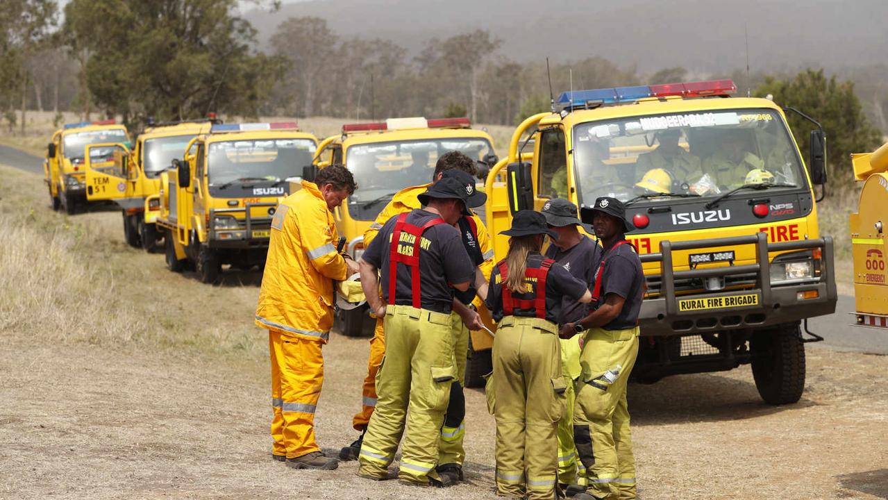
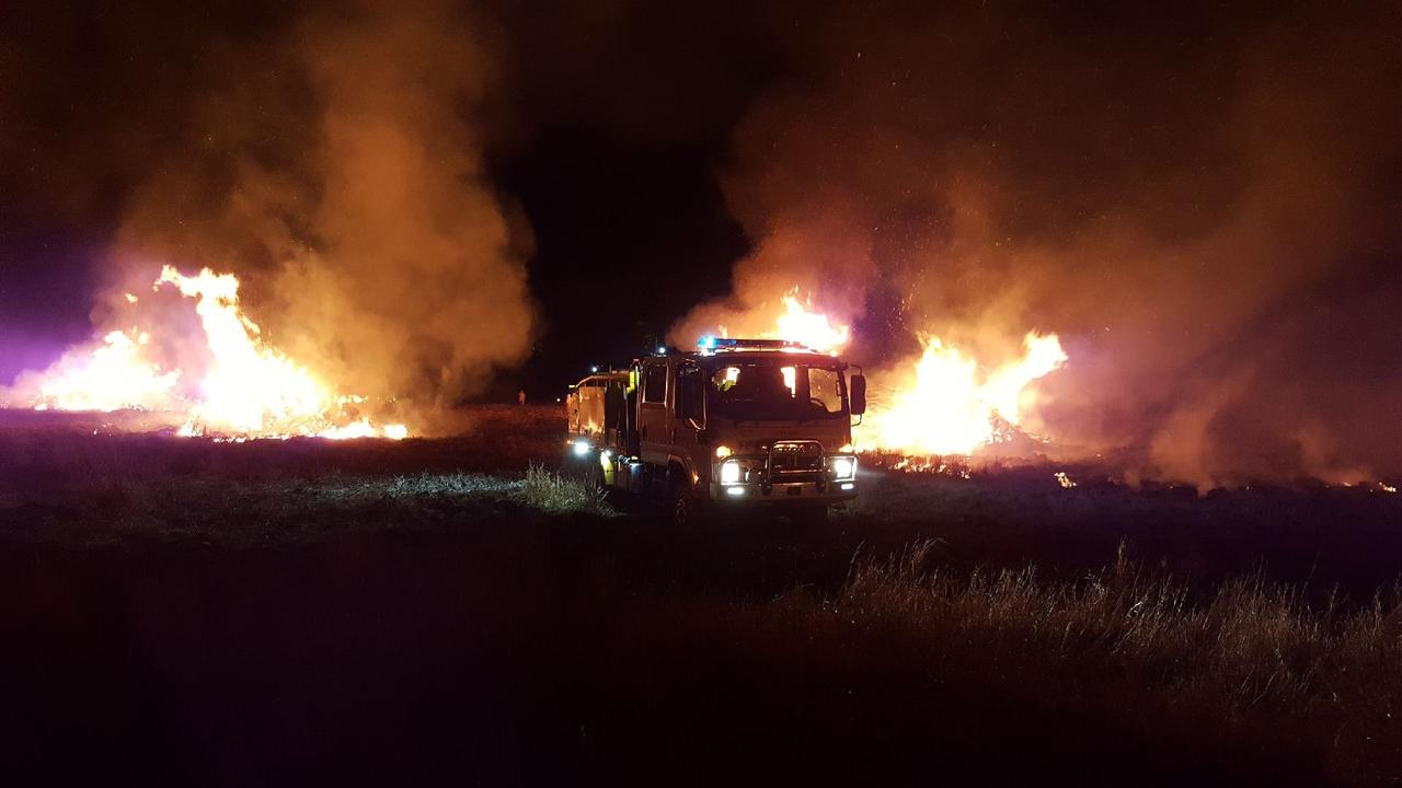
Queensland firefighters battling to save properties on the front lines made the public aware via social media that they were being forced to use bushfire maps from the Western Australian Government, claiming the state’s own maps were woefully inadequate in a crisis.
The firefighters are choosing not to use the Queensland Government’s bushfire maps, favouring those created on the other side of the country after being led to fires that did not exist, while significant blazes did not register on the system.
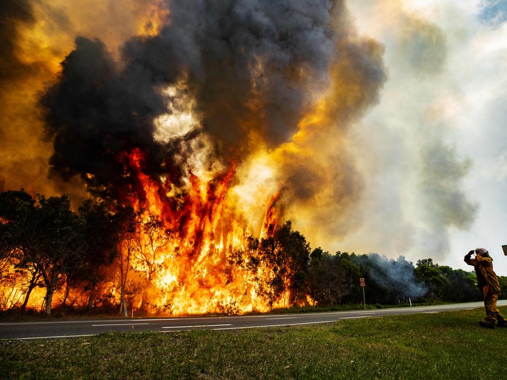
Rural firefighters tasked to serious bushfires southwest of Brisbane told The Courier-Mail they have been left confused by the Queensland Government fire map, which told them there were major bushfires in the area when there wasn’t.
In one case, the Queensland map told firefighters were was a blaze in Boonah, which they say was actually the incident control centre.
Alarmingly, one firefighter said the “biggest fire for smoke” he had seen in his life wasn’t even on the map.
Earlier this week, a rural firefighter in the Clumber area discovered Western Australia’s online bushfire map which featured significantly more information on Queensland’s fires.
The WA map enabled rural firefighters to locate smaller fires along Wilson Road at Clumber which were not featured on the local mapping.
Without the discovery of the WA map, one rural firefighter said the blaze at Clumber could have been much worse.
The damning assessment of Queensland’s fire maps comes after fire authorities were forced to review the state’s bushfire preparedness.
“The biggest fire for smoke that I’ve ever seen in my life (at Mulgowie) is not even on Rural Fire Brigade’s current incidents,” one senior rural firefighter said.
“They (my colleagues) watched this whole fire on that (WA) map. Everything’s on there for us.
“Their maps are not worth f-----g s--t.”
Queensland relies on information from firefighters to contribute to its map, which is updated every 30 minutes, according to the Queensland Fire and Emergency Service website.
WA’s mapping is a research collaboration between a company called Landgate and Edith Cowan University.
The state’s mapping imagery is generated with the help of satellites, rather than firefighters on the ground.
Landgate also provides other fire monitoring tools aimed at meeting the needs of fire management professionals and fire behaviour scientists, according to the WA Government.
One first officer of a rural station said Queensland’s map included an alert for a major bushfire in a street at Boonah, southwest of Brisbane, but the alert on the map was actually just the incident control centre for fire crews.
“There’s a little square (icon) at Boonah, at Melbourne Street, Boonah. That’s the incident control centre, mate,” he said.
“They’re terrifying everyone in Boonah.”
In a statement, QFES said that it used data from a variety of sources to inform its decision making.
“Queensland Fire and Emergency Services (QFES) crews are verbally briefed about fire conditions and the current fire situation prior to responding to incidents. Visual data from several sources, including the data set used by the WA website, is available to incident management teams and firefighters as required,” the statement read.
But QFES did not answer why the Queensland map had such little information compared to the WA map.
“QFES publishes all current bushfire community warnings to the current incidents map on the Rural Fire Service website,” the statement read.
“Critical bushfire warnings and information is communicated to members of the community through a range of platforms, including social media (Facebook and Twitter), the QFES Newsroom and local media outlets.”
$135m health bungle: Minister’s apology to affected businesses
Health Minister Steven Miles has apologised to businesses that have suffered delays because of the new Queensland Health payment system.

Hundreds of staff underpaid at Queensland utility
A Queensland Government-owned utility corporation has underpaid hundreds of its senior staff for more than a decade in a bungle that could have ripped off up to a quarter of its workforce.