
Qld weather: Heatwave backflip, South East braces for storms, hail and rain dump of up to 100mm
South East Queensland is set to see a heatwave backflip from Sunday with a looming rain band threatening to bring severe thunderstorms and falls of up to 100mm.

QLD News
Don't miss out on the headlines from QLD News. Followed categories will be added to My News.
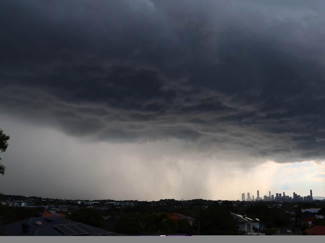
Severe thunderstorms and a possible 100mm rain dump is threatening to drench South East Queensland come late Sunday afternoon, as a looming cloud band tracks towards the east coast.
Sunday will likely be the end of the sweltering heatwave for the southern half of the state, as a developing trough in Central Queensland combining with unstable conditions in the atmosphere brings severe thunderstorms and heavy rainfall.
The Bureau of Meteorology’s Shane Kennedy said thunderstorms will likely begin in the west on Sunday afternoon and stretch south to Taroom and northern NSW before moving towards Brisbane and the Gold Coast during the night.
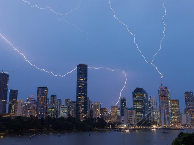
“As that cloud band thickens up heavy rainfall is the most likely factor we will see tomorrow (Sunday), with potentially some large hail and damaging winds with those storms,” Mr Kennedy said.
“Sunday will be a bit more active in general, particularly in the south east … we will see those showers and thunderstorms, with a big line forming inland and pushing towards the coast to start off a big few days of pretty wet weather.”
Mr Kennedy said the peak of the rainfall will arrive on Monday, where some areas could see isolated falls of 50 to 100mm alongside thunderstorms, with widespread rain of up to 30mm.
A broad area of the south east is likely to be affected, extending to Charlerville, the Darling Downs and Granite Belt, as well as the Gold Coast and Brisbane.
“We’ll likely see this rain band continuing into the week,” Mr Kennedy said.
“Monday will be the peak day before it quietens down on Tuesday and Wednesday with isolated falls of up to 50mm and then dropping off on Thursday with moderate rain of 20mm or less.”
“We could see some flash flooding if we do see that isolated heavy rainfall, but we are not expecting it to be widespread.”
Mr Kennedy said alongside the rain there will likely be the chance of a thunderstorm each day in the south east, with humidity hanging around despite temperatures dropping back down to average.
“Humidity will hang around with the unstable air temps, but those hot temps we’re seeing will improve a little bit in the south east with that thick cloud and will break us out of that heatwave.”
Much of the state on Saturday likely saw the end of sweltering conditions with Brisbane reaching 31C and Ipswich 32C.
Cloncurry Airport woke up to their warmest November minimum temperature since 2019 sitting at 31C, while Mt Isa also broke their warmest November morning since 1987.
The heatwave warning is expected to contract towards the north west where temperatures in the mid 40C are set to linger for the following days.

Principal who won defamation case against parents quits
A controversial Queensland principal has quit after a long leave of absence, revealing her new role in an emotional message to the school community.
$2.7bn war chest to save outback Qld town from oblivion
An outback Queensland town is making a bold, $2.7bn bid to reinvent itself and avoid economic oblivion. Go inside the plan, complete with “flying whales”.