
More rain expected to hit Queensland’s north after record-breaking totals
A road has been closed following a landslide after record breaking rainfall hits the state’s north. Flood warnings remain in place.
QLD News
Don't miss out on the headlines from QLD News. Followed categories will be added to My News.
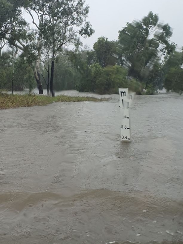
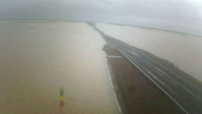
FLOOD warnings are still in place after a record breaking day of rain hit the state’s north yesterday.
Paluma had a huge 70mm within an hour this morning causing a landslide which has closed a road.
Mount Spec Rd from Crystal Creek to Paluma has closed as a result of debris from the landslide.
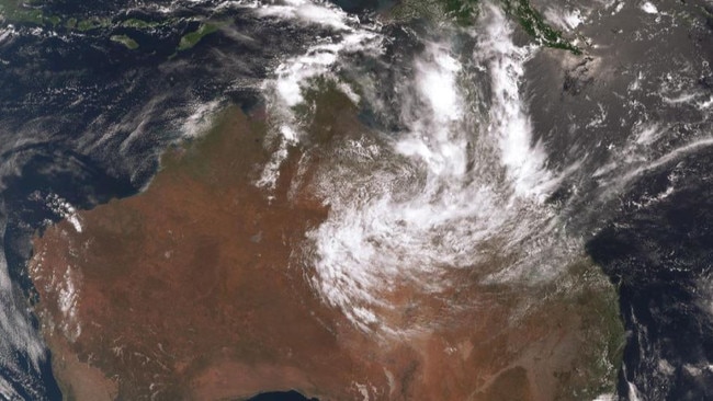
The tropical low sitting over Normanton in Gulf Country will cause more rain before its forecast to move over to the Northern Territory tomorrow.
Heavy rain, which may lead to flash flooding, is likely to hit the Gulf Country, southwestern Peninsula, North West, western Northern Goldfields and Upper Flinders, and far northern Channel Country districts tonight, the weather bureau warned.
Peter Markworth from the Bureau of Meteorology said a similar “convergence zone” to what we saw yesterday is forming over Ingham.
“It does look less likely to drop as much as yesterday as it doesn’t look as intense but will depend on its movement,” he said.
“The zone is tracking a bit faster than the one yesterday so we won’t see the same totals. But the rate of fall will be quicker so flash flooding is still possible for those regions.”
Relief is expected to come tomorrow for the northeast but Cairns and surrounds will still see a high chance of showers over the coming days.
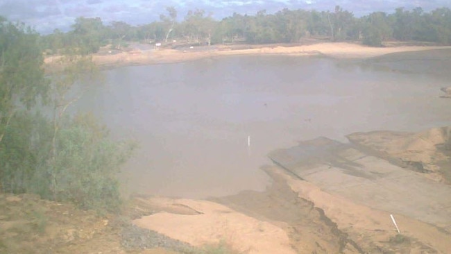
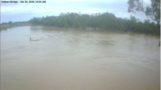
Burdekin, Townsville and Gulf Country were hit with huge amounts of rain yesterday with more rain expected today.
Home Hill, Ayr and Rita Island were the worst affected with Rita Island hitting an astonishing 529mm over the last 24 hours.
Ayr reached up to 426mm with Groper Creek in Home Hill recording 418mm, smashing rain records that have been standing for 32 years.

Inside US Navy’s largest missile sub during Brisbane visit
USS Ohio's sailors are breathing fresh air in Brisbane after joining the Talisman Sabre military exercise, as a rare tour reveals life inside America's most heavily-armed submarine. PICTURES

Family determined to give dying child ‘end of life’ bucket list
A Queensland family has vowed to give their terminally ill boy as many adventures as possible and will do all they can to help him make it to his birthday in just a few weeks.