
Man pulled from floodwaters as extreme weather event brews
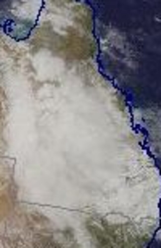
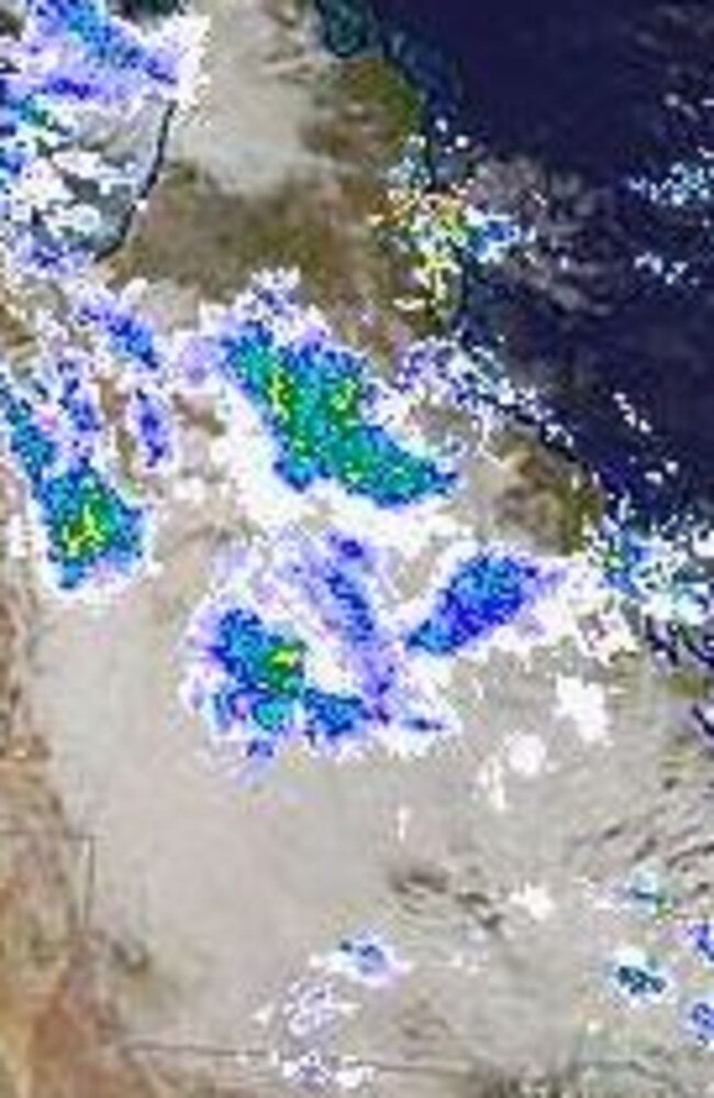
The focus into Wednesday will be on the northeast of the state, with a severe weather system yet to deliver huge forecast rainfall. SEE THE FLOOD WARNING MAP
QLD News
Don't miss out on the headlines from QLD News. Followed categories will be added to My News.
Queenslanders are yet to see the heaviest of the rainfall a severe weather system is expected to bring.
Weather bureau meteorologist Harry Clark said on Tuesday afternoon the focus over the next 24 hours would be in the northeast of the state, after 113mm fell in an hour at Mourilyan near Innisfail.
Residents south of Cairns, inland to Hughenden and south to Ayr could expect intense rain over the next day.
SCROLL DOWN FOR A MAP OF WHERE THE WORST OF THE FLOODING IS FORECAST TO HIT
Queensland is bracing for a potential 500mm deluge – with six-hourly falls of 200mm possible – and the Bureau of Meteorology issued a severe weather warning, flagging the possibility of life-threatening flooding in parts of the state.
Mr Clark said the weather system would contract eastwards overnight and southeast towards the central coast on Wednesday afternoon.
A coastal trough is expected to deepen into Wednesday morning.
“That will really determine where the heaviest falls occur, pretty much right with that coastal trough,” Mr Clark said.
The heaviest rain on Thursday is expected to be around the Wide Bay and Capricorn regions.
“There’s still a fair bit of uncertainty with that, at this stage,” Mr Clark said.
He said although it hadn’t yet rained heavily in local areas, there was widespread rain across about two-thirds of the state, right down to the St George region, and catchments would begin responding.
Several flood warnings were issued on Tuesday afternoon for rivers and creeks across north Queensland, while a flood watch is in place for a large part of north and central Queensland.
“In southeast Queensland, we’ve had fairly consistent showers now for a few days and the soil is getting quite wet,” Mr Clark said.
“While we’re not expecting the same magnitude of rainfall as further north, certainly moderate totals still have the potential for small creeks and rivers to respond fairly quickly.
“We’re not expecting widespread flooding, but we certainly could see localised flooding over the next few days.”
It follows the dramatic rescue of a man from floodwaters in the state’s northwest late on Monday night.
Emergency services were called to the Mount Isa Rugby Union Club – which is bordered by the swollen Leichhardt River – on Alma St just before 11pm on Monday, to reports from a passer-by of a man in the water.
Two police officers were the first on scene, jumping into the river to rescue the man aged in his twenties.
One of the officers was able to get the man to safety but the other became stranded himself.
A swiftwater rescue team was dispatched and brought the second officer to dry land.
It is understood that both officers were not injured but the man they rescued was taken to Mount Isa Hospital just before midnight to be treated for hypothermia.
It remains unclear how the man initially became stuck in the water.
The Bureau of Meteorology updated its weather warnings for parts of central and north Queensland at 11am on Tuesday.
The bureau issued a severe thunderstorm warning for intense rainfall around Queensland’s interior and north east tropics.
It advised six-hourly rainfall totals of up to 100mm were likely, and could lead to flash flooding, over parts of the Central West, Northern Goldfields and Upper Flinders, and Central Highlands and Coalfields.
Locally intense rainfall which may lead to dangerous and life-threatening flash flooding is also possible with thunderstorms over the northern Central West, and southeastern Northern Goldfields and Upper flinders for the remainder of the day, where six-hourly rainfall totals up to 150mm are possible.
The bureau also warned heavy rainfall which may lead to flash flooding was forecast to develop over parts of the North Tropical Coast, Herbert and Lower Burdekin, and Central Coast districts later today.
“Six-hourly rainfall totals between 100 to 150mm are likely, reaching up to 200mm about the northeast tropical coast,” the warning stated.
“Locally intense rainfall which may lead to dangerous and life-threatening flash flooding is also possible with thunderstorms in parts of the North Tropical Coast and Herbert and Lower Burdekin district, with six-hourly totals in excess of 200mm possible.”
Flood Warnings and a Flood Watch are current for catchments across much of tropical and inland Queensland.
Locations which may be affected include Clermont, Charters Towers, Townsville, Georgetown, Palm Island, Barcaldine, Moranbah, Hughenden, Richmond, Collinsville, Ingham and Innisfail.
Widespread rainfall to 9am with the state's highest of 114mm at #Topaz. Thunderstorms added to totals in the western districts. Increasing rain and thunderstorms today with warnings current for heavy rainfall and flooding. Updated warnings https://t.co/FBmpsInT9opic.twitter.com/KRQKPVlf3e
— Bureau of Meteorology, Queensland (@BOM_Qld) May 9, 2022
The warning came after 102mm fell at Garradunga Alert in one hour before 10am.
More than 150mm has fallen at Carisbrooke Station, southwest of Winton, and 114mm has fallen at Kirby, with 72mm of that in the three hours to 11.45 last night.
It says there is the possibility of life-threatening flash flooding in some areas.
The South East corner has not missed out, with areas on the Sunshine Coast copping a drenching in the past day.
Rainfall totals show 200mm fell at Coolum West in the past 24 hours, with 160mm at Doonan Creek, 159mm at Yandina Creek, 142mm at Coolum and 133mm at Sunshine Coast airport.
Forecasts for the area show Brisbane could be hit with a combined 195mm between Tuesday and Friday, the Gold Coast 140mm and the Sunshine Coast 270mm.
Premier Annastacia Palaszczuk has warned Queenslanders to expect “significant rainfall” over the coming week with almost all of the state affected.
“We know these events can develop quickly,” she said.
“There is potential for intense rainfall over the next few days.”
She urged people to visit the get ready Queensland website and monitor updates.
“Most importantly, if it’s flooded, forget it,” Ms Palaszczuk said.
The Premier said some locations were forecast to receive their highest May rainfall on record this week.
Daily rainfall totals of up to 250mm are expected from Tuesday across parts of North and Central Queensland, which will cop the worst of a severe weather system.
Sky News Weather chief meteorologist Tom Saunders said the peak of the weather event would be from Tuesday to Thursday and had the potential to bring 300-500mm for some places over a few days.
A coastal trough and inland trough have formed, and cold air moving from the west has begun to interact with humid air being drawn in from the Coral Sea.
“We will have widespread heavy rain through the central inland parts of Queensland, some heavy rain in the northwest and north coast, but also a risk of some heavy falls through the southern part of the state, including the South East,” he said.
More than 130mm fell at the Sunshine Coast Airport from midnight to noon on Monday.
The weather bureau issued an initial flood watch for western and Central Queensland, and the central and north tropical Queensland coast.
Moderate to major flooding could be likely across many catchments.
QUEENSLAND 24-HOUR RAINFALL TOTALS
Coolum West – 200 millimetres
Doonan Creek – 160 millimetres
Yandina Creek – 159 millimetres
Coolum – 142 millimetres
Noosaville – 134 millimetres
Sunshine Coast airport – 133 millimetres
Upper Doonan – 124 millimetres
Stoney Wharf Road – 119 millimetres
Cardwell Gap – 117 millimetres
Cardwell Range – 116 millimetres
Picnic Point – 105 millimetres
Bulgun Creek – 101 millimetres
Tewantin – 94 millimetres
Dunethin Rock – 89 millimetres
Maroochydore Depot – 83 millimetres
Sings Farm – 83 millimetres
Bli Bli – 81 millimetres
Eumundi – 74 millimetres
Nerada – 74 millimetres
Allingham Forrest Drive – 73 millimetres
Tully – 73 millimetres
Ball lookout 72 millimetres
Ingham Pump Station – 72 millimetres
Gairloch – 72 millimetres
Lucinda Post Office – 70 millimetres
Join the conversation

I love my TV – but we lose our minds when this happens
We all love our TVs but this is the worst thing that can happen to you.
Read more

Man fighting for life after crash north of Brisbane
A man has suffered serious injuries after he was left trapped in a vehicle following a crash north of Brisbane on Monday.
Read more