Why move for $350m Mackay Port Access Road is devastating for Mackay Touch Football
Pending works for Stage 2 of the Ring Road connecting the harbour to the Bruce Highway has delivered a blow for a growing Mackay sport. Find out what’s happening.
A move signalling the $350m Mackay Port Access Road is powering ahead as a “done deal” has been described as “devastating” for a growing sport.
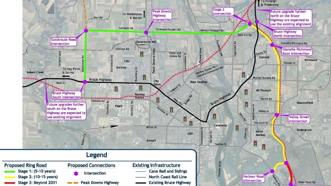
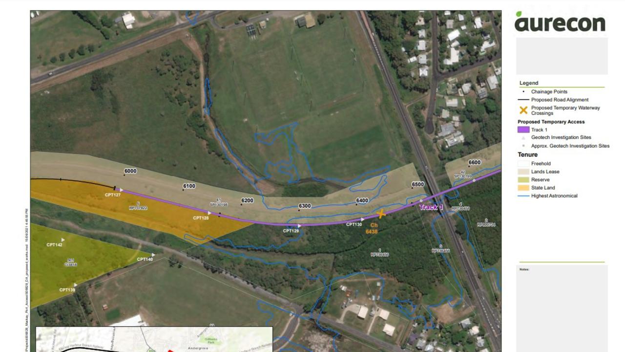
Aurecon has applied on behalf of the Department of Transport and Main Roads to complete three months of geotechnical works for Stage 2 of the Ring Road connecting the Bruce Highway to Harbour Road.
Forecast to enable the Mackay Port to diversify its exports, the road plans are more than four decades in the making with the first feasibility study for the major corridor road done in 1977.
Documents submitted to Mackay Regional Council in November state the current preliminary design is for a two-lane 9.5km roadway from Valley St in the west to Harbour Rd in the east.

Running parallel to the existing Erakala-Mackay Harbour railway line, its trajectory cuts straight through three of Mackay Touch Association’s playing fields near Norris Rd, as well as the neighbouring PCYC block.
MTA president Jason Miller said they had tried appealing to local, state and federal representatives for help but the pending geotechnical works signified the road’s location was a “done deal”.

“We’re trying to obviously join up with PCYC and trying to do what we can with council to develop the fields and continue to grow the sport but it’s pretty devastating the fact that a road is going to come through and take them out,” Mr Miller said.
He said with little consultation from the DTMR, it was incredibly difficult to plan ahead and felt many residents in the surrounding areas could also be ill-informed.
“(The road’s) been in the pipeworks for (decades) but it’s always been a fact that it’s not viable and the rest of it,” Mr Miller said.
“Obviously Covid-19 and the economy needed a bit of a pick-up.”
The Port Access Rd will introduce a new T-intersection at Glenella Richmond Rd as well as a new two-lane rural highway running under the overpasses at Glenella-Richmond Rd, Pioneer St and Mackay-Bucasia Rd, Norris Rd and Glenpark St.

Construction on the road is expected to start in 2026 but DTMR must first complete extensive geotechnical investigations, including in tidal areas, to “inform the design process”.
Investigations require building 2553sq m of 10x3m wide temporary access tracks, four temporary water crossings and a possible 603sq m contingency track.
This will allow a truck-mounted drill rig to extract soil samples at a depth of 3m at 150m intervals across North Mackay, Andergrove, and Mackay Harbour.
Documents state the investigation would cause environmental impact on almost 6500sq m of marine plants including the trimming of dense mangrove vegetation to near ground level and the removal and replanting of salt couch.

Temporary waterway crossings with pipes and culverts would be built to allow movement of fish including the exotic fish species that had spread since 2013 such as tilapia, platy, guppy and mosquito fish.
An endangered water mouse was detected in the works area but was not expected to be significantly impacted.
The application states there would be milestones for up to five years after the investigation to “prevent further degradation of the marine environment” including a marine plant rehabilitation and monitoring plan.
Aurecon stated the DTMR would endeavour to complete its investigation outside of the wet season to minimise risk of erosion and impacts to fish movement.


