
Mackay Isaac Whitsundays suburbs most at risk over rising sea level threat
Hundreds of homes and businesses on 90 Mackay streets could be at risk as new flood maps predict a dire future for coastal properties from Bowen to Clairview. But Mackay’s Mayor says the data is alarmist and flawed.

Property
Don't miss out on the headlines from Property. Followed categories will be added to My News.
Hundreds of homes, businesses and community facilities across Mackay could be washed away as new flood maps predict a dire future for the city centre.
Interactive mapping from Coastal Risk Australia has revealed the damage extent for the sugar city, projected by 2100 through rising sea levels.
East Mackay would be swallowed by the increased sea levels predicted to decimate hundreds of homes, as well as businesses and much of the sporting precinct including BB Print Stadium, Harrup Park ovals, Mackay and Whitsunday Helicopters and parts of the airport grounds.
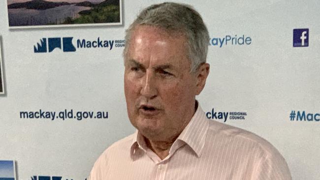
But Mackay Regional Council Mayor Greg Williamson said residents should not be alarmed by what he labelled misleading mapping.
“Council is the lead agency on flood risk in our local government area and has the most up-to-date flood information,’’ Mr Williamson said.
A Reserve Bank of Australia report stated coastal areas such as Mackay exposed to extreme weather could face a drop in house prices to offset the risk of climate change.
The RBA analysed how global warming would affect property prices.
“One potentially large exposure from climate change is mortgages, which account for approximately two-thirds of Australian major banks’ portfolios,” the report stated.
“If current values do not fully reflect the longer-term risks of climate change, housing prices could decline.”
The report stated there was little evidence of climate change “being fully priced into at-risk properties”.
“As a result, the price of properties considered to be at ‘high risk’ of being affected by climate events could decline sharply and banks could experience significant credit losses if borrowers default,” it stated.
The Mackay south, east and city suburbs are predicted to be hardest hit with more than 90 streets predicted to be under high tide after it has increased by 0.84m.
Residents affected:
East Mackay – 3564
South Mackay – 6706
Mackay – 3659
Community and sporting facilities and clubs in the area that could be washed away include Eastern Swans AFL Club, Abbott Park, Mackay Tiger Moth Museum and Mackay Aero Club, Mackay Historical Society and Museum, Mackay Basketball and most of Queens Park.
Victoria Park State School and Goodstart Early Learning Mackay will also be lost and East Mackay’s industrial precinct is expected to be largely underwater by 2100.
Residents affected:
Beaconsfield – 5490
Slade Point – 3349
One of Beaconsfield’s newest housing estates could be mostly under water in fewer than 100 years.
Most of Miraflores Estate is projected to be under high tide by 2100 including Bellavista Cct, Hermosa Cct and parts of Primavera Bvd.
Mackay Christian College, Mackay Lions Soccer Club and fields, Theo Hanson Softball Oval and the Rugby Union field also will be impacted northside.
Pockets of Slade Point will be under water including Seagull St, Swan St and Swan St Park, Sandpiper St, Tern St, Slade Point Rd, Pheasant St, Swallow St Park and a number of homes along Slade Esplanade. Parts of Slade Point School also will be impacted.
Further north the beachside township of Midgeton will almost be swallowed by the higher sea levels with Jackson St, Burton St, Park Dr, Peters Ave, Camm St, Repulse Dr, McLeod St and the beach end of Bundesen Ave predicted to be under water.
In 2021 two small Whitsunday coastal communities were chosen as case studies for climate change adaptation.
Wilson Beach will be used for an adaptation project, undertaken by Whitsunday Regional Council’s Climate Hub in partnership with Griffith University, which will explore possible impacts of sea level rise at the location.
The report estimated the cost of sea walls and road raising to protect the coastal areas sat at $270 million for Bowen and $30 million for Wilson Beach.
Residents affected:
Bowen – 10,377
A number of streets near the Bowen jetty will be heavily impacted by the projected rising sea levels with homes on Thomas St, Dalrymple St, George St, Williams St, Santa Barbara Pde, Brisbane St and Hay St expected to be submerged along with the PCYC Bowen and Port Denison Sailing Club.
Based on Coastal Risk Australia data, Wilson Beach township will be heavily under water at high tide in 2100, as will large pockets of rural and nature reserve land in the Conway region.
While in the Whitsunday Islands some of the tourism hot spots could be swallowed. Much of Daydream Islands resort is predicted to be under water as well as Hamilton Island Airport. The location where South Molle Islands resort once operated is also predicted to be swamped.
Over at Funnel Bay the Esplanade, park area and Langford Rd will be submerged, as will parts of Jubilee Pocket, Coconut Grove, nearby car park and market grounds.
Further south the coastal strip at Armstrong Beach rising sea levels are expected to wipe out many homes dotted along the shoreline, while parts of the BMA Hay Point Coal Terminal could also be impacted.
Pockets of rural and forest land at Carmila will also be under water and at Clairview Island most of the beach will be submerged.
Mr Williamson has labelled the Coastal Risk Australia’s sea level rise predictions as misleading and said residents should not be worried as the mapping was flawed.
“The mapping does have a nifty-looking slider for comparisons between now and 2100 for suburbs, but the information is alarmist and not accurate,’’ Mr Williamson said, adding the council had the most up-to-date flood information.
“Residents or prospective residents should be making use of our flood information, rather than relying on nationwide studies, such as the Coastal Risk Australia study.”
Mr Williamson said the council had included sea level rise in new development since the 1990s.
“The Mackay Region Planning Scheme currently includes a 0.8m sea level rise to 2100 and an increased rainfall intensity in flood studies to future proof new development,’’ Mr Williamson said, adding the council also considered worst case flooding in its studies.
Mr Williamson said some Coastal Risk Australia mapping referred to older topographical information that did not reflect the raised developable area and improved trunk drainage systems.
“The mapping also does not consider filling that has been undertaken for recent developments,” he said.
“New development needs to achieve minimum ground and floor levels to ensure it is above the future sea level rise predictions and expected flood events.”.
The Mackay Floodplain Management Study and Plan, which the council adopted in November last year, shows areas most at risk to flooding in Mackay.
Land in the older suburbs of Cremorne, South Mackay, North Mackay, Walkerston, and Bakers Creek are most at risk of flooding.
“This does not mean that the homes in these areas are going to flood as most habitable floor levels are above the more frequent flood levels,’’ said Mr Williamson.
“These areas are identified in flood studies and we have a property flood report that provides the ground levels and flood levels of lots so residents are able to be aware of the possible flood inundation at the property scale.”


Join the conversation

‘Environmentally delinquent’: Residents fight approved RV tourist park
A plan to transform a sleepy beach town in the Mackay region into a tourist destination for RVs and campers has been approved by council, but some residents have raised alarms.
Read more

Revealed: Shock rental finds driving property managers to quit
Stumbling on surprise adult toys to brushing against poo-smeared walls are among shock rental nightmares driving a third of property managers to quit.
Read more