
93km/h winds, large hail recorded as severe storm activity ramps up
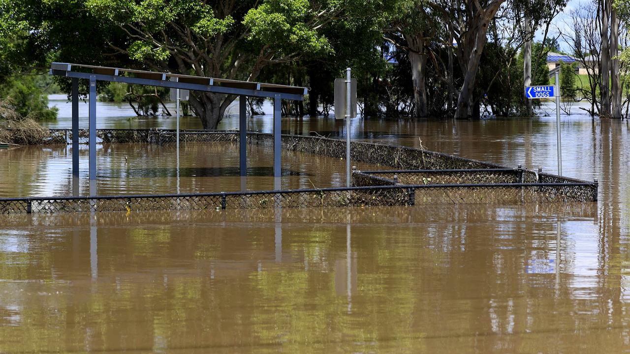
Severe storms have hit the South East tonight, with hail and strong winds recorded. The storms come as the area remains on flood watch due to the threat of another 150mm of rain falling over coming days.
QLD News
Don't miss out on the headlines from QLD News. Followed categories will be added to My News.
A new flood watch and severe thunderstorm warning have been issued for South East Queensland, threatening to disrupt the massive flood clean-up, while hundreds of Logan residents could be cut off for days despite floodwaters starting to recede.
The Bureau of Meteorology today warned of “very dangerous” thunderstorms including giant hail for Thursday into Friday.
Thunderstorm activity remains across a number of districts tonight, including in the Wide Bay and Burnett, Darling Downs and Granite Belt and Southeast Coast as well as the Gympie, Somerset, South Burnett, Toowoomba and Sunshine Coast forecast districts.
Late on Wednesday night the weather bureau said there was a severe storm moving towards Inglewood.
“A very moist and unstable airmass will interact with a strong upper trough to promote thunderstorm activity tonight and into Thursday morning,” BOM warned.
A 93 km/h wind gust was earlier in the evening recorded at Dalby Airport, while hailstones measuring up to 5cm in diameter were reported at Windera, north of Maleny.
Although Bureau of Meteorology forecaster Bradley Wood was unable to confirm the size of the hailstones, he said it was quite possible considering the severity of the thunderstorms in that area.
“Severe thunderstorms were forecast for most of that area,” Mr Wood said.
“I can’t confirm what size the hailstones were but it’s quite possible.”
Mr Wood said the current conditions are likely to continue tonight and across the next 24-36 hours.
Earlier BOM said: “A moderately unstable air mass over South East Queensland combined with strong winds in the upper atmosphere and the approach of an upper level trough from the west will lead to increasing chances of severe thunderstorms. Initially, large hail and damaging winds will be the main potential hazards, but heavy rainfall will become more likely with clusters or bands of storms later tonight.”
About 2pm, an amber flood alert was declared for South East Queensland due to the weather system and the potential for rainfall up to 80mm. High intensity rainfall associated with any thunderstorms could result in isolated totals greater than 150mm.
SCROLL DOWN FOR LIST OF CATCHMENTS IN FLOOD ALERT
More than 18,000 Energex customers were without power in South East Queensland as of 7.30pm on Wednesday, including over 12,000 in Brisbane.
This is down nearly 50 per cent of the outages reported on Tuesday night, where almost 35,000 were without power.
More than 3,500 customers are also without power in Ipswich City, with the suburb of Goodna making up 1138 of those.
Gympie also continues to report significant improvements on yesterday’s numbers, having had over 1600 properties without power at one stage on Tuesday afternoon. That number has now been redued to 219 customers without power.
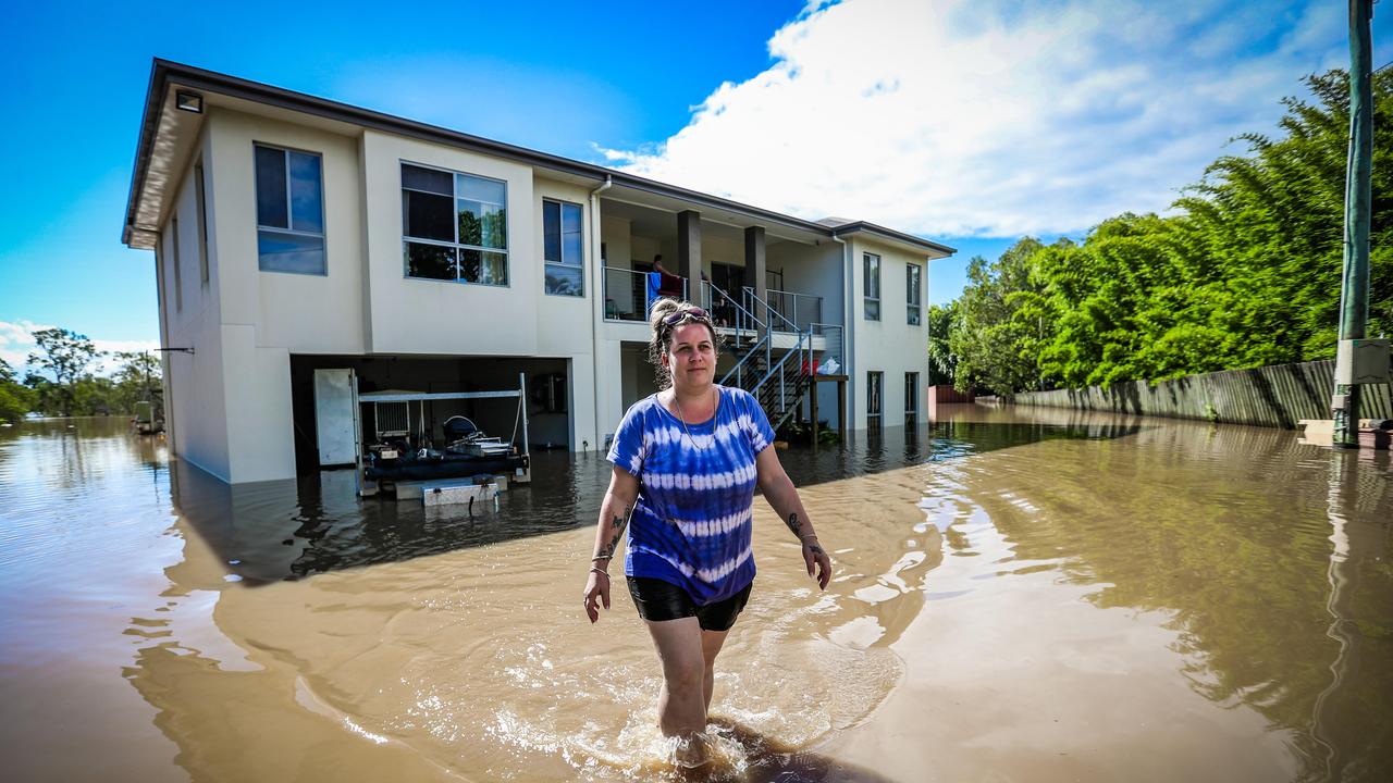
Recovery works are continuing in Gympie where 2000 homes were impacted by flooding, with 160 sustaining major damage, while about 60 homes have been inundated in Logan despite dire early predictions of a one-in-200-year flood.
About 200 homes have been affected by the flooding.
âš ï¸ #Flood Watch has been issued for #SEQ catchments for the risk of renewed rises from heavy rainfall associated with #storms. Catchments remain very wet and river levels remain high. Follow the advice of local emergency services @QldFES. See https://t.co/KcyfFyegu0 for updates. pic.twitter.com/DvUwcFepqx
— Bureau of Meteorology, Queensland (@BOM_Qld) March 2, 2022
Premier Annastacia Palaszczuk, speaking in Gympie, said there was a low probability of isolated, “very dangerous” thunderstorms on Thursday afternoon and evening in the southeast.
“There is some concern about these very dangerous thunderstorms,” she said.
“We’re not out of the woods.”
Brisbane River peaked at 2.49m overnight.
There are 379 people currently in evacuation centres while all schools – except 81 – are open.
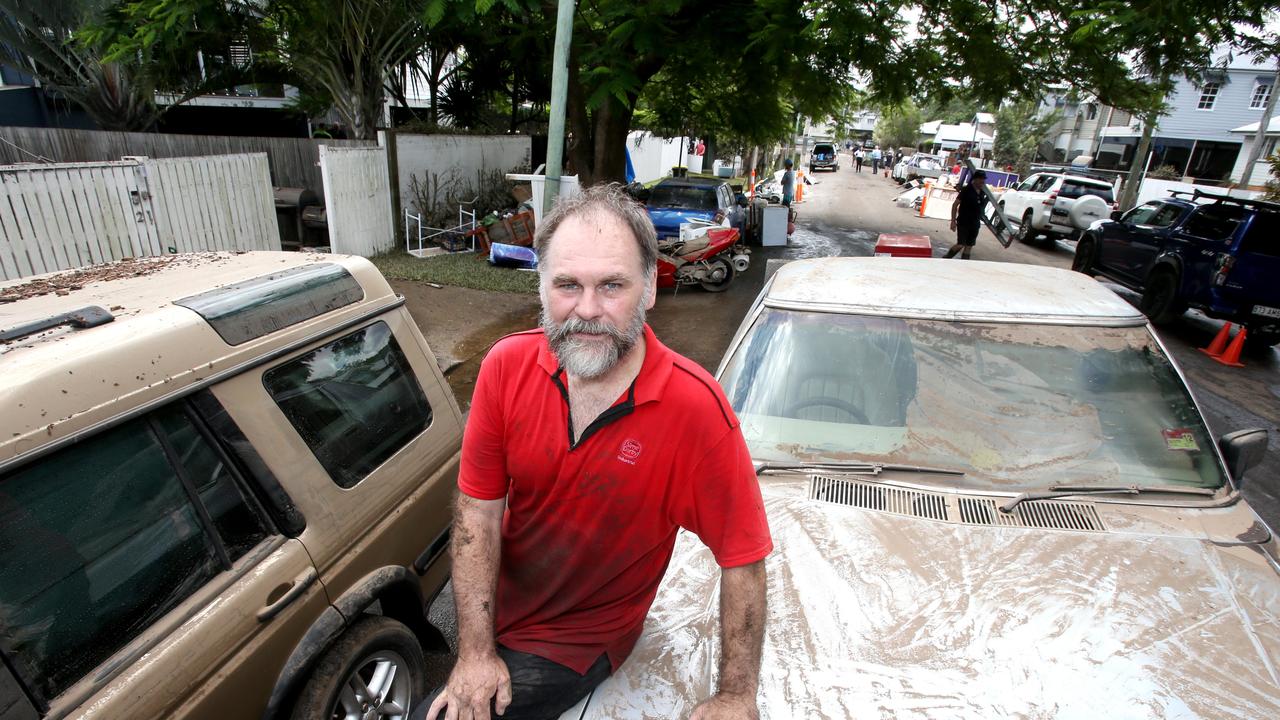
It comes as the clean-up continues across Brisbane, Ipswich and Logan and the death toll for the ongoing flood disaster rose to nine, with another man still missing.
Meanwhile the Premier said she and Deputy Premier Steven Miles had discussed whether displaced residents impacted by the floods could stay at the state government’s Wellcamp quarantine facility.
“I think it would be difficult for families … but Wellcamp is there,” she said.
“It is there to be used.
“I understand some families are utilising it at the moment.
“If there are people who are single or couples and their homes have been completely devastated, that is an option for them.”
The Premier said there was “some spare capacity” at Wellcamp at the moment.
BUREAU WARNS OF STORMS, INTENSE RAINFALL
The Bureau of Meteorology says there is the possibility of intense rainfall that could again lead to flash flooding and renewed river rises over the next three days. There is also a chance of large hail and destructive winds.
The Bureau said showers would begin to fall on parts of the southeast tonight as the new system makes its way over the state’s coastal regions.
However, rainfall predictions have increased since Wednesday morning, with up to 25mm now forecast to fall in Brisbane on Thursday and a further 40mm on Friday.
Meteorologist James Thompson said storms were forecast to hit the Darling Downs and Granite Belt regions first, with the possibility for rainfall to continue into tomorrow.
“Storms are likely to impact the southeast Thursday into Friday,” Mr Thompson said.
“There’s a chance that we’ll see storms this evening, and pretty good chance tomorrow as well, whether it be leftovers from the day before or severe storms through the southeast tomorrow afternoon and evening.
â›ˆï¸ Severe #storms likely across #SEQ on Thursday across flooded areas. Heavy to intense rainfall, large to giant hail and damaging to destructive wind gusts are possible. Flash flooding and renewed river rises possible with any heavy rain. Latest: https://t.co/CK1YVbwoZp. pic.twitter.com/dW8hqNnE6l
— Bureau of Meteorology, Queensland (@BOM_Qld) March 2, 2022
“Storms could bring a short period of heavy rainfall and damaging wind gusts but we will release further warnings if that happens.”
The new weather system is not as slow moving as the last, meaning rainfall conditions should be lighter compared to the recent flood event.
Humidity will also play a key role over the next few days, as summer storm conditions return.
“We’re going to be fairly warm today, 32C in the city,” Mr Thompson said.
“Tomorrow it could be cooler but it is going to be very humid and that will stick around until next week.”
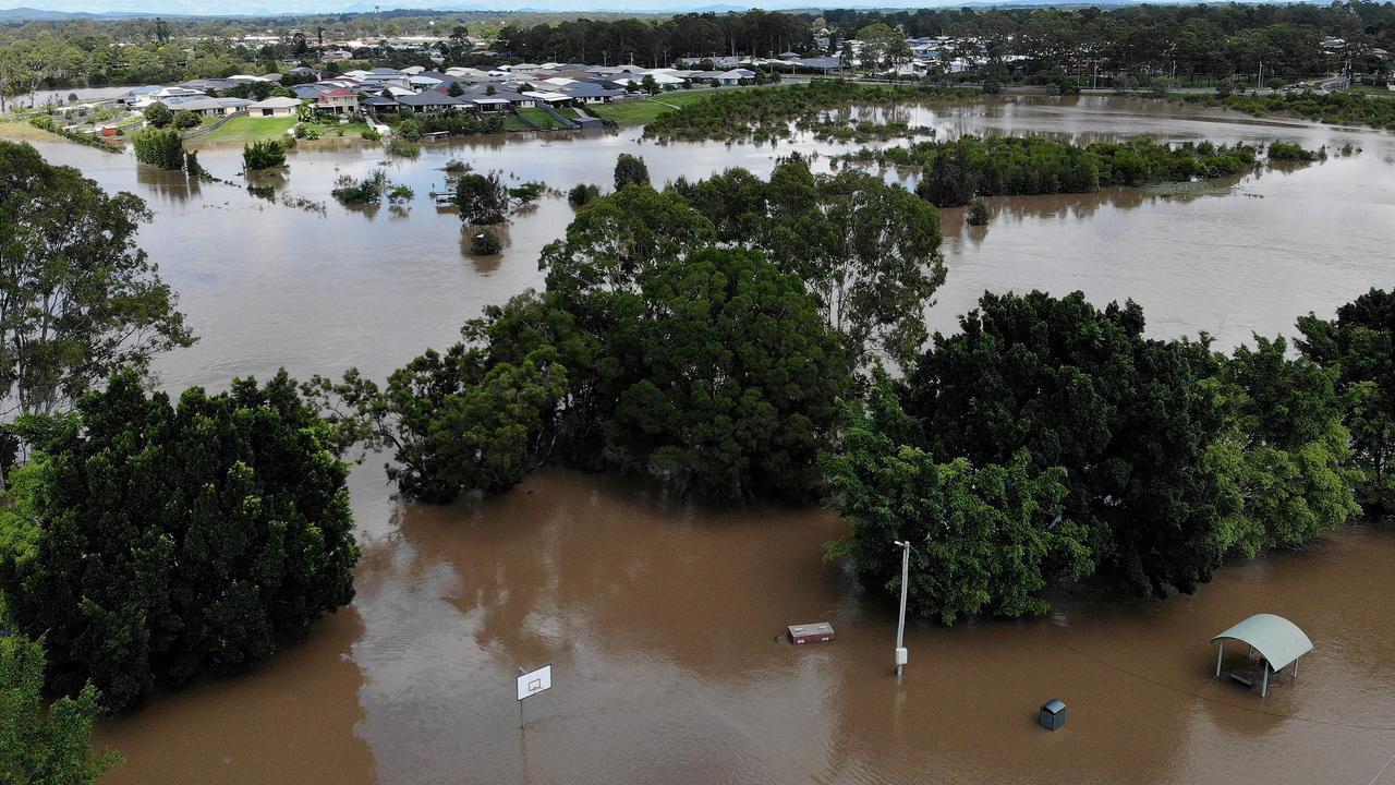
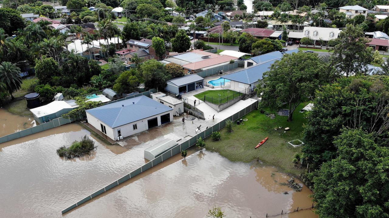
HOMES FLOOD, EVACUATIONS AS LOGAN FLOOD LEVELS PEAK
Hundreds of Logan residents face the prospect of being cut off for days as monster flood levels start to slowly recede.
Despite dire early predictions of a one-in-200-year flood, only about 60 homes in the region have reportedly been inundated with water, but about 200 properties have been affected by the flooding.
Hundreds of other properties which have not sustained any damage have been cut off with some roads around Bethania, Logan and Waterford still sitting under metres of water.
State Emergency Service boats have spent the day ferrying supplies including staples such as bread and milk to isolated properties.
At its height on Tuesday, water levels exceeded the 2017 floods by 60cm, but fell two metres short of the infamous 1974 floods.
Flooding damaged about 60 homes, but that figure is much lower than the 2017 number as the council has bought back dozens of properties in flood-prone areas.
About 25 people are sheltering in the city’s evacuation centre. Logan Mayor Darren Power said a “huge clean-up” would be required.
“It’s a huge job,” he said.
“We have 200 roads underwater.
“But it certainly could have been worse if the rain didn’t stop when it did on Sunday.
“Otherwise it would have been about a one-in-200-year flood instead of a one-in-50.”
Mayor Power said he had spoken to many of the people at the evacuation
centre who were struggling.
“A lot of them don’t have insurance, so this will really knock them around.
“We’re working with the department of housing to try and get them taken care of.”
Almost 30,000 Enegrex customers were still without power this morning.
FLOOD DEATH TOLL RISES TO NINE
Nine people have now lost their lives in this disaster, after police found the body of a 76-year-old man who had been missing in floodwaters.
The man, who reportedly went missing on the Brisbane Valley Highway on Sunday evening, was found by police divers early Tuesday morning.
He was located inside his submerged vehicle in floodwaters in Paddy Gully Creek.
Grave fears are still held for a man in his 70s who is believed to have fallen from a yacht into the Brisbane River at Bulimba on Saturday afternoon.
Logan Mayor Darren Power said 19 properties had been inundated and many more had been isolated.
Cr Power said 4000 properties could expect to be without electricity for days, worse than in 2017.
To add to people’s woes, more than 200 roads were closed across Logan creating traffic chaos especially in Beenleigh which was cut off by flooding on three sides.
The township, which is surrounded by the Albert and Logan rivers, was in gridlock throughout the day with peak-hour traffic from Brisbane banking up to the northern M1 turn-off.
Cr Power said the city had been expecting massive flooding on Sunday night with predictions for a one-in-200-year flood.
But he said less-than-predicted rainfall on Sunday night brought the statistics down to a one-in-50-year flood.
“It’s still bad but nowhere near as bad as what we thought it was going to be,” he said.
The council opened up an evacuation centre at Crestmead with 19 people from Maclean and Munruben staying overnight.
NEW FLOOD WATCH FOR SOUTH EAST QUEENSLAND
An amber flood watch has been declared for South East Queensland due to the threat of severe thunderstorms and heavy rainfall from Thursday.
A trough will move across the southeast during Thursday and early on Friday and may linger into the weekend, maintaining unstable conditions.
This will result in thunderstorms developing and bring further rainfall from Wednesday evening into Thursday, with further rainfall possible into the weekend.
Widespread rainfall totals of 20-80mm are possible across the flood watch area. High intensity rainfall associated with any thunderstorms could result in isolated totals greater than 150mm.
Catchments remain very wet following rainfall over the last week and creek and river levels remain high with flood warnings continuing for most of the flood watch area.
Higher than normal tides are currently being observed but will decrease over the next few days.
Renewed rises are possible across the flood watch area and areas of minor to major flooding may redevelop, however, peak levels are expected to be below those observed over recent days. There is a risk for localised flash flooding with heavy rainfall as catchments remain saturated.
Catchments likely to be affected include:
Burnett River (Barambah, Barker and Boonara Creeks)
Burrum and Cherwell Rivers
Mary River
Noosa River
Sunshine Coast Rivers and Creeks
Pine and Caboolture Rivers
Upper Brisbane River
Lower Brisbane River
Logan and Albert Rivers
Gold Coast Rivers and Creeks
Condamine Rivers (Upper Condamine and tributaries)
Macintyre River
Weir River
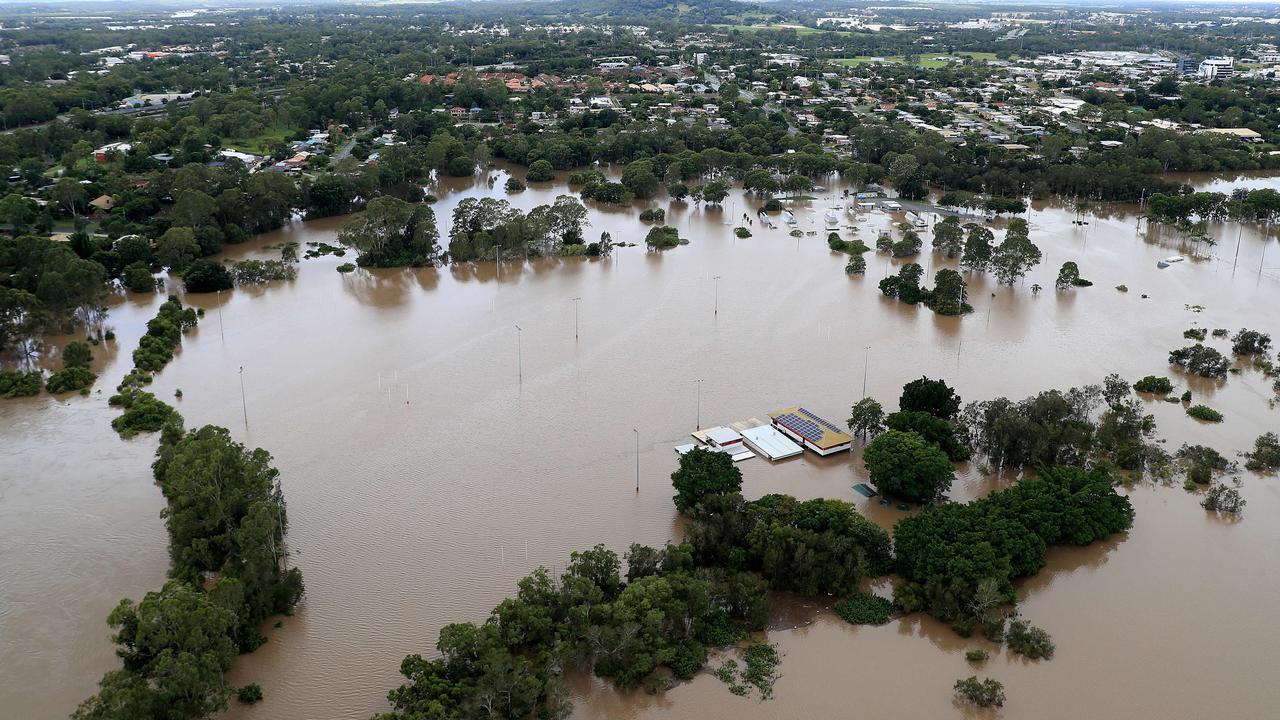
GYMPIE RECOVERY ONGOING AFTER RECORD FLOODS
Two thousand homes in Gympie have been impacted by Queensland’s recent weather event while 160 homes have sustained major damage.
Energy Minister Mick de Brenni, who is visiting Gympie with Ms Palaszczuk, said 140,000 properties across the southeast lost power at some point amid the floods.
This peaked at 57,000 homes at one point.
Mr de Brenni said electricity at 6000 Gympie properties had been affected however this was now down to 600.
WOMAN TRAPPED IN FLOODWATERS AT JIMBOOMBA
Authorities were forced to conduct a rescue of a woman trapped in floodwaters at Jimboomba early this morning.
The woman, who was reportedly out looking at flooding, got stuck in neck-high water but was able to phone for help.
The 40-year-old was believed to be travelling on a scooter before becoming trapped.
Queensland Fire and Emergency Services found the woman clinging to a street sign in neck deep flood waters near Cusack Lane and Henderson Rd in Jimboomba about 2.30am on Wednesday.
A swift water rescue team was able to bring her back to land where paramedics were waiting to assess her.
The woman was uninjured and did not require hospital transport.
SCHOOLS REOPEN, TRAFFIC CHAOS, TRAINS STILL SUSPENDED
Across the southeast, schools will reopen today, but 144 will remain closed, while multiple road closures will continue to cause chaos, with train services still suspended. Flooding is expected to continue for days across the South East as the weather bureau forecast more rain to fall in the region at the end of the week.
The Brisbane River peaked at 3.35m on Tuesday morning, with the weather bureau warning of minor to moderate peaks on the high tides on Wednesday.
Seqwater bosses said they were not concerned about rain later this week and plan to continue releasing water from Wivenhoe Dam until Monday.
More than 30,000 properties were without power yesterday as the clean up began.
Premier Annastacia Palaszczuk said conditions were easing in Ipswich after the city experienced a peak of 16.7m.

She said there were over 30 suburbs across the southeast that were inundated by more than 1000mm of rain during the weather event.
This included Mitchelton, Bracken Ridge, Aspley, Everton Hills, Kippa Ring, Brighton, Alderley, and Deagon.
“That’s just to name a few, so I think that puts into context for everyone the sheer amount of rainfall that was right across that southeast of Queensland catchment area,” Ms Palaszczuk said.

WATER RESCUES CONTINUE AS DANGER REMAINS HIGH
QFES Commissioner Greg Leach said there had been 16 water rescues between Monday night and Tuesday, with 630 in total since the flooding event began.
Brisbane Lord Mayor Adrian Schrinner said he wouldn’t be surprised if the damage bill to the city was more than $100m.

Police warned of the ongoing dangers in the Brisbane River, with houseboats, pontoons and large debris continuing to move down the river.
Among the carnage was a CityCat which sunk in water off Addison Quays after it was struck by a houseboat and came loose from its mooring on Monday night.
Tug boats were also positioned to tow a 550-tonne barge back to it’s home near the City Botanic Gardens on Tuesday after it broke free on Monday and
floated towards Howard Smith Wharves, causing a mass evacuation.
The crane was part of the Kangaroo Point green bridge construction.

Cr Schrinner called on southeast residents to join the Mud Army 2.0 and said more than 2000 people had already signed up to the council website.
He said bus services were running on reduced services but would expand in coming days while ferry services would resume after terminals were checked by engineers.
Water will continue to be released from Wivenhoe Dam over the next seven days with the combined drinking water and flood compartment currently sitting at about 170 per cent.
INSURANCE CLAIMS CONTINUE TO RISE
Suncorp CEO Steve Johnston this morning said 13,000 claims had been recorded by the insurance giant.
“That is an extraordinary amount of claims,” he said.
The hardest-hit suburbs of Deagon, Boondall, Everton Park and Caboolture had the highest number of claims.
Mr Johnston said it would be a “challenging event” to work through but said assessors from interstate and New Zealand would be drafted to flood zones.
He said many homes would be repaired for a second time after devastating flooding in 2011 and stressed the importance of building more resilient residential and public infrastructure.
More Coverage


Part of my brain was surgically removed, now I’ve got my life back
Brisbane scientists have launched the world's largest epilepsy study, recruiting thousands of Australians to unlock new treatments for the quarter-million sufferers nationwide.
Read more

Vacant stores, no shoppers: Inside Myer Centre’s deserted reality
Brisbane's once bustling Myer Centre is deserted of shoppers and filled with vacant stores two years after the retail giant’s exit, despite promises of a $500m transformation. SEE THE VIDEO
Read more