
Will today bite as much as yesterday?
A severe weather warning is in place for the Southeast Coast of Queensland, with Rainbow Beach in the firing line.
Gympie
Don't miss out on the headlines from Gympie. Followed categories will be added to My News.
THURSDAY 7am
IF YOU heard yourself saying it was cold during the day yesterday - that's because your skin was feeling it.
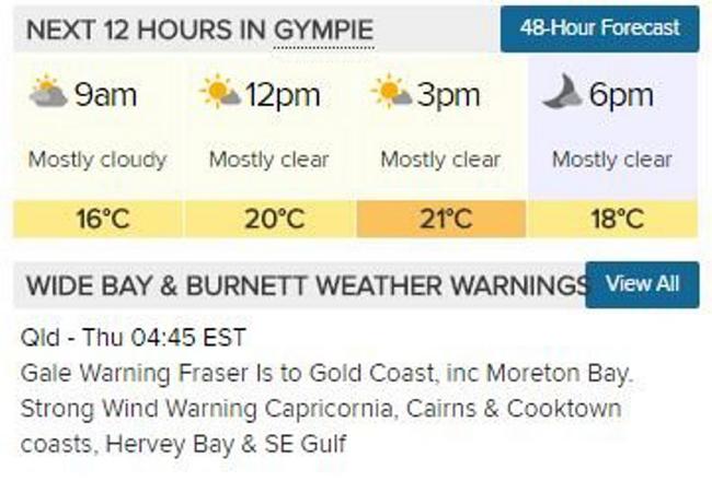
At 4pm yesterday afternoon Gympie was 14 degrees, but with strong winds stirring around the region it felt more like 8.6 degrees, Bureau of Meteorology forecaster Adam Blazak said.
The cool air mass over south east Queensland coupled with the wind chill factor, kept the temperatures down to almost 10 degrees below the Autumn average top temperatures yesterday, and then it felt another six degrees colder than that.
"It's a fairly big margin between what the thermometer suggests and what the skin is telling us, " Mr Blazak said.
While today's top of 21 degrees is a little more in line with this year's average, it will still feel more like 19 degrees, the meteorologist said with winds of 25 to 30kmh keeping us on our toes.
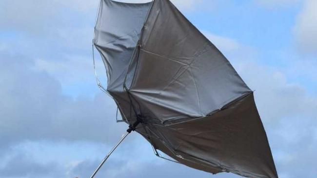
On the coast, winds of up to 60kmh are expected today harking a BOM gale warning between the Fraser Island Coast and Sunshine Coast today.
The BOM has advised that there will be very strong surf conditions which could be quite dangerous.
Local disaster coordinator Andrew Ryan said the powerful surf could be hazardous for coastal activities including boating, crossing coastal bars, and rock fishing.
"While we know many surfers have been waiting for big surf like this, these conditions really are only for very experienced surfers," he said.
"Some minor beach erosion is also possible due to higher-than-normal tide levels ... along the coast."
"Even when the winds die down, there will be quite a powerful swell remaining into the weekend," Mr Blazak said.
Mr Blazak said the forecast was the little last gasp of winter until mid next week, when the temperatures get back up in line with the average for this time of year.
WEDNESDAY: A severe weather warning is in place for the Southeast Coast of Queensland, with Rainbow Beach in the firing line where winds could reach up to 60kmh offshore and the ocean could swell to around 4m.
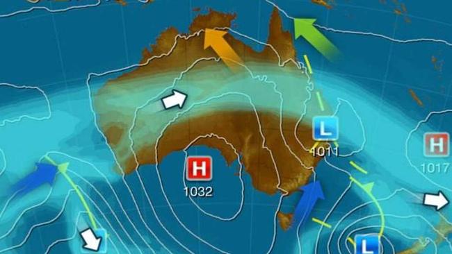
Thursday will bear the brunt of the rough weather after an east coast low expected to form off the New South Wales coast sends gale force winds sweeping up the Queensland coast, Bureau of Meteorology forecaster Adam Blazak said.
"We can expect the winds to increase quite markedly around coastal areas, certainly Rainbow Beach will feel the effects of the system on Thursday," Mr Blazak said.
"Wind strength could reach up to gale-force winds, so up to 60kmh winds on Thursday."
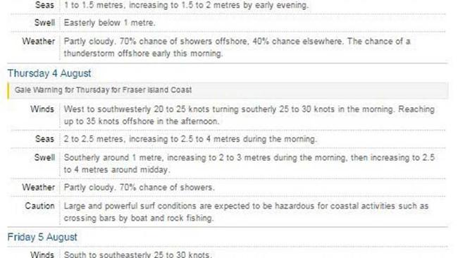
West to northwesterly Winds will build through out today reaching up to 25 knots offshore in the evening and bringing a possible 2m swell by nightfall.
By Thursday those strong winds are set to create powerful surf conditions, while another strong swell from the south is set to make ocean conditions even more dangerous heading into the weekend.
The Bureau of Meteorology is cautioning against coastal activities such as crossing bars by boat and rock fishing.
Windy conditions will not just be restricted to the coast though, with the region's hillier, wind-exposed areas in for a buffeting.

"If you are out on higher ground along the ridge tops, there will be very strong winds reasonably close to the surface," Mr Blazak said.
"If you get up on some of the hills, you are going to feel those stronger winds pushing through."
Mr Blazak said the winds may begin to subside as early as Friday as the system begins to weaken and move away from the coast.
"But having said that, it's still going to be a reasonably windy and rough weekend down on the water," he said.
"It does depend on what this system wants to do.
"In the worst case, it might hang around right though until Sunday afternoon."
Mr Blazak recommended anyone heading to the beach should check the forecast first.
"It would be difficult to say which day the conditions will subside, because we do have a secondary swell moving in from the south that complicates it," he said.
There is a 70% chance of rain today and tomorrow.
Forecast: Sandy Cape to Double Island Point
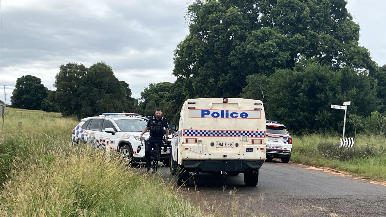
Named: Man at centre of gunshot allegations identified
The identity of a Kingaroy man whose alleged actions with a gun led to a major police response where officers swarmed a property and set up road spikes can be revealed.
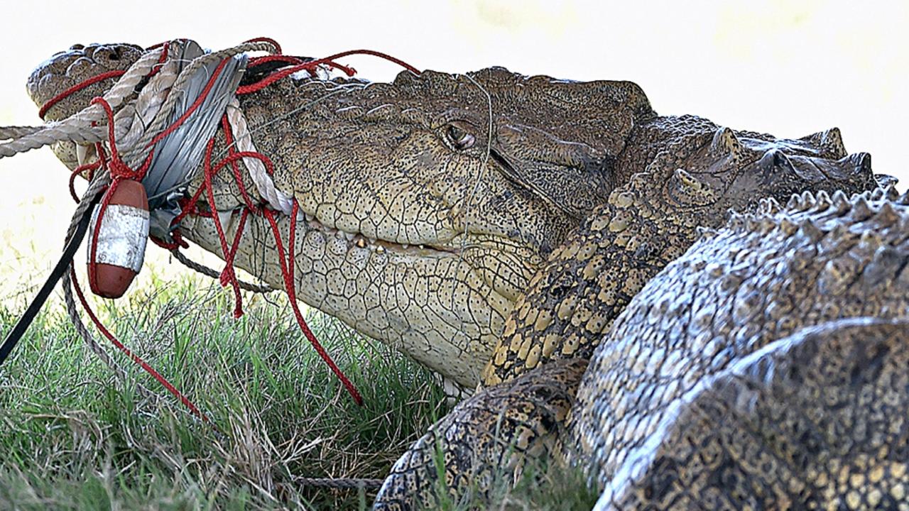
MAPPED: Every SEQ croc sighting as fisherman shares shock encounter
A fisherman who says he’s seen the “humanised” campground croc rangers are searching for has spoken out as an expert explains why the “vagrant” reptile’s future is likely bleak and the history of recent southern sightings is revealed.