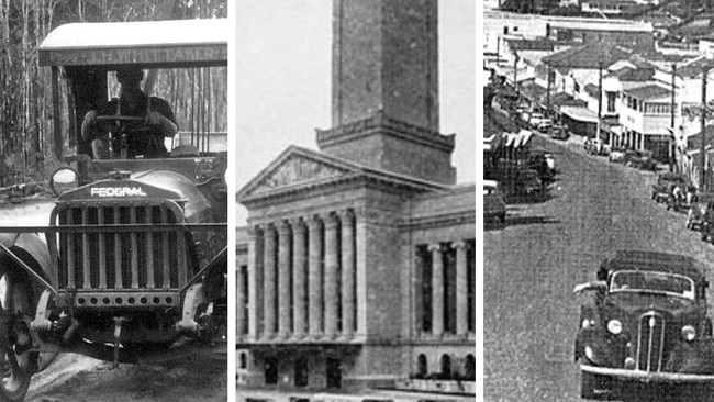
Museum reveals Bruce Highway from Maryborough Brisbane in 1920s
As the $1 billion Gympie Bypass closes in on a year until completion, a historian has revealed the very different route the Bruce Highway once took from Maryborough to Brisbane, and the months it took to make that journey.

Gympie
Don't miss out on the headlines from Gympie. Followed categories will be added to My News.
A museum on the Fraser Coast has triggered a flashback to 100 years ago after detailing the months-long journey from Maryborough to Brisbane.
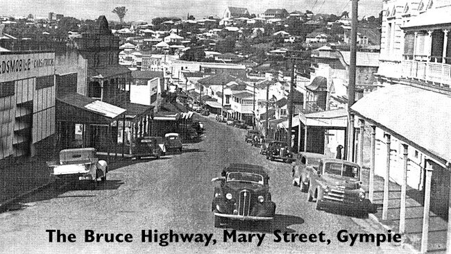
Historian John Anderson from Hervey Bay Historical Village and Museum wrote a detailed social media post depicting the significantly different, and long, route from Maryborough, through Mary Street in Gympie, down through the Mary Valley and on to Brisbane.
How 20km Bruce Hwy stretch has become the deadliest in Qld
Unfenced camping area on K’gari closed after dingo activity
“Today, it is a common occurrence to travel by car from Hervey Bay to Brisbane, spend hours in the city and return back to Hervey Bay on the same day,” Mr Anderson said.
“The early history of this area records the overland journey from the original Maryborough township to Brisbane, via Ipswich, was measured in months, not hours.”


The journey from Maryborough to Brisbane takes about three and half hours on sealed roads today, but it was a bush track in the 1920s.
Smaller settlements such as Bauple, Gootchie and Theebine were travel stops on the route and the highway cut directly through larger cities such as Gympie and Nambour, Mr Anderson said.

“Imagine if the highway traffic of today travelled down the narrow Mary Street, Gympie, up and down the many hills and a few railway level crossings,” he said.
“There were few trips to Brisbane even into the 1950s, when the highway would be closed by railway workers shutting the gates to allow the frequent goods and passenger trains to pass.”
The highway was once located further west, cutting through Kenilworth and Maleny to Landsborough. From the 1950s onwards, “much work was done to shorten the distance” by rerouting the stretch through Cooroy, Eumundi, Yandina and Nambour before reaching Landsborough.

What is now known as the Steve Irwin Way was formerly the highway heading south from Landsborough - Glass House Mountain settlements including Beerwah and Beerburrum were all stops along the way before Caboolture.
The road then continued to the coast at Redcliffe where one would have to drive across the Hornibrook Highway Toll Bridge to reach Sandgate and close in on the final destination.

The stretch was the longest toll bridge in Queensland at the time and cost sixpence, or five cents in Australian dollars.
“Brisbane, our state capital, was then a much different place,” Mr Anderson said.
“One of the highlights was a one shilling (10 cents) ride up a small lift to the top of the City Hall clock tower and look-out.

“That was the highest point in the city with views across to the Airport and Moreton Island.
“Our forebears would not believe that when the new Gympie Bypass is opened, there will be a double highway from the Curra/Gunalda area right down to Melbourne.”


