
Gympie flood forecast: BOM reveals likelihood of major flooding
After a freak flooding event claimed two lives and left one missing in January and a second flood watch warning this month, the weather bureau has given an outlook for Gympie going forward.

Gympie
Don't miss out on the headlines from Gympie. Followed categories will be added to My News.
The Bureau of Meteorology (BOM) has revealed the likelihood of the Gympie region receiving a major flood event, one month after the January floods caused widespread damage across the Wide Bay.
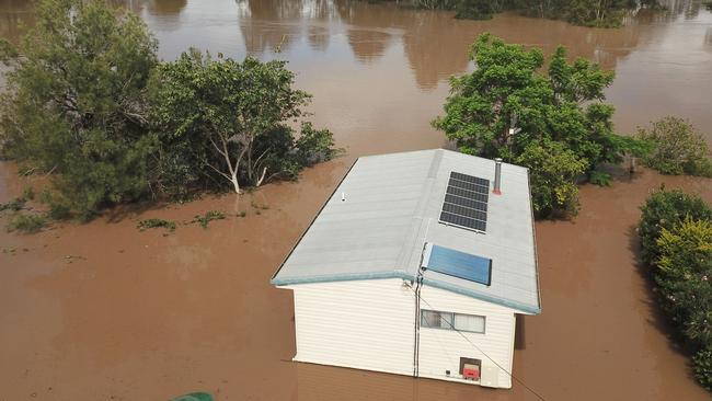
The Mary River in the Gympie region has been placed on flood watch twice since the start of the year, including during a torrential downpour from ex tropical cyclone Seth in January, which dumped more than 650mm of rain across the Wide Bay and Burnett regions.
The flooding, which made national headlines due to its stealthy appearance, claimed at least two lives and caused widespread damage to roads, businesses, and countless homes.
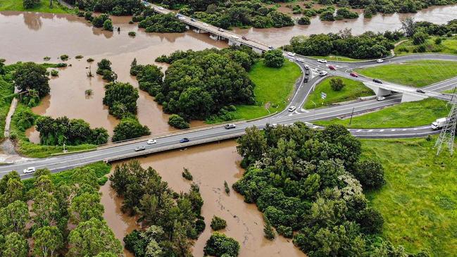
Gympie itself was spared and did not record major flooding despite its sister Mary River city of Maryborough being inundated.
According to the Bureau of Meteorology the region isn’t in for a repeat in the foreseeable future.
Meteorologist Helen Kirkup told the Gympie Times on Wednesday that while it was impossible to predict when the region would next flood, it was unlikely to happen any time soon due to climate driver La Nina expected to return to neutral by Autumn.
La Nina can cause increased rainfall and higher chances of tropical cyclones in Queensland, according to the BOM.
This is what caused ex tropical cyclone Seth and the intense flooding across the Wide Bay.
“How the system works is the La Nina in the Pacific Ocean just means the warmer water is in the right part of the ocean and it will be evaporated and dragged over Australia and so in general we do get more rainfall,” Ms Kirkup said.
“Obviously getting more rainfall means a particular catchment might get more rain, become saturated, and when they get a lot of rain it will flood.”
She also said the Gympie region was particularly at risk during these events, due to “fast responding” river catchments; meaning there was a short window to warn residents before flooding.
Ms Kirkup said La Nina, which was nearing its peak at the time of publishing, would convert to a neutral El Nino – the opposing climate driver which made for dry weather conditions and an increased chance of bushfires rather than floods.
El Nino and La Nina years can last between one and eight calendar years.
Prior to the January floods, the Gympie region had not flooded for almost a decade, after the flood waters reportedly peaked at 18.55 metres in 2013.


Relationships revealed in trio charged over Pheobe’s death
A surprising web involving alleged murder victim Pheobe Bishop’s inner circle has been revealed, with those charged in relation to her death reportedly linked by a complicated relationship.

Former mechanic bashes cops months after bashing 60yo
A man with a string of assaults on his record has been told to keep his hands to himself after punching and kicking Gympie police who were trying to arrest him.