
Flood emergency: Flood watch issued for Mary, Burnett Rivers
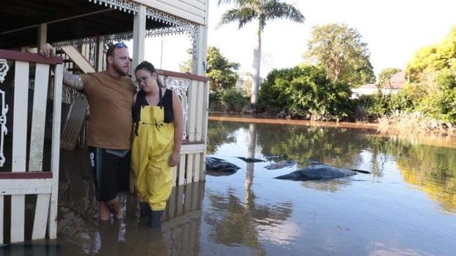
As the flood clean-up continued across Gympie and the Fraser Coast on Wednesday in stifling hot and humid conditions, the weather bureau warned the danger may not be over yet.


Gympie
Don't miss out on the headlines from Gympie. Followed categories will be added to My News.
Renewed river rises bringing minor to major flooding are possible across Gympie and the Fraser Coast over the next few days and localised flash flooding will be a risk with rain and storms predicted across the region.
A trough will move across the southeast during Thursday and early on Friday and may linger into the weekend, according to the Bureau of Meteorology.
This will maintain unstable conditions resulting in possibly severe thunderstorms and further rainfall from Wednesday evening into Thursday, with further rainfall possible into the weekend.
Widespread rainfall totals of 20-80mm are possible across the flood watch area, which includes the Mary River. High intensity rainfall associated with any thunderstorms could result in isolated totals greater than 150mm.
The Mary River catchment remains very wet following rainfall over the last week, and creek and river levels remain high with flood warnings continuing for most of the flood watch area. Higher than normal tides are currently being observed but will decrease over the next few days.

Renewed rises are possible across the Mary River catchment area and areas of minor to major flooding may redevelop, however, peak levels are expected to be below those observed over recent days. There is a risk for localised flash flooding with heavy rainfall as catchments remain saturated.
Catchments likely to be affected include the Burnett River, Burrum and Cherwell Rivers, Mary River, Noosa River and Sunshine Coast rivers and creeks.
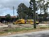
The Gympie and Fraser Coast flood clean-up continued on Wednesday in stifling hot and humid conditions, and under the threat of rain and river rises.
As the temperature headed for 33C, storms and showers were predicted across the Gympie region on Wednesday evening, with a 90-95 per cent chance of up to 25mm of rain on Thursday in Gympie and Maryborough, and possibly 80mm over the next few days.
Both cities have a very high chance of showers on Thursday, and the chance of a thunderstorm, “possibly severe with damaging winds and heavy falls” in the afternoon and evening
A good shower of rain would help the flood clean-up and rid both cities of their rancid flood smell.
But the threat of more flooding in an already saturated river catchment could be devastating.
“Rainfall has since eased and flood levels are generally falling,” the BoM said.
“Thunderstorm activity is forecast to develop from late Wednesday with further rainfall forecast during Thursday. This may cause renewed river and creek level rises and continued flooding in some parts of the catchment. The situation will be monitored closely.”
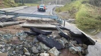
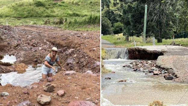
As the Mary River continued to drop on Wednesday, Kidd Bridge reopened to the Southside and the water fell below Bells Bridge on the Wide Bay Highway, revealing massive flood damage.
The Bureau of Meteorology has forecast a trough developing over southern inland Queensland and northern inland NSW on Wednesday, leading to showers and storms - some likely to be severe.
More Coverage


New details emerge after target shooting shuts down Bruce Hwy
Police are investigating after a near-two hour shutdown of the Bruce Highway following reports of gunfire.

‘Can’t be ignored’: Push for clarity on e-scooters amid rise in crashes
Qld’s Attorney General is calling for clarity around the use of e-scooters across the state amid a rising number of crashes involving the devices, including a tragic fatality.