
‘Atmospheric river’ behind Wide Bay’s wall of water
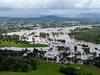
A weather expert has explained the rare weather phenomenon behind the wall of water that hit the region last week, causing the catastrophic flooding that inundated Gympie and the Fraser Coast.

Fraser Coast
Don't miss out on the headlines from Fraser Coast. Followed categories will be added to My News.
A weather phenomenon known as an “atmospheric river” appears to have caused the catastrophic wall of water that has devastated communities across the Wide Bay.
Meteorologist and civil engineer Dr Adrian McCallum said it was “fascinating yet concerning stuff”.
His comments come after heavy rain caused huge flooding across south-east Queensland, including in Maryborough and Gympie.
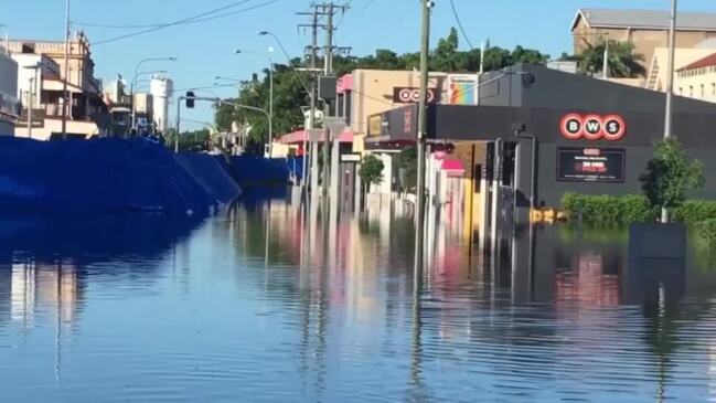
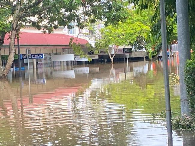
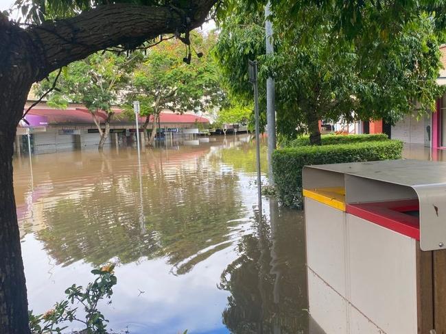
The Mary River at Gympie peaked at 23.96m on the weekend, while in Maryborough, the floodwaters were expected to peak at 10.7m on Monday night.
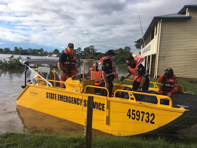
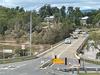
The flooding inundated homes and businesses across the Wide Bay region and cut off hundreds of roads across the state.
“It is a reminder of our vulnerability and our need to perhaps more carefully consider where we approve construction and development,” Dr McCallum said.
Dr McCallum, who lectures in weather and climate at USC, said he first heard about atmospheric rivers 10 years ago.
“The term atmospheric river really just describes those very rich areas of enhanced water vapour where the air is very, very wet,” he said.
“We probably haven’t done enough research on the east coast of Australia to fully understand when they might form, why they might form and what sort of impact that might have.”
Dr McCallum found a recently published research paper on Monday morning about the formation of atmospheric rivers on the east coast of Australia.
“It’s very intriguing that this high level research paper, which is very useful, has just been published now that it is affecting many of us on the east coast,” he said.
“The atmospheric river by definition is an area of enhanced water vapour transported in the lower atmosphere.
“So there’s a lot of moist air being pushed on shore by the wind, the question you ask is why is that occurring and that’s a question that I don’t really know, I’m studying now.
“It’s probably because that low level low pressure system, which is pushing air on shore, is also being supported at the mid level and upper level of the atmosphere.
“If that pressure system at the surface continues all the way up through the atmosphere, or there is additional low pressure higher up in the atmosphere, then that can cause those systems on the surface to be stronger and more stable and I think that’s what has occurred in this case.”
He said the east coast of Australia down to Sydney was susceptible to the weather phenomenon.
“It just depends on how the low pressure systems line up vertically within the atmosphere,” Dr McCallum said.
“If they do line up and support one another then one of these systems can form.
“Then if it sits there happily for a while, it can pump a heck of a lot of moisture over land.”
Dr McCallum said a lot of the rain fell at or near the Great Dividing Range.
“Because this rain came in at a fairly low level, it then hit the Great Dividing Range, it was forced upwards, which caused it to turn into rain, and down it came.
“As we’d understand, there’s essentially a limitless amount of water in the ocean out there, so if one of these systems sits out there for a while, which is what occurred on this occasion, then it can just keep pumping it in and that’s kind of what happened.”

History lecturer Dr Margaret Cook said La Nina had certainly made her presence felt during some of the worst floods in Queensland’s history and the unpredictable weather phenomenon had done it again.
Dr Cook, who specialises in the history of ‘natural’ disasters in Australia, especially floods and earthquakes, said there were many lessons we can learn from this extreme weather event, and past floods.
“This is not the first time that these regions have been flooded and sadly it will not be the last,” she said.
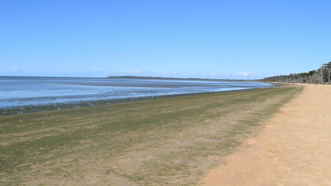
Toxic algae discovered in popular recreational fishing spots
A study of harmful algal blooms in Hervey Bay has found the presence of some species that can cause fatal food poisoning, including some found in Australian waters for the first time.

The Sunday Quiz: What is the tallest waterfall in the world?
Peter Dutton became Opposition Leader in what year? Which car firm makes the Camaro model? Put your knowledge of trivia to the test with The Sunday Quiz.