
Warning cancelled for FNQ with Cyclone Niran forecast to ‘rapidly intensify’ as it moves east
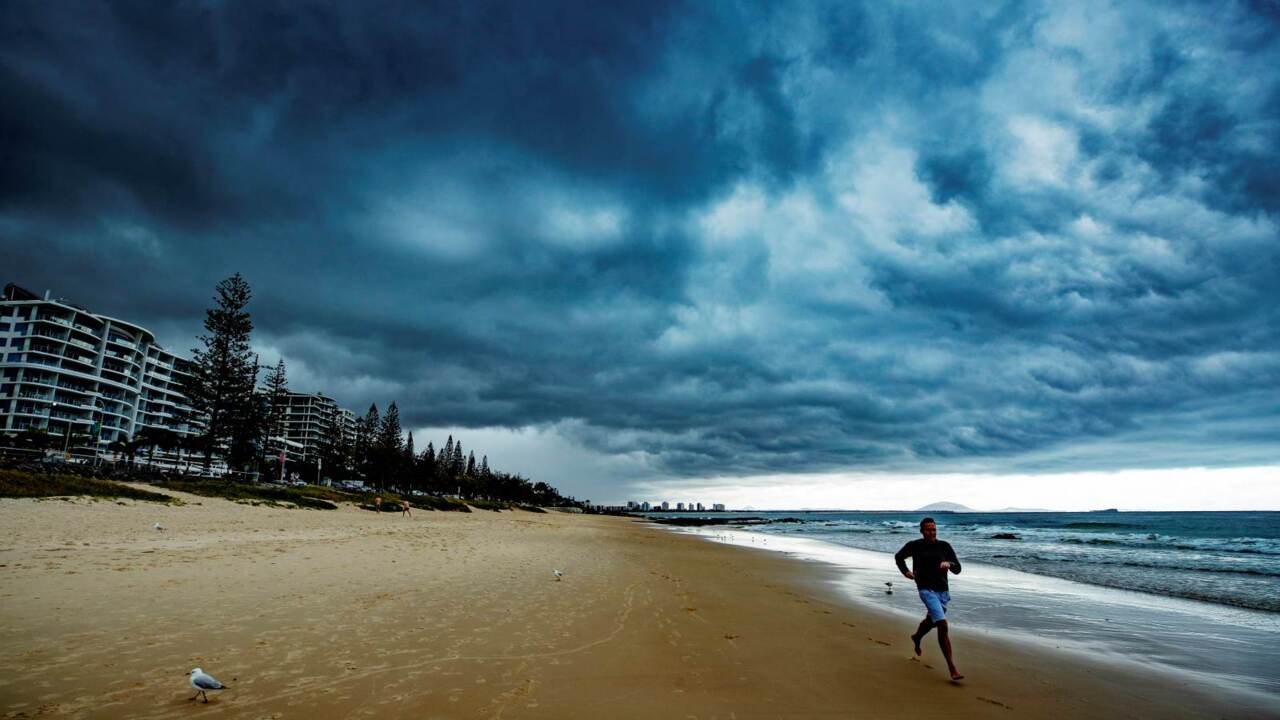
The Far North is not expected to cop any further effects of Cyclone Niran and the cyclone warning is now cancelled. The storm is expected to “rapidly intensify” as it moves away from Queensland. A flood watch is still in place for Cape York.
Cairns
Don't miss out on the headlines from Cairns. Followed categories will be added to My News.
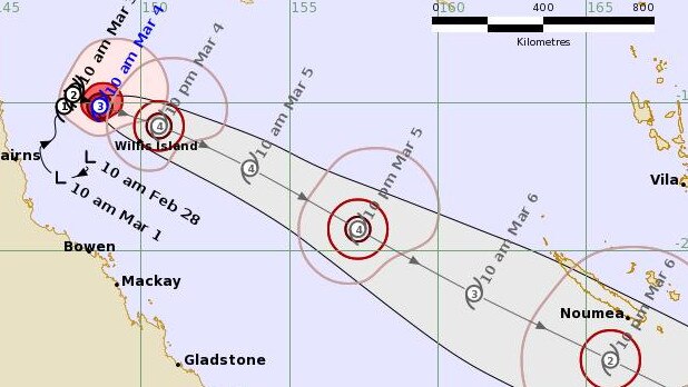
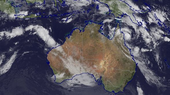
THURSDAY 11AM: Cyclone Niran is forecast to reach Category 4 strength on Thursday night as it moves away from the Far North coast.
At 10am, the storm was 200km northwest of Willis Island and 365km northeast of Cairns, moving east southeast at 8km/h.
STAY INFORMED: SUBSCRIBE FOR $1 FOR FIRST 28 DAYS
It has sustained winds near the centre of 130km/h with wind gusts to 185km/h.
The Bureau of Meteorology says the system is forecast to rapidly intensify as it adopts an east-southeast track away from Queensland during Thursday.
RELATED: Are you entitled to power outage compensation?
“The system is expected to continue moving away from the Queensland coast over the next few days before approaching New Caledonia over the weekend,” BOM said in a statement.
No direct hazards are expected for Queensland coastal or island communities.
However, a marine wind warning for gales between Cooktown and Cairns has been issued.
The storm is forecast to reach Category 4 strength by 10pm Thursday.
ALERT FOR BOATIES
The Acting Regional Harbour Master has cancelled its preparedness (Phase 2) warnings for the ports of Cairns, Half Moon Bay Marina, Cooktown, Cape Flattery, Port Douglas, Mourilyan, Innisfail, South Johnstone and Clump Point.
Mariners are advised to monitor local conditions.
A marine wind warning for gales is in place between Cooktown and Cairns.
HEAVY RAIN ON CAPE
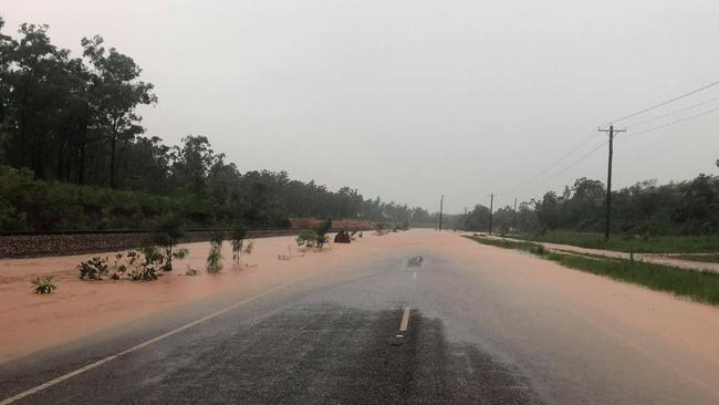
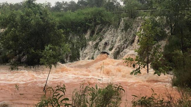
A flood watch is in place for the Cape York Peninsula north of Cape Melville and Pormpuraaw following several days of heavy rain.
The BOM says heavy rainfall from shower and thunderstorm activity is expected to continue during Thursday and into Friday.
Isolated daily rainfall totals up to 150mm are possible.
Rainfall totals of between 80 - 387 mm have been recorded in the watch area over the past seven days.
Catchments in the watch area are saturated from recent rainfall and river level rises are occurring.
Catchments likely to be affected include: Jardine River; Ducie, Jackson and Skardon Rivers; Wenlock River; Embley and Mission Rivers; Watson River; Archer and Coen Rivers; Holroyd and Kendall Rivers; Coleman and Edward Rivers; Jacky Jacky Creek; Olive and Pascoe Rivers; Lockhart River; and Stewart River.
Severe storm warnings were in place for the region for most of the day on Wednesday.
Weipa had 149mm of rain in 24 hours, while Telegraph Crossing, northwest of Coen, recorded 112mm of rain in 4.2 hours.
POWER OUTAGES
The majority of Far North homes and businesses now have power restored.
For the full list of closures and outages, click here.
BOIL WATER NOTICE
Cairns Regional Council has advised Bartle Frere to boil drinking water until further notice.
Customers should bring water to a boil by heating the water until a continuous and rapid stream of air-bubbles is produced from the bottom of a pan or kettle.
Kettles with automatic cut-off switches are suitable.
Variable temperature kettles should be set to boil.
After heating, water must be allowed to cool before using it, and be stored in a clean, closed container for later use. Care should be taken to avoid scalding injuries.
Customers should boil all water used for:
■ Drinking
■ Brushing teeth
■ Washing and preparing food or beverages
■ Preparing baby formula
■ Making ice
Unboiled water can be used for:
■ Showering and bathing (avoid swallowing water). As a precaution babies and toddlers should be sponge bathed to prevent them swallowing water
■ Washing dishes by hand or in a dishwasher, providing dishes are air-dried before being used after washing
■ Washing clothes
Originally published as Warning cancelled for FNQ with Cyclone Niran forecast to ‘rapidly intensify’ as it moves east
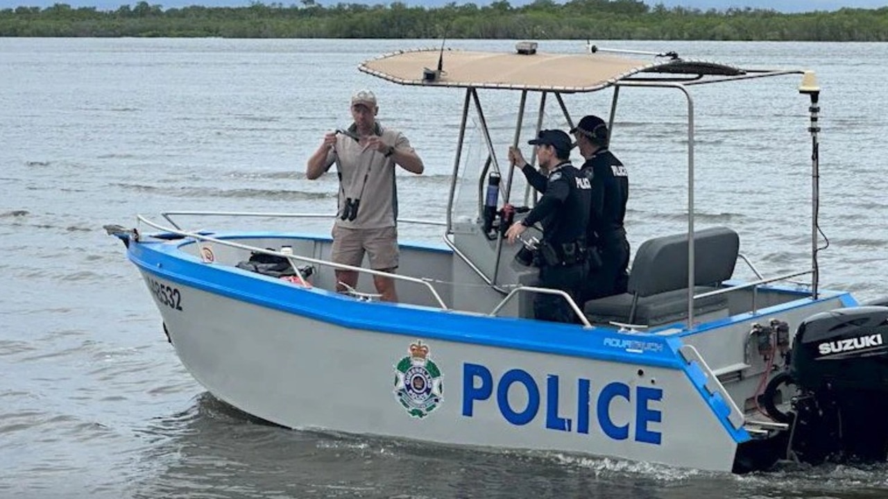
Horrific find in search for missing fisherman
Police have located human remains inside a crocodile as part of the recovery of a man reported missing from Aurukun.

Air, road, and sea: When fresh groceries will hit Cairns’ shelves
After a days of bare fresh produce shelves reprieve is on the way for shoppers as supermarkets delivers an update on flights, trucks and barges headed north. When fresh fruit and veg will hit shelves>>