
Parts of the Gold Coast told to evacuate to high ground to ‘survive’ as flooding inundates state
Residents in parts of the Gold Coast have been warned to “take action” to survive, as wild weather and flooding continues to inundate Queensland.
Weather
Don't miss out on the headlines from Weather. Followed categories will be added to My News.
Residents in parts of southeast Queensland have been told to evacuate to high ground to “survive”, as major flooding and severe thunderstorms continue to batter the state.
Gold Coast City Council has issued a “take action now” warning for the Currumbin Valley, saying Currumbin Creek Rd was now likely to be flooded.
“If you are near floodwater, you may need to get up as high as you can to survive,” the warning stated.
The council advised locals to follow their emergency plans if in danger, and warned it might be “too late to leave safely” for those without one.
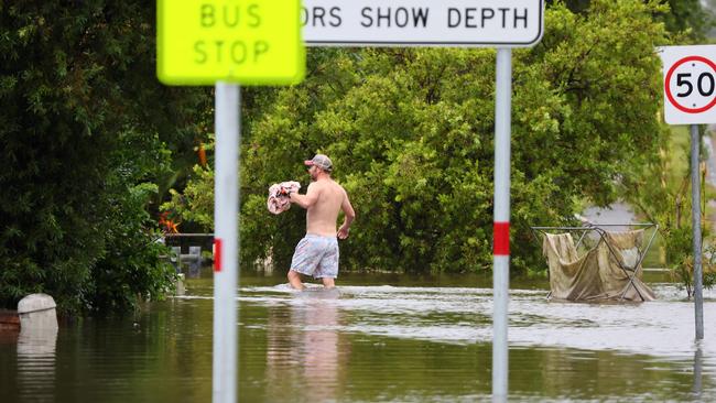
“Water at the Currumbin Creek water level gauge … is now at 46.84m and is rising,” the warning added.
“This is more than 1.9m above the usual creek level.”
Residents have been reminded to never drive, walk or ride through floodwater.
“This is the main cause of death and injury during flooding,” the council said.
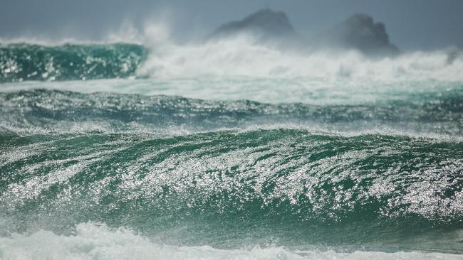
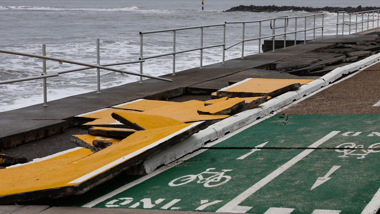
The Bureau of Meteorology also issued a “hazardous surf warning” for the Gold Coast on Saturday.
“Surf and swell conditions are expected to be hazardous for coastal activities such as rock fishing, boating, and swimming,” the warning read.
Surf Life Saving Queensland said locals should consider staying out of the water and avoid walking near surf-exposed areas.
A flood watch is also in place from the Gulf Country to southeast Queensland, with “very isolated intense” rainfall possible in the southeast.
“Showers, rain, and thunderstorms are forecast across much of northern, central and southeast Queensland today as deep moisture is drawn into an inland trough,” the Bureau said.
“Localised flooding, isolation of communities and disruption to transport routes are possible within the Flood Watch area over the next few days.”
Southern Queenslanders can expect some relief overnight on Sunday, however, with rainfall easing as the trough moves off the southeast coast.
Western Queenslanders are also copping the full force of what Premier David Crisafulli described as an “unprecedented” weather event while visiting Quilpie on Friday.
“What is unfolding is a really large weather event,” he said.
“This isn’t regular wet season rain, people in western Queensland can handle that well.
“We are dealing with an event that is at unprecedented levels in many of these communities.”
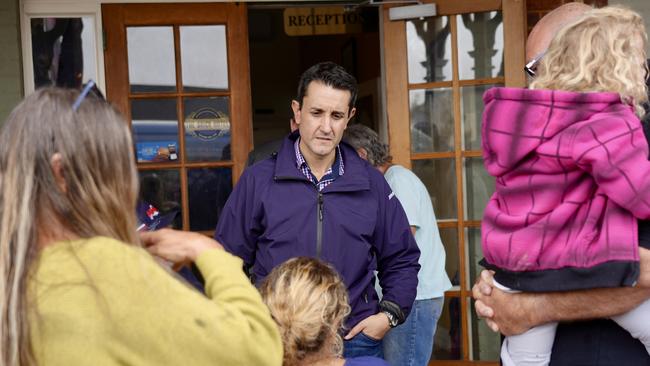
Mr Crisafulli said the recovery operation would be long-term for much of Queensland, with state and federal governments activating disaster assistance to seven councils.
“Western Queenslanders are made of pretty tough stuff and they are always tight-knit communities,” he said.
“In a disaster you see it to another level but they have been tested and tested strongly.”
Mr Crisafulli said stock losses could reach hundreds of thousands, with fresh fears for the state’s agricultural industry.
“You are dealing with many, many hundreds of thousands of acres of country that will be inundated,” he said.
“To put it into perspective, you’ve got somewhere in the order of a million head of cattle, a million sheep that are impacted at the moment.
“Agriculture underpins these communities and they are going to need help not just in the short-term in trying to get fodder there but in the long-term to get them back on their feet.”
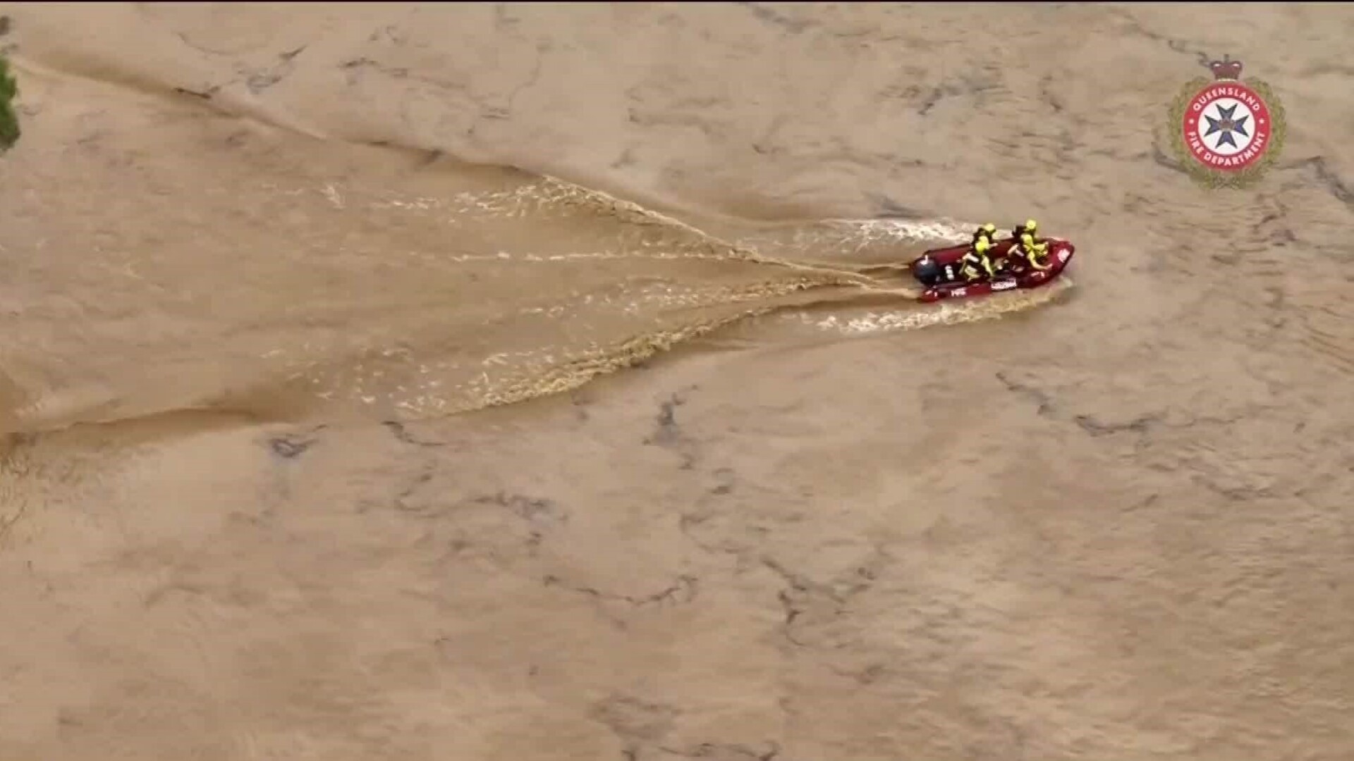
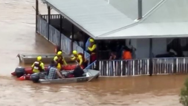
At least 100 homes have reportedly been inundated, with dozens flown to safety as the flood emergency escalates.
“Levels of the Thomson River have hit about 8.6 metres and are expected to rise,” Mr Crisafulli said.
“That is higher than the 1974 (flood) level.”
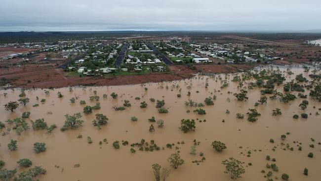
The Bureau of Meteorology said, as of Saturday morning, river levels at Stonehenge and Jundah had risen above the January 1974 flood level, and the river level at Retreat had reached above the April 1990 flood level.
“As these floodwaters combine along the Cooper Creek, major flooding above the January 1974 flood level is possible at Windorah during Saturday,” the Bureau reported.
Mr Crisafulli warned floodwaters could be detrimental for the rural town of Jundah in the state’s central west.
“We have a community without power, without sewerage and we’ve got several evacuations where people have gone to higher ground at the golf course,” he said.
Senior meteorologist Miriam Bradbury said while significant flooding would continue across Queensland heading into the weekend, hazards would also increase in southeast NSW and parts of eastern Victoria.
“As we move into Saturday, our low pressure trough is going to direct the moisture further towards the east coast,” she said.
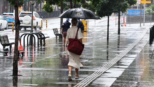
“That means a wet day is on the way for many of our eastern population centres, including Brisbane, the Gold Coast, Sunshine Coast, Sydney, Newcastle, Wollongong, all looking at their wettest day on Saturday.”
Major flood warnings are currently in place for the Bulloo, Georgina, Paroo, Thomson, Barcoo, Warrego, and Western River, as well as Eyre and Cooper Creek.
“Many of these locations have already seen flood peaks moving through but we’re continuing to see some rain moving into the upper reaches of some of these catchments,” Ms Bradbury said.
“That means that over the next few days we may see secondary peaks moving through the river systems or we might see a prolonged peak above the moderate to major flood level.”
In a message posted to Instagram, Mr Crisafulli said he wanted west and northwest Queenslanders to know the government and state would support them.
“We needed to be here to tell these Queenslanders that they matter,” he said.
“Above all, we need to be here to make sure that we shine a light, that the recovery needs to continue.
“My message to these communities is you are small in number but you are big in what you do for our state, economically, but also to the social fabric of our communities.”
Originally published as Parts of the Gold Coast told to evacuate to high ground to ‘survive’ as flooding inundates state
‘Never seen anything like it’: Icon destroyed
One of Sydney’s most iconic sites has been destroyed after a “hazardous” and “scary” swell smashed parts of the city, causing widespread damage.
Read more
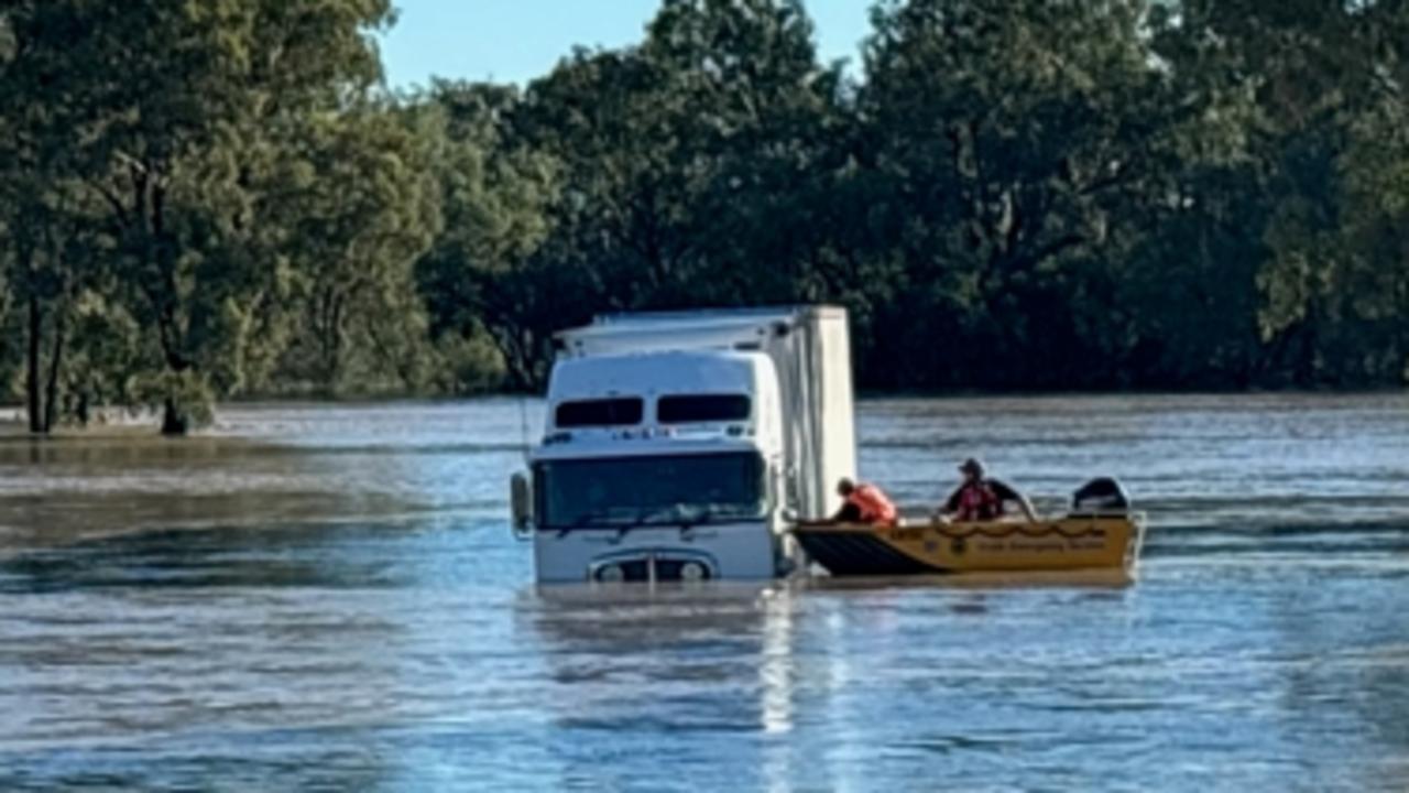
Truck driver rescued as floods smash Aussies
Incredible photos have captured the moment a truck driver was rescued from floodwaters, as severe weather smashes the country.
Read more