
Map shows where summer will hit hard around Australia
A season of extreme weather is coming – with meteorologists tipping one of Australia’s longest-standing climate records is likely to fall. See what extremes are predicted for where you live.

Weather
Don't miss out on the headlines from Weather. Followed categories will be added to My News.
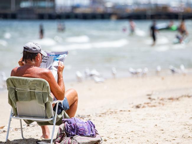
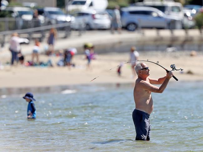
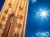
A brutal summer is coming – and with it, a high risk Australia will set a new record for extreme heat, according to Sky News Weather meteorologist Rob Sharpe.
The mercury has hit 50.7°C twice in Australia’s recorded history – once on January 12, 2022 in Onslow, WA, and once on January 6, 1960, in Oodnadatta, SA.
But that record could be set to fall.
“I rate it at a greater than 50 per cent chance of breaking that record this summer,” he said.
“Countless other countries have broken their national record in the last 10 years. I think it’s going to be Australia’s time this summer,” Mr Sharpe said.
It’s but one of several grim predictions Mr Sharpe and fellow Sky News Weather meteorologists make in their Severe Weather Outlook report series for 2023-24.
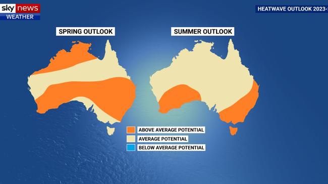
The team forecast Australia will likely record one of its warmest spring seasons on record, followed by one of its hottest-ever summers – and all that on the back of our warmest-ever winter.
The coming seasons will also be marked by warmer than usual oceans, and elevated humidity in some areas, the Severe Weather Outlook reveals.
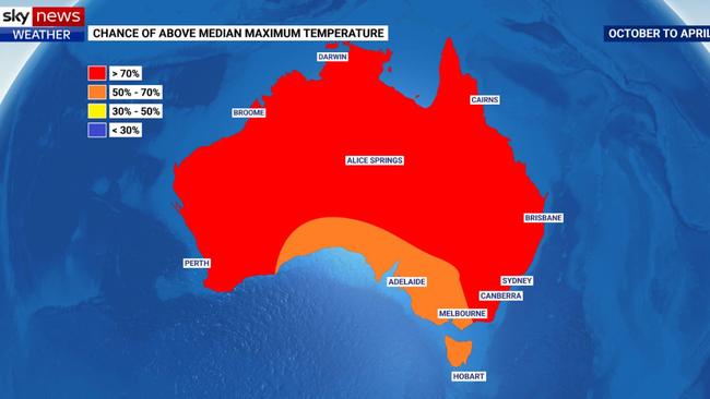
“For Sydney, Brisbane and Darwin I’m expecting this be a very hot and uncomfortable summertime; at times likely to break records in those three cities,” Mr Sharpe said.
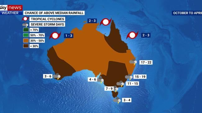
The risk of severe thunderstorms will vary across the country – below average for central and southern areas, above average in the north, and about normal for the east coast.
In the tropics, less tropical cyclone activity than normal is forecast – but damage as always depends on whether they happen to make landfall – and where.
“We usually average 11 tropical cyclones in a season, but over the last two decades the average has only been nine,” Mr Sharpe said.
“This time around we’re expecting between five and seven tropical cyclones to fall within Australian waters this season, of which one to three should make landfall.”
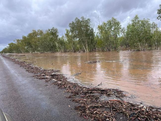
Drought is also set to become a reality in some parts of the country, with southern Queensland, northern and eastern inland NSW, and parts of WA most at risk.
Dam and reservoir levels are currently high in some areas – above 90 per cent in NSW and Victoria, 77 per cent in SA and 70 per cent in south east Queensland.

“For communities that are less reliant on their rivers and dams and more reliant on rainfall itself, they’re going to feel the impacts of drought more rapidly than others,” Mr Sharpe said.
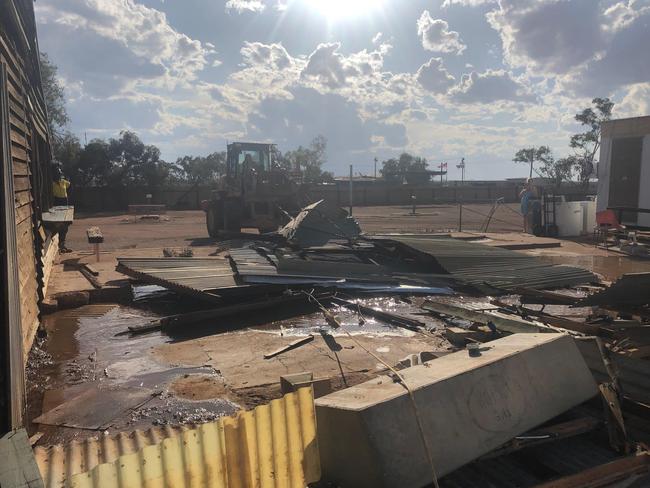
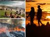
Bushfires have already been a feature of the season, with enormous fuel loads created after three years of heavy rainfall. But those conditions have also left a still relatively high level of moisture in the soil, which means many trees are not dying off as they were ahead of the Black Summer.
Mr Sharpe said grasslands had dried out more than some areas of bushland, so they were a particular area of concern, but so too were the areas of bush that didn’t burn in 2019/20.
“All it takes is one major fire to happen in the wrong place at the wrong time with really nasty weather,” he said. “That’s what happened in Maui – one big fire event which completely devastated Lahaina.”
The Bureau of Meteorology’s latest update stated El Nino conditions were “likely to persist until at least the end of February”, while the current positive Indian Ocean Dipole (IOD) would continue until “at least the end of spring”.
Both phenomena typically lead to reduced spring rainfall, the Bureau said.
Watch Sky News Weather on Foxtel (Channel 601).
STATE BY STATE: WHAT TO EXPECT
NEW SOUTH WALES/ACT
– All of NSW has an 80-95% chance of seeing above normal temperatures across the severe weather season; possibly hottest on record.
– Below normal rainfall for much of the state increases drought risk – most likely in northern parts of the state
– Sydney and much of NSW coast should see substantially less rainfall this severe weather season
– Much higher than usual threat of bushfires across the state, particularly across the north and east, and Sydney outskirts
– Sydney has a very high chance of being warmer than average over the Severe Weather Season (October-April)
VICTORIA
– Hotter than usual weather likely across state, particularly across the north and east where the odds are greater than 80% of exceeding normal.
– Below normal rainfall expected across the state, with drought likely in some regions
– Dam levels expected to remain fairly high courtesy of last year’s floods
– Melbourne has a high chance of being warmer than average over the Severe Weather Season (October-April)
QUEENSLAND

– All of Queensland has an 80-95% chance of seeing above normal temperatures across the severe weather season; possibly hottest on record
– Landscape already drying out across southern Queensland; drought a high risk during next six months
– Average (or slightly below) number of tropical cyclones expected
– Higher than usual threat of bushfires across much of the state through spring and early summer
– Brisbane has a very high chance of being warmer than average over the Severe Weather Season (October-April)
SOUTH AUSTRALIA
– Season very likely to be hotter and drier than usual across state – especially through inland regions
– Considerable chance that Australia’s hottest temperature (50.7°C) could be surpassed in multiple towns in December or January
– Hotter and drier weather expected to cause flash droughts in parts of the state
–The Severe Weather Season (October-April) in Adelaide should be warmer than last year and warmer than average
WESTERN AUSTRALIA
– Extreme heat expected to develop across Western Australia across the severe weather season, with many regions likely to see records broken – especially inland and in the north.
– WA is expecting a below normal tropical cyclone season, which will also favour below normal rainfall for the state.
– Drought will take hold in multiple parts of the state as hotter than usual weather increases evaporation rates for regions that have seen below normal rain this year.
– Perth should again be warmer than average throughout the Severe Weather Season (October-April)
TASMANIA
– East and west facing very different prospects in coming season
– Eastern Tasmania likely to see below normal rainfall and hotter than usual temperatures – particularly at night
– Western Tasmania should see normal rainfall and temperatures between October and April
– Hobart has a high chance of being warmer than average over the Severe Weather Season (October-April)
NORTHERN TERRITORY
– Northern Rainfall Onset and North Australian Monsoon both likely to arrive later than usual
– A much hotter than usual Build-Up expected that should challenge temperature records, making it extremely uncomfortable
– Tropical cyclone season likely to be near or below average, with below normal rainfall favoured through the wet season
– Darwin’s Severe Weather Season (October-April) should be warmer than last season and warmer than normal

Millions brace for brutal cold fronts
A fresh wave of wild weather is preparing to lash Australia, bringing freezing winds, thunderstorms and icy blasts to millions.

Wild weather warning for this capital city
There will be “one last sting in the tail” of the polar air blast that has marched across Australia, with wild winds to continue battering the nation.