‘It’s unusual’: Weather danger to hit millions
Forecasters are warning an “unusual” weather change - not seen for almost two decades - could lead to dangerous conditions across much of the nation.
Weather
Don't miss out on the headlines from Weather. Followed categories will be added to My News.
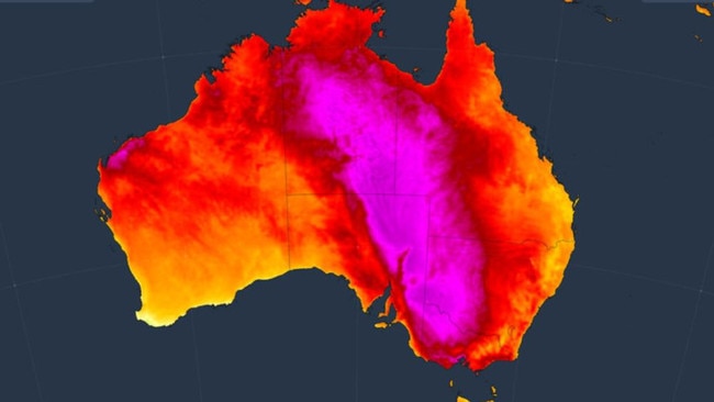
A burst of heat across Australia could lead to dangerous conditions over the next 48 hours with potentially the earliest 40C summer days in Adelaide and Melbourne in almost two decades.
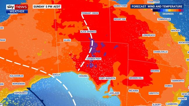
Adelaide could reach 40C on Sunday, which would be 13C above average. While parts of Victoria may surpass 45C on Monday. That’s stoking bushfire fears.
“For Adelaide and Melbourne, 40C would be the earliest in summer in 18 years – since 2006 – so that alone would be unusual,” Sky News Weather meteorologist Alison Osborne told news.com.au.
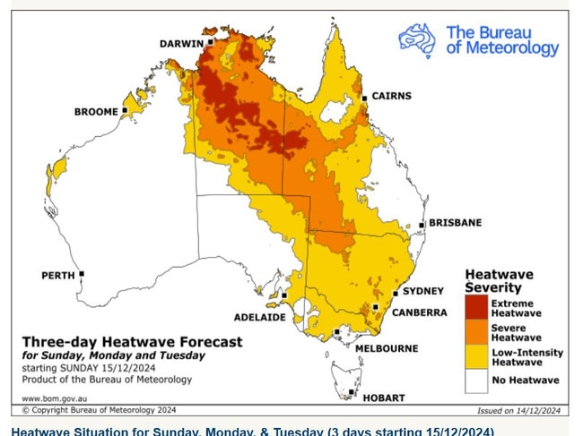
And it’s not just South Australia and Victoria – the Bureau of Meteorology has heatwave weather warnings in place for every state and territory aside Tasmania.
The Top End, including Darwin, is looking at an extreme heatwave continuing into early next week while all of New South Wales will be in a heatwave on Sunday.
The cause of the heat spike is a high pressure system which has moved from the Great Australian Bight, over the country’s south east and has pushed into the Tasman. That’s dragged down hot, parched air from the interior.
“This will result in high temperatures this weekend and then into the east by Monday,” Ms Osborne said.
Earliest 40C summer days for years
First to feel the heat will be Adelaide, which is expected to hit 40C on Sunday and then 38C on Monday with a sweaty overnight low of 27C.
“Adelaide CBD sees on average three days per year over 40C and this would be the earliest in summer since 2008,” Ms Osborne added.
Renmark could reach 45C on Monday.
Fire dangers will rise across SA on Sunday and spike on Monday as winds strengthen and temperatures exceed 45C from the state’s east and into western Victoria and NSW.
“Monday is extremely hot and windy which is shaping up to be a dangerous fire weather day for much of Victoria,” said Ms Osborne.
According to the Country Fire Authority, Monday will see extreme fire danger across all of eastern and central Victoria.
Melbourne will experience a summery 31C on Sunday. But that will be cool compared to the wall of heat that could see the city hit 41C on Monday – 16C above average for Victoria’s capital at this time of year. That would be the earliest 40C day in summer since 2006.
Away from the coast it will only be hotter.
Mildura and Swan Hill are looking at 40C on Sunday and then 46C on Monday, which would be their hottest days for five years.
Across the border into NSW and the heat persists.
Broken Hill could max out at 44C on Monday. While Echuca, Deniliquin and Griffith are all set to peak at 45C.
On Sunday and Monday, Wagga Wagga, Dubbo, Tamworth and areas between will bump around the 39-40C mark.
There will be relief on the coast with Sydney merely in the upper twenties on Sunday and Monday and then peaking at 32C on Tuesday.
But it’ll be scorching in Canberra with a run of heat. Sunday will top out at 36C, Monday 37C and Tuesday 35C with possible rain.
When cool change will come
“A cool change will move across the south east, dropping temperatures dramatically, and possibly bringing storms,” said Ms Osborne. When that change comes will depend on the location.
A possible thunderstorm on Monday in Adelaide will be part of that cooling down with Tuesday likely to reach just 26C. But temperatures will then steadily increase as the week progresses back into the low thirties.
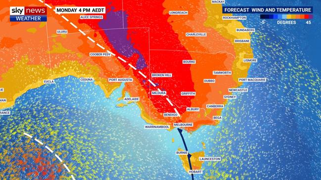
Those storms could also reach Melbourne on Monday. Then on Tuesday, Melbourne could rise to just 23C, with up to 10mm of rain, and then 21C on Wednesday.
Tasmania won’t entirely sit the heat out. Sunday in Hobart will be a balmy 24C but Monday will rise to a 33C high before dropping to 21C on a wet Tuesday.
Brisbane can expect a run of wet days, with up to 10mm in the gauge (perhaps 20mm on Tuesday), and maximums hovering around 30C.
Cairns is stuck on days of 34-35C dropping only slightly on Friday to 32C.
Darwin is on rinse and repeat too, with 35C highs and 27C lows with possible storms.
North west Western Australia is also in the grips of heatwave with Broome seeing 35C most days this week.
Sunday and Monday will be pleasant in Perth with mid-twenties maximums, but it will get hotter in the WA capital with Tuesday and Wednesday forecast to top out at 34-35C.
Originally published as ‘It’s unusual’: Weather danger to hit millions


