
TMR grants access to Cape flood cam access as rain bomb drops
A decision has been made over Cape York flood cameras amid rising flood waters that have grounded a remote air service and left one traveller going to extreme lengths to get back to Cairns.

Cairns
Don't miss out on the headlines from Cairns. Followed categories will be added to My News.
In response to safety concerns TMR have allowed public access to a series of Cape York flood cameras amid rising flood waters that have grounded a remote air service and left one traveller going to extreme lengths to get back to Cairns.
Monsoon activity impacting the western coast of the Cape York Peninsula on Wednesday morning continued to dump rain in already water logged catchments.
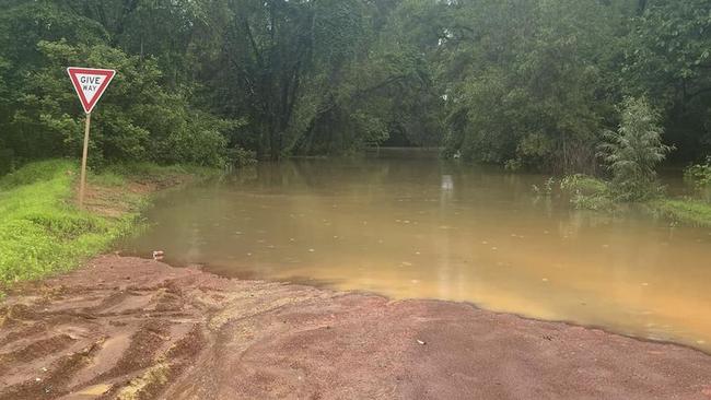
The Wenlock at Moreton, Archer River causeway and Shelley’s Crossing at Laura were all impassable on Wednesday morning.
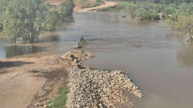
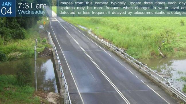
But Transport and Main Roads have at long last added the dangerous Archer River causeway and the Laura River to a list of publicly assessable river height webcams, previously restricted to disaster management personnel.
“Last month we were able to add low-resolution images from more flood cameras to (the) QLDTraffic (website),” a TMR spokesman said.
A new camera has been installed at the flood-prone Bushy Creek in Julatten and access to other flood cameras “will follow as soon as possible,” according to TMR.
Weipa health worker Tracy Sekac has long campaigned for access to river height information she claims could save lives during the wet season.
“It’s been terrific to see increased public access to the flood cameras with the Laura and Archer rivers being made available, it’s long overdue,” she said.
“There are a few others, one being Myall Creek that should be added as there are numerous incidences every wet season of people being stuck there.”
According to Pormpuraaw locals larger aircraft operated by Skytrans have been unable to land at the Pormpuraaw Airport due to the low lying airstrip.
Skytrans chief executive officer Alan Milne confirmed that Pormpuraaw Aboriginal Shire Council had requested the suspension of 36 seat Dash 8 arrivals.

“The problem is with the wet weather water has got under the substrate and caused problems with the runway,” he said.
“We will be substituting Dash 8s with (nine seat) Cessna Caravans to make sure we can keep services going.
“We have put some options to (council) and they are very interested in that.”
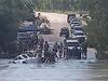
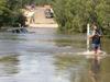
And further north a flooded Peninsular Development Rd at Myall Creek outside Weipa has caught travellers off guard.
Anthony Hall stranded at York Down Station east of Weipa in a desperate bid to travel back to Cairns put out a call for help on social media.
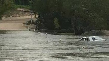
“We are in a spot of bother wondering if anyone in Wiepa would come to Myall River with a boat and enough car space for five people and bit of gear so we can get a plane out of there back to Cairns,” he wrote.
“Any help will be massively appreciated and more than happy to pay (for) fuel (and) time.”
Heavy rain in the Gulf region flooding the Gilbert, Etheridge, Flinders, Norman and river systems has essentially cut off road access to Doomadgee, Burketown, Normanton, Karumba and Georgetown, according to flood alerts reported by Queensland Traffic.
A flood watch issued by the Bureau of Meteorology on Tuesday confirmed likely flooding for the western Cape and Gulf regions.
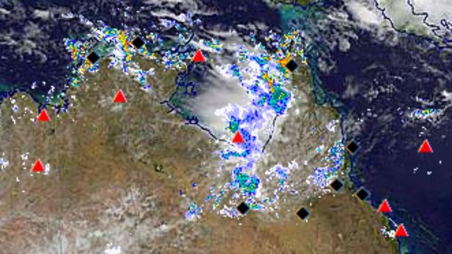
“River level rises are expected to continue and riverine flooding is likely within the Flood Watch area,” the Bureau stated.
“Catchments are wet and rivers will respond relatively quickly to further rainfall.
“Impacts to transport routes have been observed within the Flood Watch Area. Further localised flooding, isolation of communities and disruption to transport routes are likely within the Flood Watch area over the next few days.”
More Coverage
Originally published as TMR grants access to Cape flood cam access as rain bomb drops
Update on man found unresponsive at beach
Emergency services have provided an update following an incident involving an unresponsive man at a Far North beach.
Locals warned of ‘life-threatening flooding’, as NQ braces for cyclonic rain totals
Townsville residents are being warned to brace for possible flooding up to the second storeys of buildings, as Premier David Crisafulli sends a powerful message to North Queensland amid warnings of cyclonic rainfall levels.