
New technology to save the Great Barrier Reef
Saving the largest living thing on earth is no easy task, but a new piece of technology promises to transform the way the marine environment is managed.
QWeekend
Don't miss out on the headlines from QWeekend. Followed categories will be added to My News.
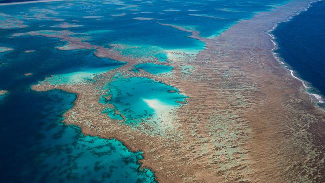
The Great Barrier Reef, revered worldwide for its exquisite beauty and unique, biologically diverse marine ecosystem, faces many significant challenges that threaten its very existence. It is facing warmer water temperatures and poor water quality from contaminants such as pesticides, fertilisers and soil from grazing and cropping land.
Stretching 2300km along the Queensland coast, there are at least 35 major rivers that discharge water into the reef.
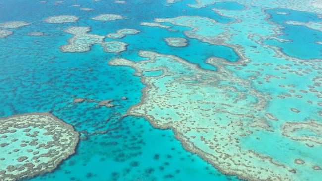
Spanning an area the size of New Zealand, the Great Barrier Reef is the Earth’s largest living structure and the only natural wonder visible from space.
Hannah’s untold story and the heart-wrenching goodbye
Brisbane’s most popular dog: ‘If I had 200, I could sell them today’
Protecting this massive, irreplaceable global icon for future generations is vital but also extraordinarily challenging.
Science, however, has stepped up to the job.
The world’s largest reef forecasting and monitoring project called eReefs has transformed the way the marine environment is managed.
It all began in 2012 when the Great Barrier Reef Foundation partnered with the Bureau of Meteorology, CSIRO, the Australian Institute of Marine Science and the federal and state governments to pioneer the world-first project with a six-year, $30 million collaboration. Delivering more than 60 Reef-saving projects, the Foundation has allocated another $9.6 million to take its eReefs project even further.
Comparable to real-time weather reports provided by the Bureau of Meteorology, eReefs tracks and predicts the condition, temperature and water quality of the Reef.
The program collects information on ocean temperatures and currents, river flooding, land catchment activities and extreme weather events. It can model water quality in 3D across the entire reef using data from NASA and the European Space Agency sentinel-3 satellites.
The data is then used to develop detailed maps, images and videos to show reef “hot spots” most at risk of bleaching and avoid future bleaching events that strip coral of its iconic bright colours.
It reveals the rivers having the biggest impact, tracks run-off which is linked to outbreaks of crown-of-thorns starfish and can also show where the next crown-of-thorns outbreak might occur. It demonstrates how individual landowners’ actions can make a difference.
The system enables anyone – reef managers, scientists, boaties, fishermen – to track the growing combination of threats facing the Reef. Information allows scientists to “see through’’ cloud cover that shuts down all satellite images and helps target the most important areas of the reef to survey and assess for damage after a cyclone.
Other applications of the technology include the Queensland Government using the technology to assess the spread of white spot disease from prawn farms.
It has been used as a forecasting tool by Australian and US naval forces in military training exercises.
It is even touted as able to help yachties win races and aid search and rescue efforts.

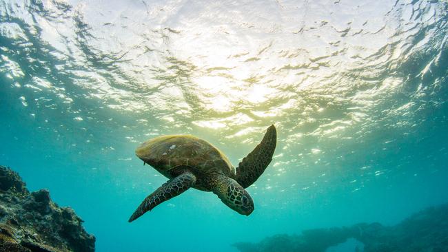
Described as the “action station’’ for the Reef, the non-profit Great Barrier ReefFoundation delivers more than 60 projects aimed at solving the problems facing the survival of the Reef and its marine life. Aside from the eReefs program, its other projects include saving endangered green turtles by restoring the world’s largest nesting area on Raine Island, on the outer edges of the reef off north-eastern Australia.
Naturalist Sir David Attenborough has described the annual journey of as many as 60,000 female green turtles returning to their birthplace to lay eggs as “one of the most spectacular ocean migrations on the planet”.
In a mammoth effort, the Foundation and its partners moved 40,000 cubic metres of sand to prevent tidal inundation, and installed 1750m of fencing that prevents adult turtles falling off cliffs, landing on their backs and dying.
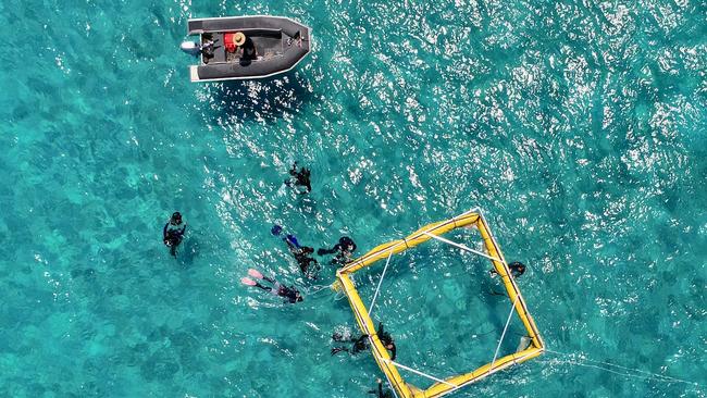
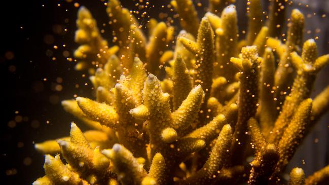
Another project is “coral IVF” – an innovative coral regeneration project to save stressed, damaged and bleached reefs.
Specially designed floating “coral nurseries” containing billions of coral sperm and egg bundles are released to give mother nature a helping hand and accelerate the rate of reef regeneration.
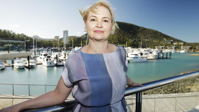
Great Barrier Reef Foundation managing director Anna Marsden says the scale of the Reef is hard to comprehend and it is even harder keeping a watch over such a massive area.
“Yet with the growing combination of threats to the Reef today, that’s absolutely what we have to do,’’ she says.
“By pioneering eReefs, we can now better understand the impact of poorer water quality from run-off and higher ocean temperatures from climate change, and how that translates to individual reefs.”
Since 2015, eReefs has been used to produce the water quality results for the Reef Water Quality Report Card. The report card measures progress towards the Reef 2050 Water Quality Improvement Plan, a joint commitment of the Australian and Queensland governments to improve the quality of water flowing from catchments into the Reef.
Bureau of Meteorology chief customer officer Peter Stone says since 1998 there have been up to 15 extreme weather events associated with cyclones, floods, droughts and coral bleaching, leading to a large amount of sediment and nutrients to be discharged from catchments into the Reef.
He says the eReefs program is used by researchers, scientists and natural resource management organisations who work with farmers to understand how the flow, sediment and nutrients from their regions affect the Reef.
“Before eReefs was developed, there was a significant amount of water flowing from the land to the Reef … it just wasn’t possible to measure at all,” Stone says.
“We’re now able to accurately predict in near real time what the impact of major rainfall and weather events will be, across the entire length of the Great Barrier Reef.
“This creates a powerful picture of how the whole reef ecosystem responds. The information is available to reef managers for the previous two weeks and the next three days.”
Without change, the future outlook for the Reef is undoubtedly bleak. Without help, the“perfectstorm” of climate change, pollution and sediment run-off, more severe cyclones and crown-of-thorns starfish outbreaks, could be the end of this irreplaceable ecosystem.
But while human activity has caused much of the problems facing the Reef and its marine life, the Great Barrier Reef Foundation believes bringing people together and science can and will save it for future generations.
Great Barrier Reef Foundation head of projects Theresa Fyffe says eReefs has become a vital tool in improving the reef’s water quality, allowing the Reef to be seen in real time as a “living, connected ecosystem, from paddock to reef, from Cape York to southeast Queensland”.
“It highlights to reef managers, industry and the broader community exactly how their actions can impact this unique ecosystem and its marine life, not only in a negative way but also in a positive way,” she says.
Charlie Morgan, formerly of the Mackay-Whitsunday-Isaac Healthy Rivers to Reef Partnership, says eReefs has been instrumental in understanding the effect river catchments and seasonal influences have on Whitsunday reefs. It has clearly revealed how the actions of land owners can affect the pristine beauty of tourism hot spots.
“It has shown us that catchments as far away as the Fitzroy River in central Queensland do have an impact on the water clarity of the Whitsundays,” Morgan says.
“This is critical information that enables us to know where to target our efforts to improve the quality of water flowing out to the Reef.”
Perhaps the most passionate defender of the Reef is Great Barrier Reef Foundation chief scientist Professor Ove Hoegh-Guldberg who sees the long-term benefits of eReefs’ data as “game changing”.
Being able to predict water quality outcomes under a range of scenarios, assessing the impact of weather patterns and changes in land management practices, he says, will give vital information on critical seagrass and coral reef habitats.
This, in turn, could identify coral reefs that could most benefit from intervention or those that should be considered as “refuges to be protected in perpetuity”.
“By creating and making publicly available environmental data in 3D for the entire Great Barrier Reef lagoon, eReefs has allowed managers, stakeholders and scientists to understand the processes and patterns driving this ecosystem in greater detail than ever before,” he says.
In partnership with the Great Barrier Reef Foundation.
