By Ashleigh McMillan and Roy Ward
Emergency authorities warned Victorians to avoid unnecessary travel overnight on Sunday and stay vigilant for downed trees and damage on Monday.
After enduring days of severe weather, much of regional Victoria and metropolitan Melbourne faced the prospect of being hit by wind gusts of 100km/h from late on Sunday afternoon and into the early hours of Monday.
Victoria’s coastal communities were on high alert through much of the state, with peak gusts of up to 130km/h forecast for areas stretching from the South Australian border to the Bellarine Peninsula, as well as Melbourne’s south-eastern suburbs, the Dandenongs, Mornington Peninsula and Wilsons Promontory.
A 146km/h gust battered Wilsons Promontory about 2.30am Monday, while the alpine resort of Falls Creek also copped a mighty 132km/h blast of wind. Off Melbourne’s shore, a 141km/h gust was recorded at Fawkner Beacon in the waters of Port Phillip Bay. On land, St Kilda and Aireys Inlet recorded peak gusts of 113km/h.
High winds are also expected in Victoria’s north-eastern ranges, the Macedon Ranges, parts of the northern country, north-east and Mallee forecast districts.
SES chief officer operations Tim Wiebusch said Victorians needed to be vigilant and watch for damage and road hazards after they wake up on Monday morning.

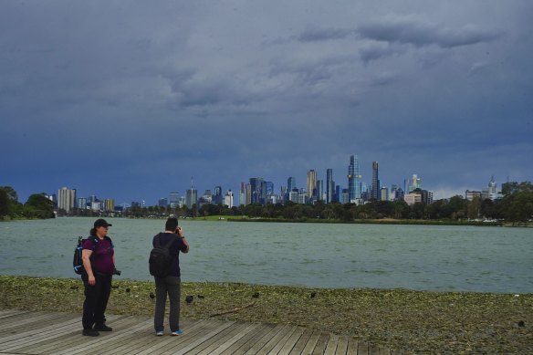
Melbourne is being battered by yet another cold front.Credit: Luis Ascui
“It doesn’t get much more significant than this when it comes to severe weather,” Wiebusch said on Sunday. “We have not issued a work-from-home directive but everyone needs to think about where they are overnight and on Monday. Have a plan.
“If you are expecting trees down on the roads in your area, you may choose to work from home for the day.”
Emergency services also warned people to charge their mobile phones before bed and to have torches, candles or other non-electric lighting ready in case their power goes off overnight.
The department of education said on Sunday night that any school closures would only become clear on Monday morning.
Schools being closed will be added to the department’s current closures website, with updates to be announced by 8.30am AEST on Monday.
The SES had 307 calls in the 24 hours to 5pm on Sunday, with the greater Geelong region being the busiest with 17 calls from the Bellarine area, 15 from the Geelong area and 15 from the South Barwon area.
The service received 201 calls for downed trees and 82 for building damage.
Meteorologist Joanna Hewes said the winds were associated with a cold front moving across Victoria that was due to reach Melbourne in the early hours of Monday morning.
“The front is expected to reach far western Victoria late tonight, about 11pm, but we could see strong winds ahead of that front any time from this afternoon,” she said.
“Take some time today to prepare by moving your vehicles undercover and away from trees, tying down loose items such as outdoor furniture and trampolines, and avoiding travel if possible during the peak of the winds overnight, particularly through heavily treed areas.
“After the main cold front has passed through, we are still expecting to see further gusty showers and thunderstorms in behind the front, and they’ll be gradually easing throughout Monday.”
In a Bureau of Meteorology video published on Sunday afternoon, meteorologist Sarah Scully said the cold front was forecast to arrive in Melbourne between 2am and 4am.
“We’re expecting a line of showers and thunderstorms to form along that frontal band,” Scully said. “There will be much colder conditions behind the front with the potential for small hail and as well snow down to low levels.”
Areas around Port Phillip Bay, Western Port and Gippsland Lakes were warned to prepare for high tides, which could lead to inundation from seawater in low-lying areas.
Mount William, the tallest peak in the Grampians, recorded wind gusts of 102km/h overnight on Sunday.
The latest episode of wild weather came after a man drowned in rough seas off Rye pier on Saturday afternoon.
VICSES state duty officer Erin Mason said volunteers were ready to assist their communities, as the severe weather warnings would likely lead to a rise in callouts for help.
She encouraged Victorians to ensure vehicles were parked safely, clean their gutters if it is safe to do so, avoid walking or driving in high-risk areas, and stay informed about the latest warnings through the bureau’s website and the VicEmergency app.
Hewes said above-average temperatures in inland Australia were causing the gusty conditions.
“We’ve got this really warm air over continental Australia, and then cold air that’s coming up from the Southern Ocean. When those two blobs of air interact, you get very strong winds,” she said.
Melbourne is expected to reach a top of 14 degrees on Monday, with one to seven millimetres of rain on the way. Conditions will dry up by Tuesday, with a top of 17, before a mostly sunny Wednesday brings a peak of 20 degrees.
Get the day’s breaking news, entertainment ideas and a long read to enjoy. Sign up to receive our Evening Edition newsletter.