By Mary Ward
Sydney’s rainy weather will most likely intensify on Sunday as a cloud band continues to move across Australia, bringing storms and cold temperatures for the first weekend of winter.
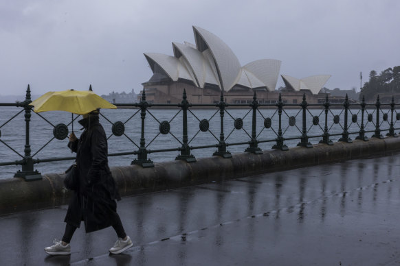
After an overcast but dry start to the day, rain hit Sydney in the late morning. More than 20 millimetres had been recorded at Observatory Hill by 2pm.

Wet weather at Circular Quay on Saturday afternoon.Credit: Anna Kucera
The rain forced Vivid to cancel the festival’s Light Walk around Sydney Harbour as well as events at Tumbalong Park, The Goods Line and the Royal Botanic Gardens on Saturday night. The festival said other music, food and ideas events would continue as planned.
Helen Reid, a meteorologist at the Bureau of Meteorology, said the weather was expected to worsen on Saturday evening and through to Sunday, with blue skies forecast for Monday.
“Through the Sydney region, Illawarra, Blue Mountains and Lower Hunter, we can expect to see an increase of rainfall later today,” she said. “There’s also a sense winds will be increasing with this system.”
Reid said “freshening” winds – a term used to describe winds intensifying significantly after relatively still conditions – would occur along the coast, with the possibility of thunderstorms.

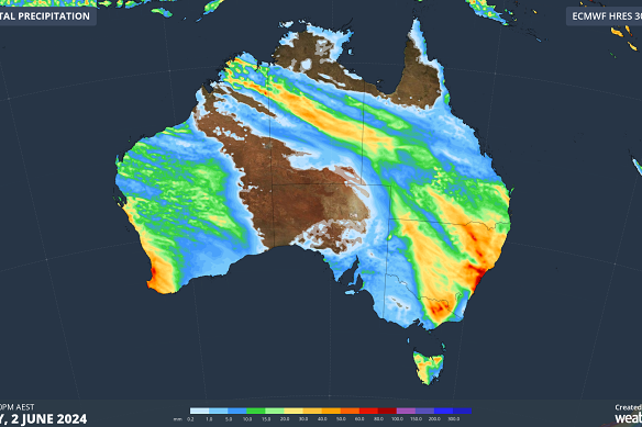
Rain forecast from Friday to Sunday.Credit: Weatherzone.com.au
The bureau has issued strong marine wind warnings for Sydney’s enclosed waters and coast, and all regional coasts north of and including Batemans.
Wind warnings will remain in place on Sunday, with gale-force winds expected in coastal areas between and including Sydney and Coffs Harbour.
“As we look into Sunday, we can expect widespread moderate to heavy falls … potentially leading to flash flooding and river level rises,” Reid said, noting a low-pressure weather system would most likely bring an increase in rainfall and rough surf conditions as it moved slightly offshore on Saturday night.
The system will move southwards on Sunday and into Monday.
Weatherzone meteorologist Ben Domensino said there were signs the low-pressure system would develop a few hundred kilometres away from the NSW coast as a Tasman low rather than an east coast low, meaning its impact would be less intense.
“Tasman lows are not as dangerous as east coast lows because their most severe weather occurs out to sea. However, there is still potential for dangerous weather in NSW on the weekend,” he said.
After the wet weekend, there is a chance of morning showers on Monday, with blue skies set to return on Tuesday.
The bureau issued a special warning to the state’s sheep graziers on Saturday morning, warning the weather forecast across the Hunter, Illawarra, Central and Southern Tablelands and Snowy Mountains could result in losses of lambs and sheep.
Get to the heart of what’s happening with climate change and the environment. Sign up for our fortnightly Environment newsletter.