By Benjamin Preiss and Lachlan Abbott
Emergency services have warned communities across the state to prepare for riverine and flash flooding as heavy rain and strong winds sweep across Victoria.
Gippsland and the Surf Coast are among the areas at risk of flooding with the Bureau of Meteorology forecasting rainfall as high as 200 millimetres in some parts of the state.
Flooding hit Swan Hill in the state’s north on Wednesday after a deluge of rain, while bureau figures revealed Ultima - about 30 kilometres south-west of Swan Hill – experienced Victoria’s highest total of 90.2 millimetres in the 24 hours to 9am on Wednesday.
The bureau’s senior meteorologist Kevin Parkyn said rainfall was expected to continue throughout Wednesday night and into Thursday. He said rainfall totals could reach 200 millimetres in the Otways and Gippsland.
“Unfortunately, where we do see intense rainfall, particularly through the Gippsland catchments, it will result in flooding,” he said.
Parkyn said many rivers would have minor or moderate flooding, but that could hit major flood levels depending on rainfall.
Flights departing Melbourne Airport experienced hour-long delays on average due to the weather, leading to long queues of planes on the tarmac as only one runway was operating on Wednesday afternoon.
Parkyn said south-easterly winds reaching up to 90 km/h had brought trees down on roads and damaged vegetation.
“Be prepared over the next 24 to 48 hours for the heavy rain to lead to flash flooding, but also for the riverine flood risk as well,” he said on Wednesday afternoon.
Parts of Swan Hill were flooded on Wednesday after the Murray River town was hit with 75.8 millimetres of rain in the six hours to 7am, forcing a primary school and the town’s RSL to close.

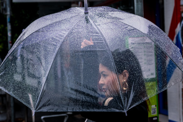
The weather bureau forecasts that Melbourne will endure four days of consecutive rain.Credit: Justin McManus
“Due to the heavy rain, the front and many other parts of the school grounds are currently flooded and many connecting roads into the school,” St Mary’s Primary School in Swan Hill posted to its Facebook page. “For safety reasons, the school will be closed this morning.”
The State Emergency Service received more than 300 requests for assistance by Wednesday afternoon, including about 30 in Swan Hill.
SES chief operations officer Tim Wiebusch said creeks, streams and rivers were rising on the Surf Coast on Wednesday. There was also a risk of damaging winds on the Surf Coast and Dandenong Ranges.
But Wiebusch said Gippsland was the focus of riverine flooding. The Genoa, Cann, Snowy, Bemm, Tambo, Mitchell and Avo rivers could all have higher levels than the October floods last year.
Wiebusch warned communities around the Traralgon Creek to prepare for moderate to major flood levels. Some homes in Traralgon were severely damaged after flooding in the Gippsland town in 2021.
“There is definitely a risk of inundation of properties in low-lying areas that will start with the likes of caravan parks,” Wiebusch said. “But if we do see those higher rain totals, we will see the potential for homes in the most low-lying areas impacted by flooding.”
He said local and major roads in Gippsland may be cut off. The rain in Gippsland is expected to continue into Friday and possibly Saturday.
Warmer weather will return to Melbourne on Monday and Tuesday with a top of 28 degrees predicted.

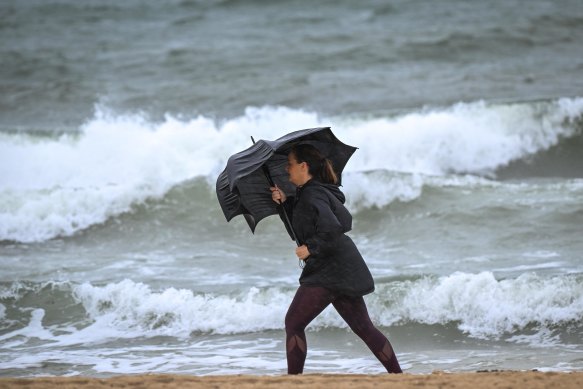
A woman battles through the wild weather in Port Melbourne on Wednesday morning.Credit: Eddie Jim
Meanwhile, two people have been rescued from a car swept up in floodwaters and others from a home on the NSW south coast.
Nationally, the temperature outlook for Australia this spring and summer is for above-average temperatures, and the strong possibility of a drying El Nino climate driver.
Get alerts on significant breaking news as happens. Sign up for our Breaking News Alert.
With AAP
correction
An earlier version of this story incorrectly said the Victorian town of Sassafras received 231 millimetres in the 24 hours to 9am on Wednesday. The weather bureau’s figures instead referred to the small locality of Sassafras in NSW.