This was published 2 years ago
Warmer winter ahead as El Nino chances increase
By Laura Chung
Australia is likely to see warm and dry conditions this year with the Bureau of Meteorology updating the chance of an El Nino occurring to 70 per cent.
Previously, there had been a 50 per cent chance of one occurring this year.

The Bureau of Meteorology has updated the chance of an El Nino occurring to 70 per cent.Credit: Alex Ellinghausen
The BOM updated its climate driver on Tuesday after three of four criteria that the agency measures exceeded El Nino thresholds.
The first three – warmer ocean waters accumulating near South America, international modelling, and a certain level of air pressure difference between Tahiti and Darwin over three months – have all occurred.
The last criterion is the weakening of equatorial trade winds, which is yet to happen. But the BOM’s models show that by August an El Nino event will be well under way across Australia, indicating that this final climate occurrence isn’t too far off.
Australians are familiar with the El Nino cycle over the Pacific Ocean. It’s one of the most important drivers of unusual weather over the entire globe. For most of Australia, El Nino brings dry weather, while its “sister” climate driver La Nina is wetter.

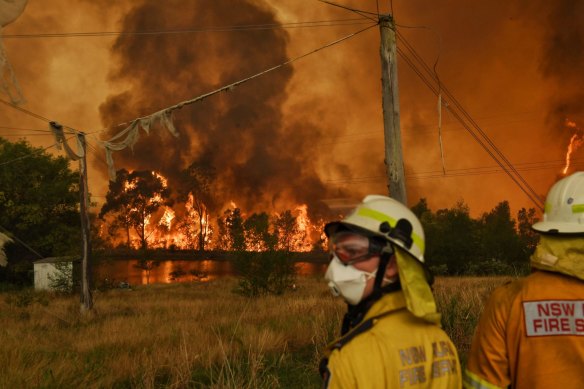
The last El Nino contributed to one of the worst droughts in Australia and the Black Summer Bushfires. Credit: Nick Moir
This means that winter in 2023 will be drier than average for much of Australia, resulting in warmer than average daytime temperatures. Night temperatures are also expected to be warmer than average, except for inland, eastern and central Australia.
The warmer winter could affect holidaymakers keen to hit the snow, with the season starting this week. In Perisher, some parts of the mountains have received healthy snow dumps, but others remain fairly green.
El Niño typically suppresses rainfall in eastern Australia during the winter and spring months. Already, bushfire agencies across the country are concerned about the increased risk over the coming summer.
It’s been three years since Australia experienced an El Nino weather pattern, with the last contributing to one of the country’s worst droughts and the Black Summer Bushfires.
There have been more than 27 El Nino events since BOM records began.
Climate change continues to shape the world’s weather patterns. In April 2023, the global sea surface temperature was the highest on record, according to weather bureau data, while Coral Sea surface temperatures were the second highest.
Get to the heart of what’s happening with climate change and the environment. Our fortnightly Environment newsletter brings you the news, the issues and the solutions. Sign up here.