This was published 4 years ago
Storms batter south-east Qld: 61mm of rain in 20 minutes, widespread blackouts
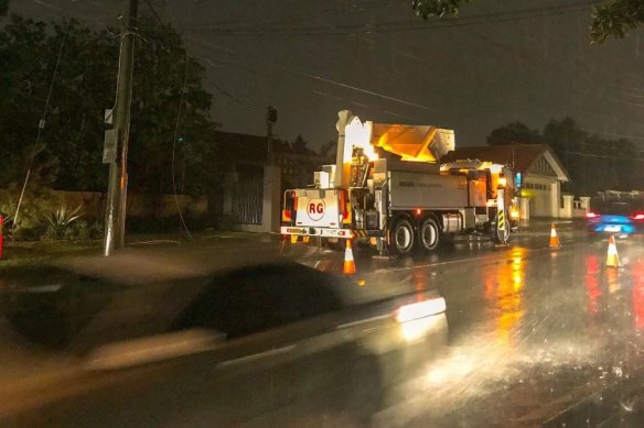
Thousands of south-east Queensland residents were without power after thunderstorms hit south-east Queensland overnight, with the Logan suburb of Greenbank receiving 61 millimetres of rain in 20 minutes.
Energex restored power to 18,000 customers by 6am on Wednesday but south of Brisbane almost 1700 residences were still without electricity, including residents of the Scenic Rim and Logan suburbs of Jimboomba, Canungra and Greenbank.

Energex has restored power to 18,000 customers.Credit: Energex, Twitter
“Thanks to all of SEQ for your patience, and we’ll keep on working until the final affected properties are restored this morning,” Energex posted on Twitter.
Meteorologist Rosa Hoff said a trough rolling into the south-east brought on severe thunderstorms that hit the region late Tuesday afternoon.
“We received a lot of rainfall out of it but not too much damaging wind gusts,” she said.
“In terms of rain, it was quite heavy at times with Greenbank receiving 61 millimetres in just 20 minutes and Mitchelton saw 59 millimetres fall in 30 minutes.”
Ms Hoff said Stradbroke Island received persistent showers with a total of 177 millimetres.
“We’re not going to see as much weather activity [on Wednesday] but, generally, the threat of severe thunderstorms has eased but regular thunderstorms with a bit of a rumble could be seen,” she said.
“Showers will continue ... but it will become more patchy and ease off tomorrow but the weekend is set to be more sunny.”
The Bureau of Meteorology warned that Tropical Cyclone Niran about 350 kilometres north-east of Cairns was a category 2.
“Tropical Cyclone Niran is expected to remain slow-moving off the north Queensland coast while gradually intensifying over the next 24 to 36 hours.
“Coastal crossing of the cyclone is not expected.
“However, as the cyclone strengthens, or if it drifts slightly westwards, it may cause gales about exposed coastal and island communities between Cape Melville and Innisfail today or early on Thursday.”
Wind gusts of 100km/h could develop near exposed coastal and island communities between Cape Melville and Innisfail, the weather bureau said.
The cyclone was forecast to accelerate away from the coast in a south-easterly direction on Thursday.