
”Warmest start to April on record” forecast as above average temperatures hit
THE next few days could see record breaking heat across the country, but what’s causing our autumn to be more like summer?


technology/environment
Don't miss out on the headlines from technology/environment. Followed categories will be added to My News.
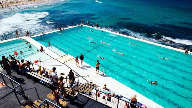
IT’S likely quite a few chocolate eggs ended up as a melted gooey mess on the weekend as uncommonly hot temperatures swept across the country.
The heat is in no mood to budge either with the mercury likely to remain well above average.
Sky News Meteorologist Tom Saunders said on Tuesday that we could be about to experience “the warmest start to April on record”.
Sydney will peak at 30C next weekend, Melbourne will see 25C and Perth’s 32C on Tuesday will be far warmer than the 25C April norm. The march of Cyclone Iris, parallel to the Queensland coast, could bring heavy rains and gales but temperatures are still toasty for April.
So what’s up with the weather and what’s causing the late burst of heat?
First, let’s look back at the long weekend.
“It was a glorious long weekend that felt more like summer rather than autumn,” said Mr Saunders on Sky News on Tuesday.
“Maximum temperatures in central NSW were 10 degrees above average. Sydney Airport on Monday hit 33C and that was just 3 degrees off the all-time April record.”
But that’s nothing compared to the next few days with sunshine and settled conditions just about everywhere.
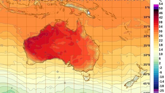
“Based on forecast for the coming week, it looks like it will be the warmest start to April on record across much of Australia,” Mr Saunders said.
“In Sydney, the first nine days of April will more than likely have an average maximum of 27.1C, when the average for April is 22.5C so that’s 5C above average.”
Iris has powered up to a Category 2 cyclone and is currently tracking south off the Queensland coast. There are warnings for heavy rain, gales and destructive winds in areas including Bowen, Mackay and the Whitsundays.
What’s causing this late summer-like spell can be summed up in two words: high pressure.
“High pressure will dominate the week and these systems will keep the skies clear and more importantly will keep the cold fronts well south of Australia,” Mr Saunders said.
“[Cold fronts] usually bring colder air from the Southern Ocean this time of year and that sees a drop in temperatures across south eastern Australia into the teens.
“But without any significant cold fronts, temperatures will remain well above average.”
Last week, the Bureau of Meteorology released its April to June climate outlook which suggested warmer conditions could follow now that the La Nina system has all but petered out in the Pacific Ocean.
Wetter than average conditions could only be expected in the far north and extreme south east — such as the eastern coast of Tasmania.
Warmer than average weather was likely over Tasmania, Victoria and parts of NSW and South Australia and the south west of WA.
Only central and northern Queensland should expect a milder autumn.
THIS WEEK’S WEATHER IN THE CAPITALS
Warm and sunny all week with some cloud. 25C on Monday will steadily rise towards 30C on the weekend before temperatures drop aback into the mid-twenties.
The capital could get to as high as 29C on Thursday with the rest of the week just a touch cooler. Mostly fine.
Partly cloudy with some sun. Temperatures in the low to mid-twenties.
The coldest day is likely to be Friday at 17C with a high of 23C on Wednesday. Mostly sunny with a shower or two.
Another glorious weekend coming up with highs of 28C, with 26C during the week and mostly fine and sunny conditions.
Tuesday will be the hottest day at 32C with the mercury bubbling between 27-29C for the rest of the week and into a sunny weekend.
Around 34C with afternoon storms.
Queensland’s capital will see scattered showers during the week with drier conditions for the weekend. 27-29C through the week. However, further north where the effects of Cyclone Iris are being felt, there are predictions of 200mm or more of rain and destructive winds.
Originally published as ”Warmest start to April on record” forecast as above average temperatures hit
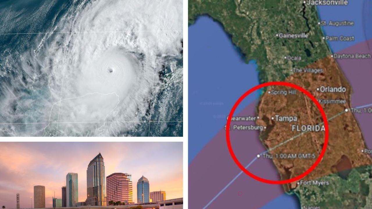
‘Tsunami’: 3 million exposed to 15ft surge
Over a million US residents living less than 10 feet above sea level are warned of Hurricane Milton’s 15-foot storm surge, which could have a tsunami-like impact.
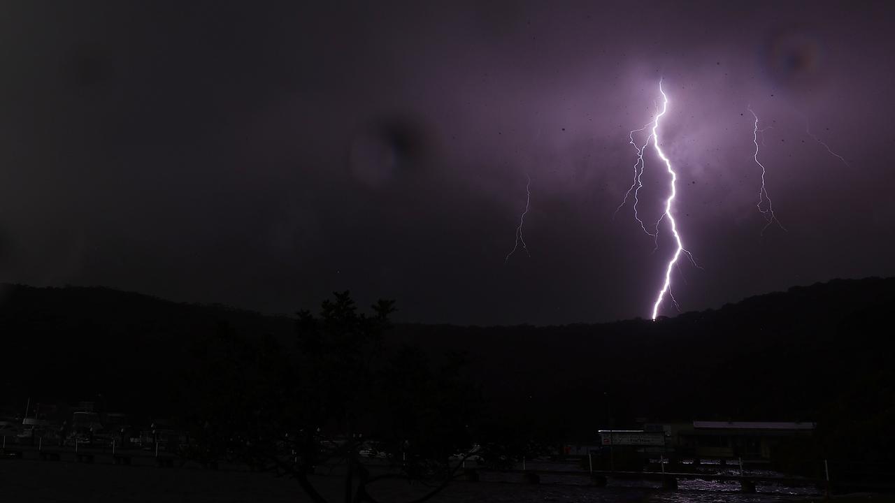
200k lightning strikes hit state in one day
A shocking number of lightning strikes were recorded in a single day as residents of one state battled hail and severe storms.