Warning of ‘dangerous storm outbreak’ for south east; cyclones in west and north
Forecasters have warned of a wild week of weather approaching which could see multiple cyclones, driving rain and wind hit many major cities.
A hectic seven days of wild weather is set to be unleashed across Australia with scorching heat, flooding rain and destructive winds all likely.
The punishing temperatures that have led to the fires around Perth has some days left to run yet. At least two cyclones are on the cards, including one that could hit populated parts of Western Australia, while the south east is being warned about an upcoming “dangerous storm outbreak”.
The relatively calm conditions that will settle on some parts of the country for the next few days are a respite before the weather cranks up a gear.
The system that brought heavy rain to parts of the eastern states is weakening but there could still be some downpours particularly on the New South Wales north coast.
But fresh trouble is brewing from the west and north.
“A storm outbreak is on the way,” said Sky News Weather meteorologist Rob Sharpe.
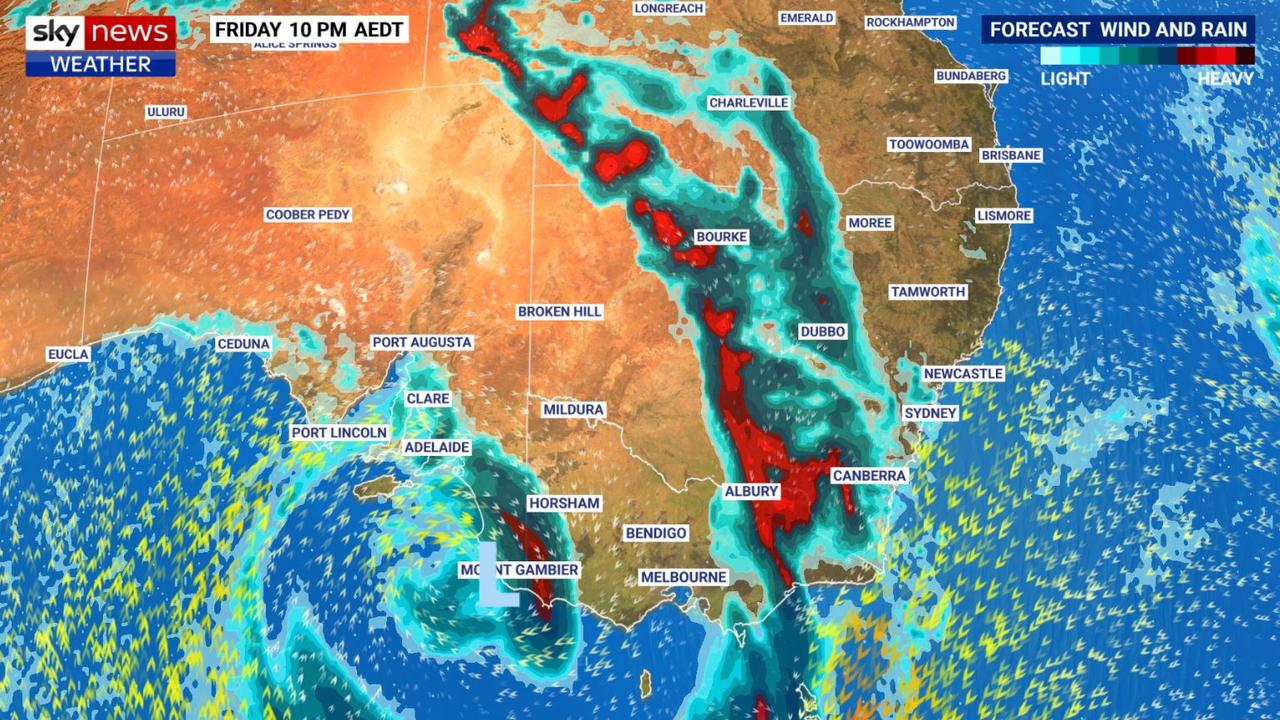
Tropical moisture heading south is forecast to run into a low pressure system charging in from the Great Australian Bight, probably around Thursday.
“That will enhance storm activity with Friday in particular looking quite dangerous across Victoria and NSW into Saturday.
“Severe storms could also be seen from Tasmania up into Queensland,” said Mr Sharpe.
RELATED: Fears homes destroyed in WA bushfires

Meteorologists have warned there is a high risk of flash flooding from storms given the humid air mass that has settled in and around Sydney, Canberra, Melbourne and Hobart.
Adelaide will hit 28C on Wednesday and Thursday before dropping to maximums in the low twenties heading into the weekend. The rain could arrive on Thursday with falls on Friday of up to 15mm.
A warm few days in Melbourne topping out at 31C on a sunny Thursday. But then, on Friday, up to 25mm could pour down as the cold front passes through bringing a possible storm. That rain could persist across the weekend.
Hobart will go from a high of 19C on Wednesday up to 27C on Friday and then down to 18C on Monday. The weekend is likely to see some heavy showers and a possible storm on Saturday.

Calm in Canberra with highs in the mid-twenties until Friday when the storms could roll in filling the gauge with 20mm on Friday and 30mm on Saturday.
At this point it’s forecast that Sydney may escape the worst of the rain, but that could change over the coming days. Currently it’s look like a pleasant week with maximums in the mid to high twenties with some showers on the weekend.
Warm in Brisbane with temperatures inching up each day from 27C on Wednesday to 34C on Sunday. Wednesday could see some heavy showers for the Queensland capital.

END TO PUNISHING HEAT IN WA
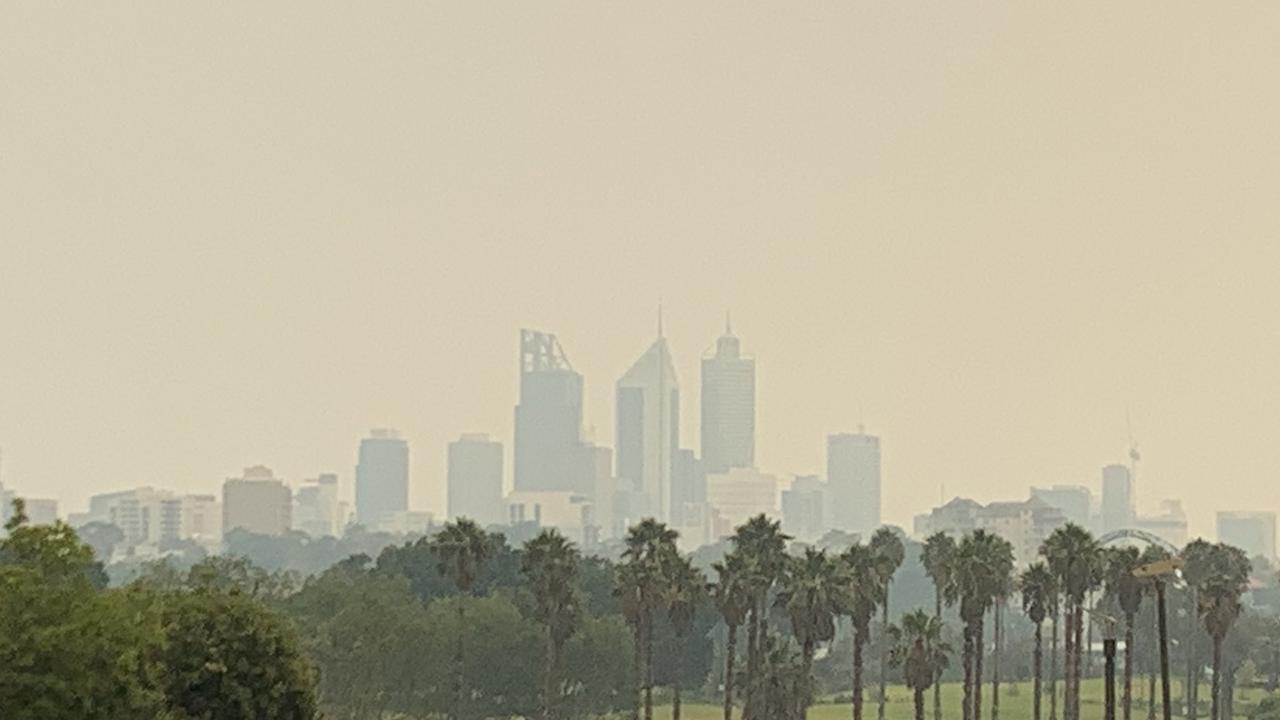
On the other side of the Nullabor, Perth continues its run of punishingly hot days which has helped the bushfires take hold.
There’s good news, kind of. A cool change will see a significant drop in temperatures. But coming right up behind it could be a cyclone, bringing flooding rain after burning fires.
A high of 34C on Wednesday will start a trend towards more reasonable conditions temperature wise. Saturday could even see the high drop below 30C – to an almost chilly 24C.
But as the mercury drops the rain gauge will fill with potentially some wet days on the weekend.
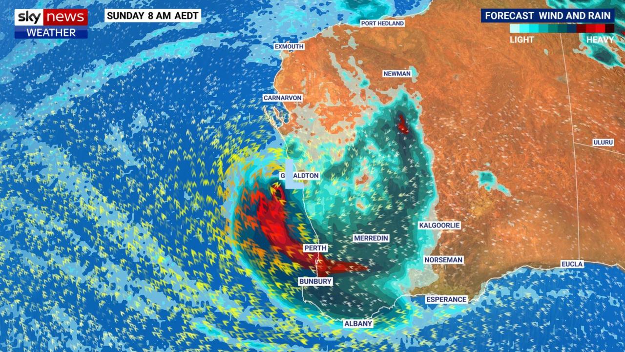
A tropical low is heading southward from north western Western Australia. As it heads into the ocean it’s likely to power up to cyclone intensity.
Generally cyclones don’t make it down as far as Perth, as they need tropical waters to survive, but some forecast models have suggested one could indeed strike the WA capital.
Waters off southern WA are currently warmer than usual which means the cyclone could venture down the coast than might usually expected. Forecasters will be keeping a close eye on how the storm tracks.
“There is a substantial severe weather threat down the east coast even as far as Perth,” said Mr Sharpe.
“Even if it remains a tropical low there will be heavy rain and the threat of damaging wind gust for the Perth area.”
Another tropical cyclone is looking possible in Australia’s north. Potentially forming in the Gulf of Carpentaria on the weekend it could bring severe storms, rain and wind on Sunday or Monday to northern Queensland.
The monsoon is in full force across the Top End with Darwin drenched.
Around 30mm will fall on the city until the end of the week with thunderstorms likely every day. Temperatures will reach into the thirties.
Originally published as Warning of ‘dangerous storm outbreak’ for south east; cyclones in west and north


