
Tropical low off Qld coast forecasted to strengthen into category 2 tropical cyclone in less than 24 hours: BOM
A tropical low sitting off the east coast of Australia is less than 24 hours from forming into a category 2 tropical cyclone – and could make its way towards millions.

Environment
Don't miss out on the headlines from Environment. Followed categories will be added to My News.
A tropical low bearing down the Queensland coast is less than 24 hours from developing into a category 2 tropical cyclone – forecasted to bring gusty conditions and showers in its wake.
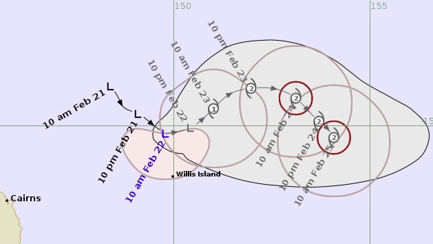
Currently located 505km east northeast of Cairns, in the state’s Far North, the tropical low is moving at a speed of about 6km per hour eastwards.
Sustained winds near the centre of the low – dubbed 22U – are reaching about 75kmh, with wind gusts of up to 100kmh.
Despite the system lingering off the coast, the Bureau of Meteorology’s latest models have forecasted it will develop into a tropical cyclone by Sunday morning,
“During next week, the system is expected to turn southeast and then south while continuing to strengthen,” the bureau’s latest cyclone information bulletin states.
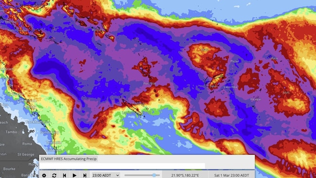
“Considerable uncertainty exists in the track the system will take beyond that, but there is a risk it will move closer to the central Queensland coast late next week.”
Earlier on Saturday, BOM senior meteorologist Angus Hines said the weather formation was unlikely to move anywhere quickly should it strengthen into a tropical cyclone.
He explained it was forecasted to linger in the Coral Sea for several days.
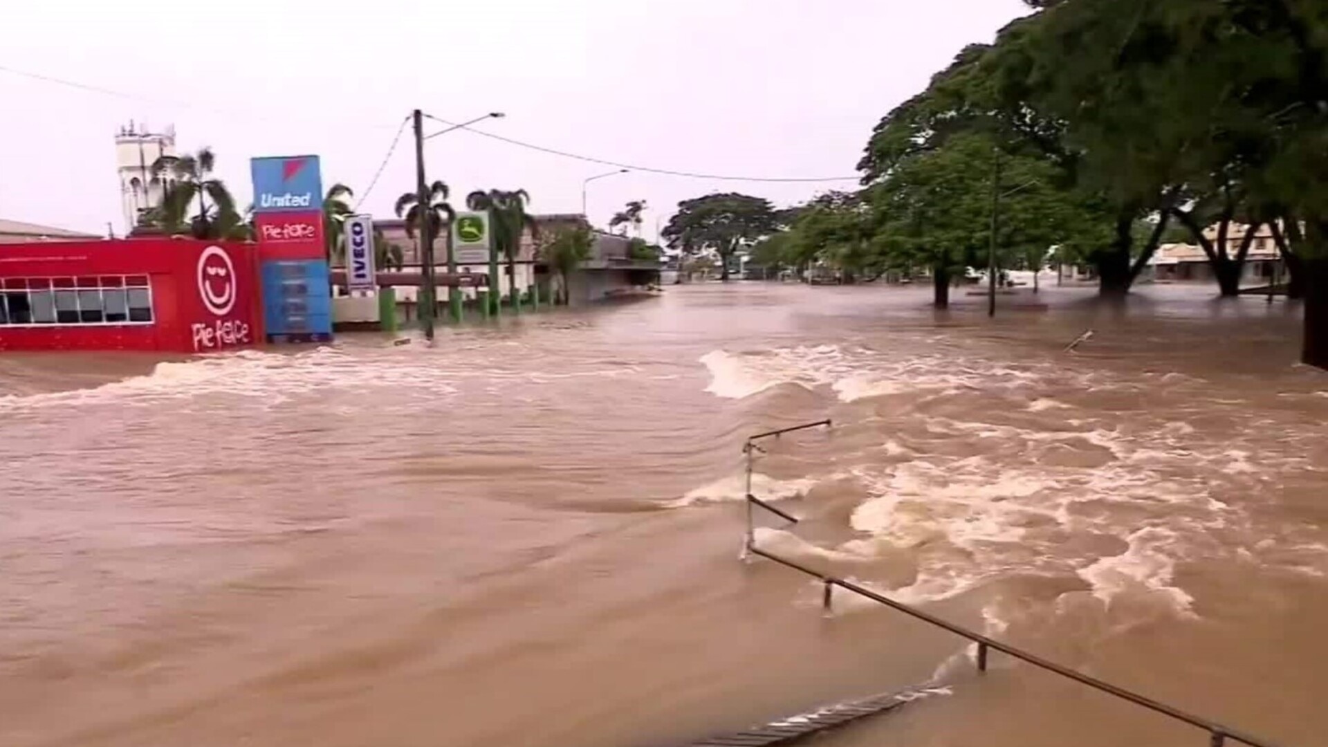
“This could bring some gusty conditions, showers and increased swell to the central and northern Queensland coast,” Mr Hines said.
“But otherwise (it) will have minimal impact on our weather.”
The system may start to move “more swiftly” later in the week, Mr Hines explained.
He said there were a few paths it could follow – most of which would result in the system moving to the southeast, further away from Australia and resulting in its impacts weakening.
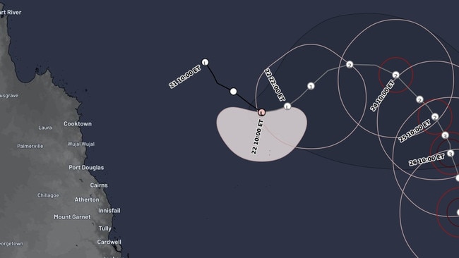
“But there is definitely still a chance late in the week, it could veer towards Queensland – bringing stronger weather impacts to parts of the Queensland coast,” Mr Hines said.
The updated warning comes as a second tropical low – located off the Western Australian coast – is also forecast to develop into a tropical cyclone.
However the low is currently located more than 500km north in the Indian Ocean and is moving further west.
Mr Hines said little to no impact was being forecast for the Australian mainland and even the offshore islands due to the system’s trajectory.
More Coverage

Originally published as Tropical low off Qld coast forecasted to strengthen into category 2 tropical cyclone in less than 24 hours: BOM

‘Extreme’ danger warning as temps soar
Millions of Aussies bracing for blistering temperatures this weekend, with the extreme conditions sparking several warnings.

PM’s $500m pledge for local jobs
The Prime Minister has announced a crucial investment package during a pre-election speech, but not before he took a few healthy swipes at the opposition.